I have imported a .csv into my survey mode that were uploaded from an existing survey. When I try to stake out the points it seems that the rover is bouncing around a lot and seems like its not getting a great fix. What settings should I adjust to get this more precise? In my mind it should be a few cm accuracy?
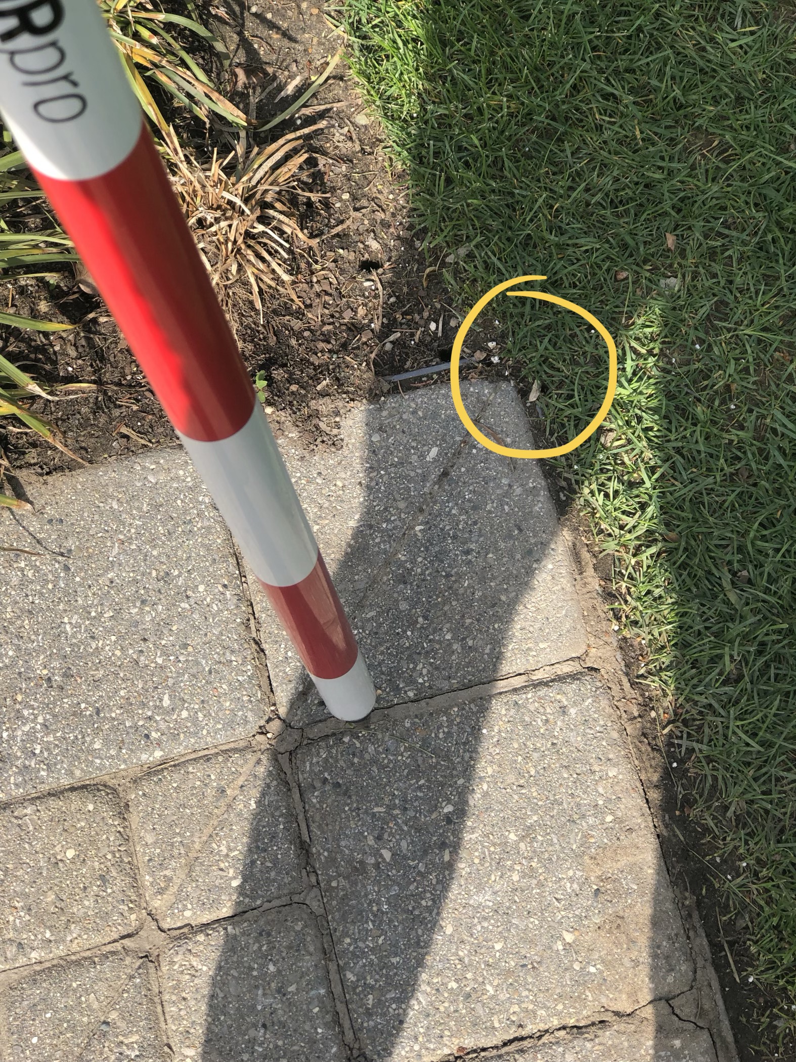
The photo attached is where the survey brought me to and it is supposed to be right at the corner of the bricks… Please let me know what to adjust. Thanks!
How was your base station setup?
Is it over an arbitrary point?
Is there now something in the vicinity of the base station that could cause interference?
Did you place the base station over a known point and then type in the coordinates of the known point?
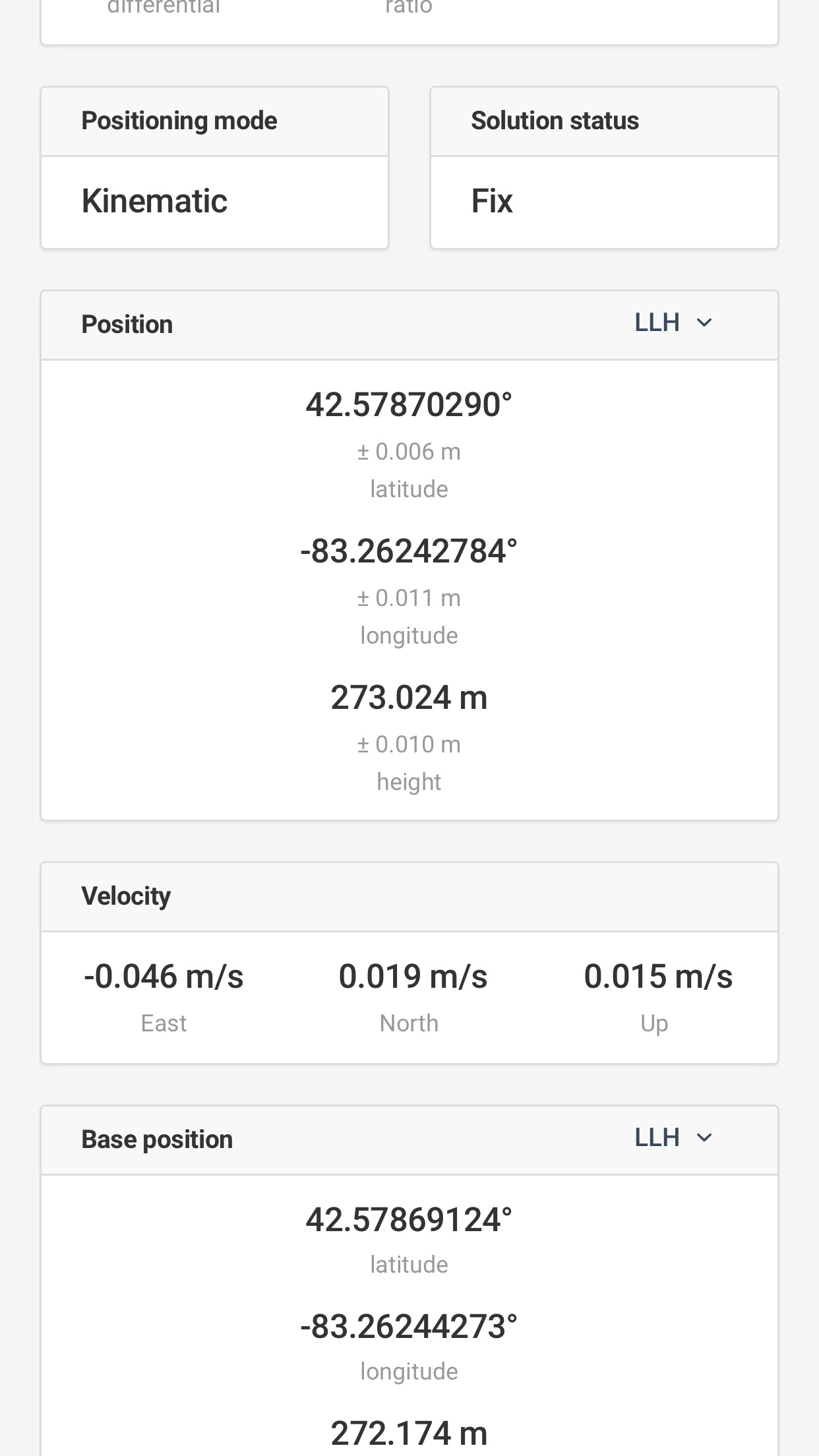
Are your coordinates from your previous survey in WGS84?
Is it consistently out in the same direction and distance?
That can be ignored. It was a remnant from the other post where the base had been set in XYZ and the control points were imported in LLH. Returned base to LLH and that’s how the fixed issue was resolved. Now we have this thread…
Easy troubleshooting.
Do the same thing one more time. Survey one point, wait 20-30minutes. If you survey the same point and get the same data your FIX is golden.
Now, if you do the same whith stakeout, this would almost rule out fals FIX as the reason for misplaced points.
What you are left with then is error in your coordinate format.
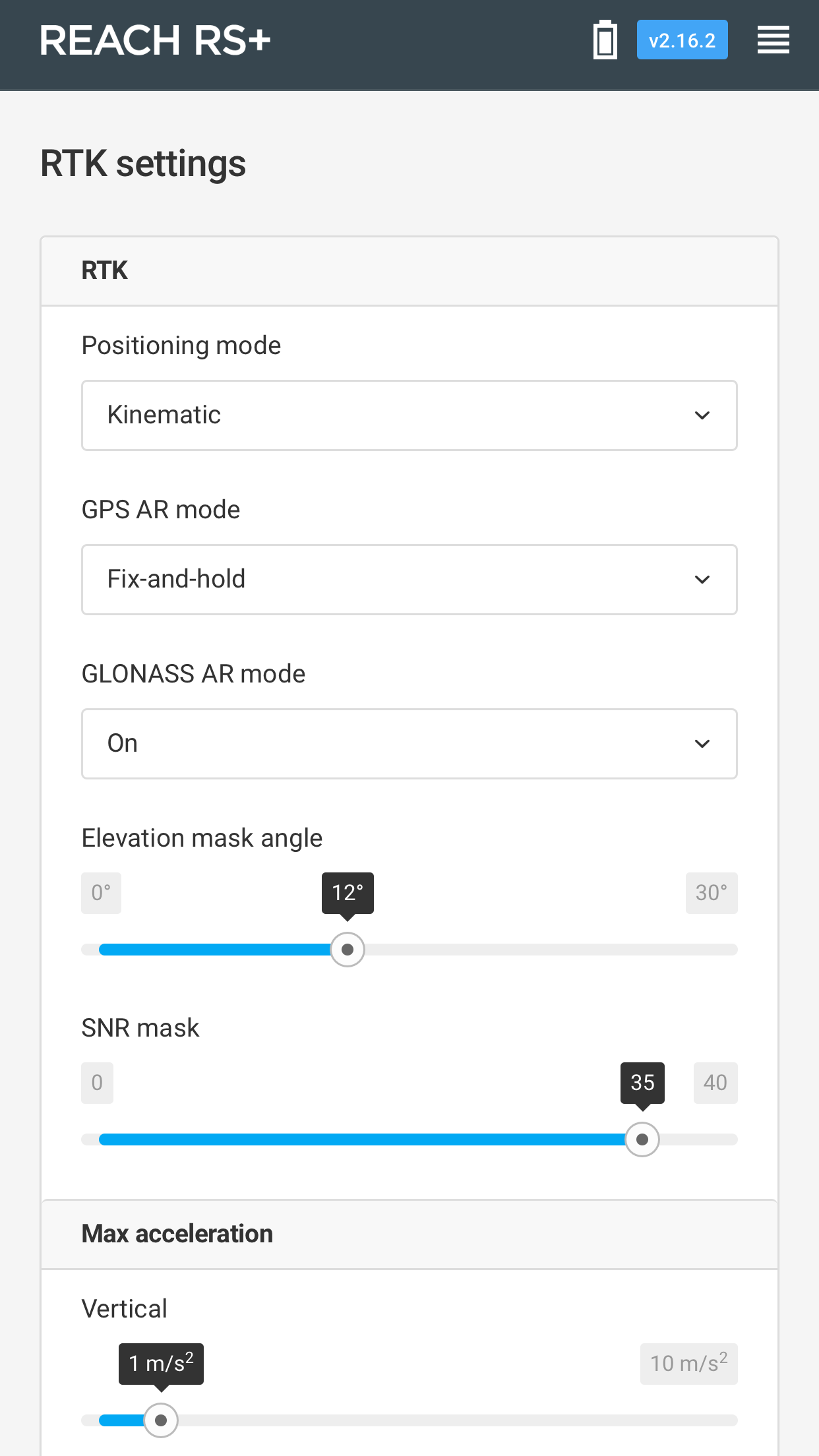
Does having the base positioning mode set to kinematic as shown rather than static in RTK have any effect on positioning when manually entering a base coordinate?
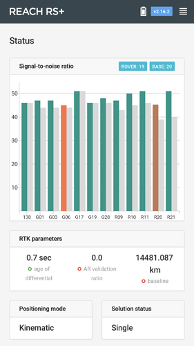
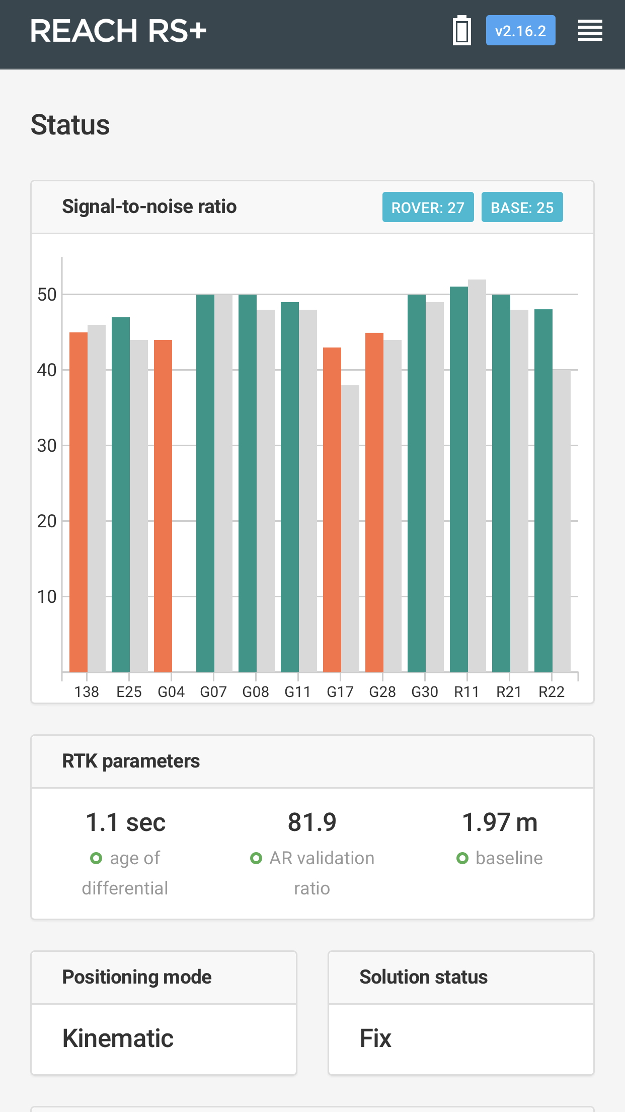
Obviously the baseline has changed substantially from way too far out (14481 km???)(were u using ntrip cors settings? Maybe this is cause for error?) to about 6’ apart.
Should get better readings now. Try and see what you get with the shorter baseline.