


Check out our new article to learn how Reach receivers can ease your archaeological survey, facilitating fast and accurate data recording. The researcher from the University of Toronto, @sc.murray, shared her experience of surveying with Reach RS+ during the archaeological project around the bay of Porto Rafti in Greece.
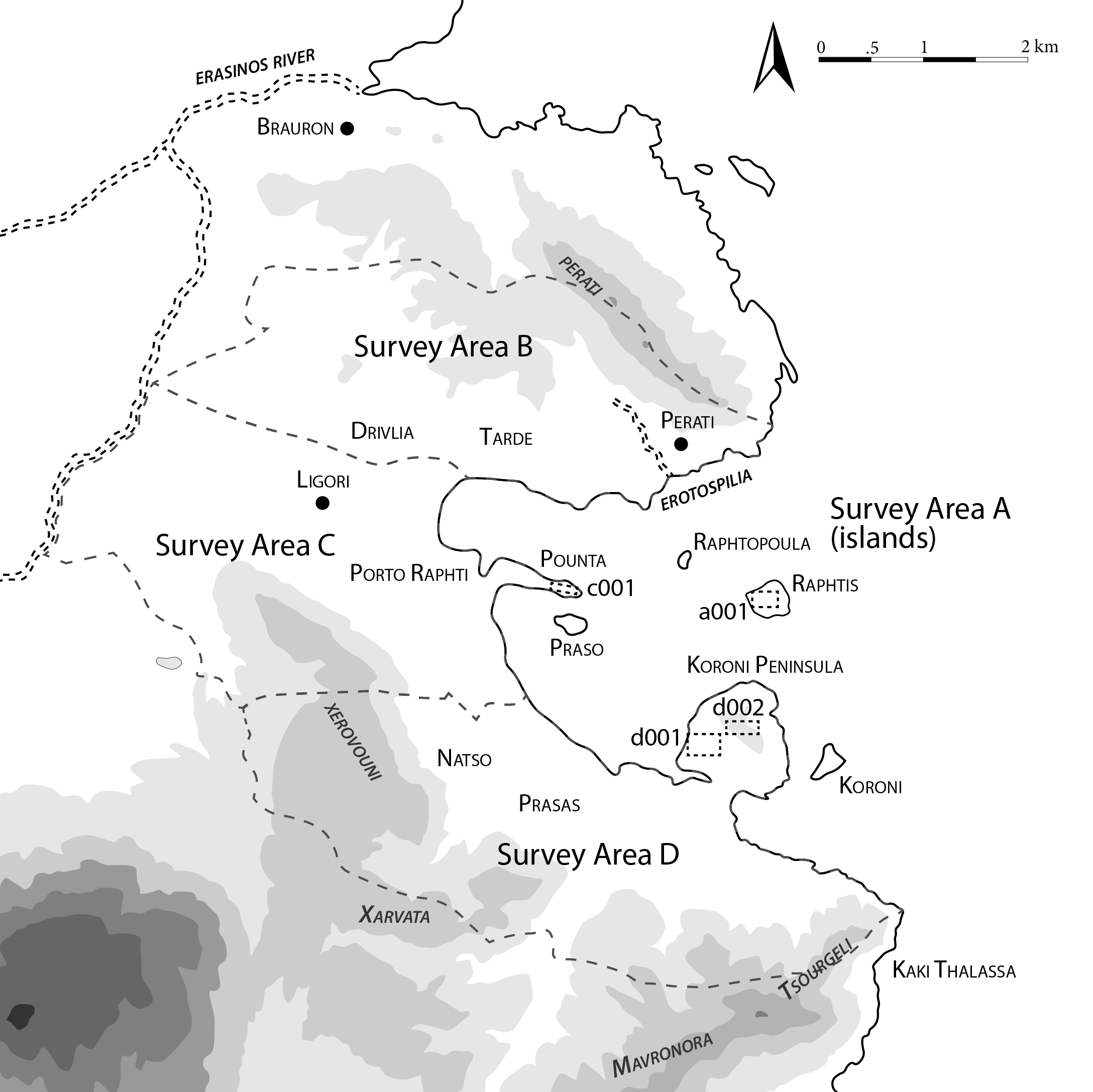
A map of the area surveyed by Sarah’s archaeological team
The 2019 survey season in Porto Rafti
Sarah’s team started working with Reach RS+ back in 2019 during the project’s first season, called the Bays of East Attica Regional Survey. Their archaeological project aims to expand scholarly knowledge about the area’s history around the modern town and bay of Porto Rafti in eastern Attica. Although it looks like just another Greek resort town, Porto Rafti is incredibly rich in archaeological material, with several sites dating from the Final Neolithic to Late Roman periods.
The team used Reach RS+ units to accurately map features (walls and other manmade modifications to the landscape) and set out survey units, like 20x20 meter grid squares, to track where the collected artifacts originated in the field.
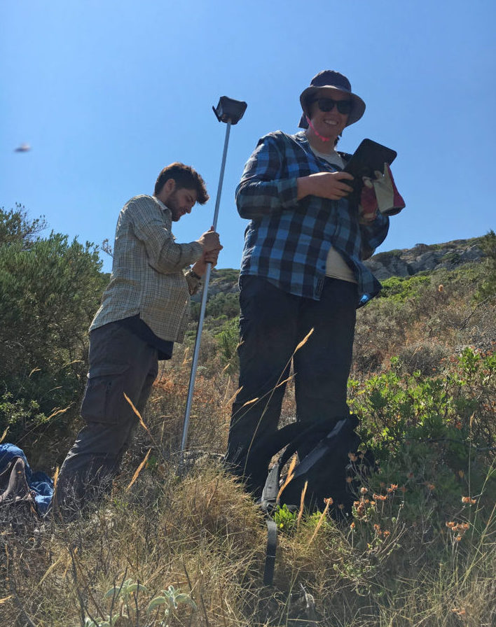
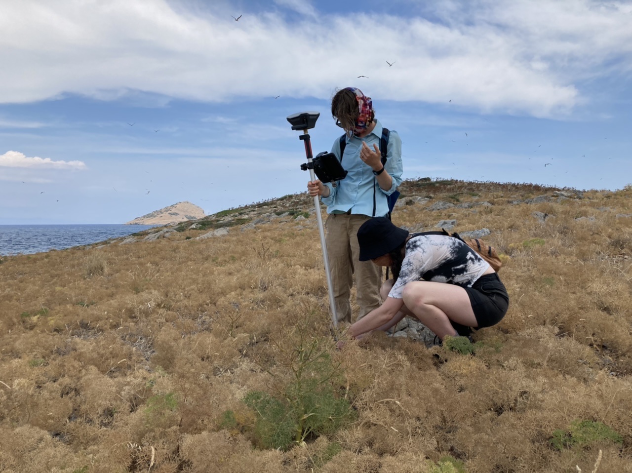
Archaeologists map extensive features on the Koroni peninsula, Greece (photos by Sarah Murray; Maeve McHugh)
In 2019, the team used two Reach RS+ units—one as a base and another one as a rover, to plot survey units and take points on the locations of features. To start the day, the base was installed on a reference point—usually on the acropolis of Koroni, the main Hellenistic citadel in the survey area, or the peak of Raftis island, where the team was documenting a major Late Bronze Age site. After that, the compact Reach rover could be freely moved across the site by any team member assigned to layout survey units or map other aspects of the archaeological landscape. The researchers collected spatial data with the ReachView app and found the workflow quite simple.
“Instead of using a proprietary data processing computer, Reach RS+ runs from an app that’s free to download on a tablet or smartphone, so you need to bring even less equipment into the field. The app is super intuitive to use and pretty much always worked as it was supposed to.”
Sarah Murray, co-director of the Bays of East Attica Regional Survey

A map of the survey on the Koroni peninsula, 2019
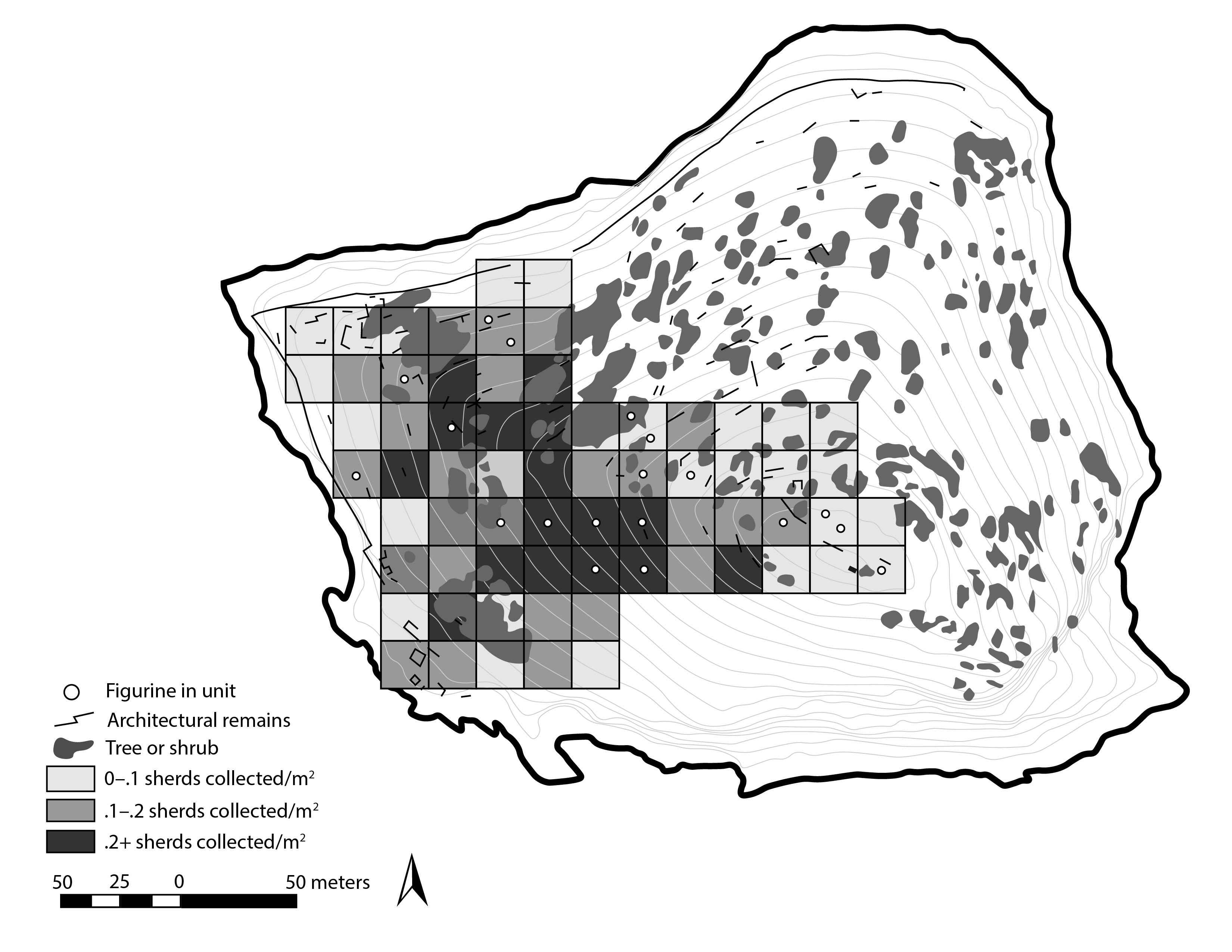
A map of the finds densities on Raftis island, 2019
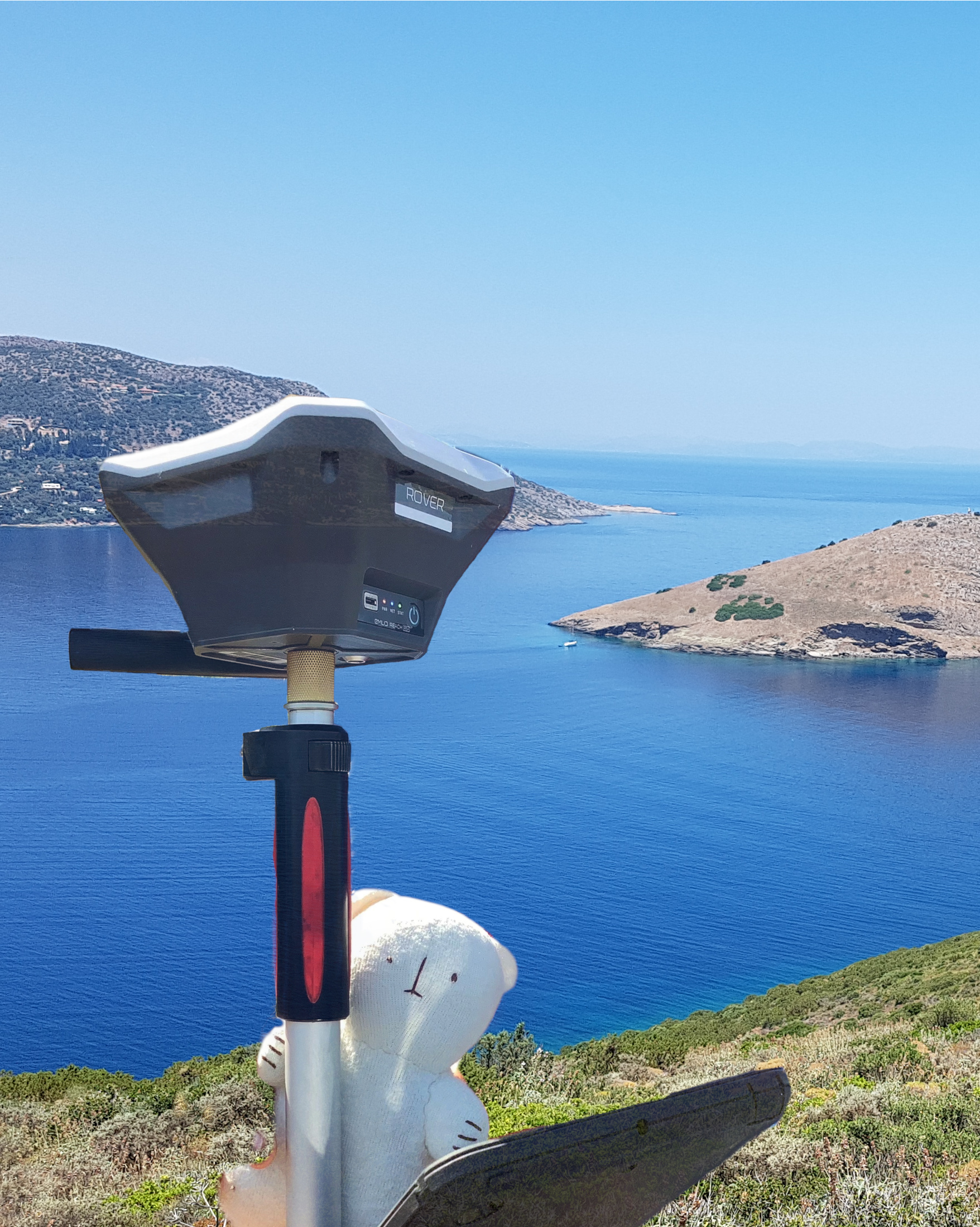
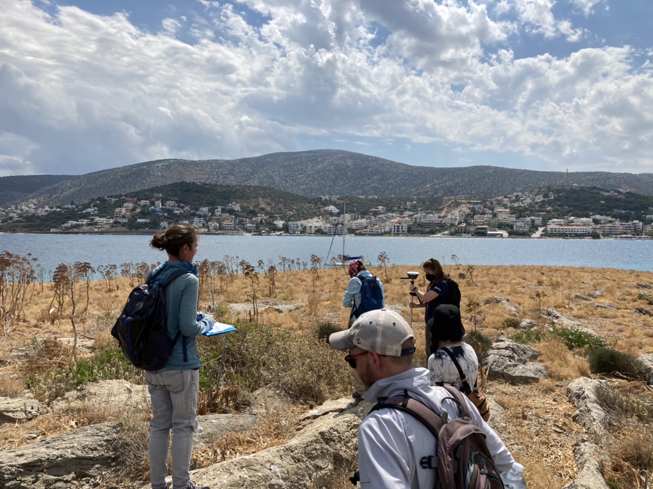
The 2021 survey season on the islet of Praso
The new surveying season in eastern Attica began in 2021, focusing on a new site: the islet of Praso. Although moving to a new location, the team continues to use Reach RS+ units. This year, the team switched to a base-free system, applying the Greek HEPOS RTK corrections service to provide RTK corrections through a cell phone internet network. The archaeologists no longer need to set up a base, using just a rover and the corrections transmitted through the HEPOS system. They simply turn on the Reach RS+ rover unit, launch the ReachView 3 app on a phone or iPad, connect to the corrections service, and immediately have access to centimeter-accurate positioning. With high precision, archeologists set up the survey grid and record the location of the finds in the area.
Among the finds, there are, of course, the usual piles of pottery and tile, but also things that are rarely found on the surface, like ceramic wasters, pieces of ore, glass, figurines, obsidian and chert lithics, and even fragments of ancient ceramic kilns.
“With all of these special and exciting finds, it is extra important that the spatial data the team captures is precise and accurate: so we’re really happy that Reach RS+ makes good survey data easy and fast to acquire!”
Sarah Murray, co-director of the Bays of East Attica Regional Survey
Archaeologists on the islet of Praso in Porto Rafti, Greece (photos by J. Frankl)
Read the full article in our blog and share updates on your archaeological projects.