Report_Dicky.pdf (427.9 KB)
vrs12890.pdf (1.6 MB)
dicky.zip (9.3 MB)
Everything was there dicky.zip. In addition, it is worth reviewing the Land Survey Overview, which shows additional graphics (Report_Dicky.pdf)
Report_Dicky.pdf (427.9 KB)
vrs12890.pdf (1.6 MB)
dicky.zip (9.3 MB)
Everything was there dicky.zip. In addition, it is worth reviewing the Land Survey Overview, which shows additional graphics (Report_Dicky.pdf)
Thank you Tore! I was able to get RTKConv to work. I found that I had to open and close RTKconv each time. If I left it open and re-ran the process it did not seem to work. There are 2 things I still do not understand.
How to export the VRS so that it can now be used a reference base in processing a survey done with my Reach Rover. I saw your post but just could not figure that out 
When you enter the data and length of time in GNSS, is that what determines the “observation” time that will be used as a "reference base when exported (#1 above).
I know you are busy so if you do not have time to explain, I understand. Maybe when you get caught up you can do a video demonstration of that process. You are awesome and I sure do appreciate all the post and help you provide!! It just takes me longer to understand it.
GNSS solution creates a folder on your C:/ drive somewhere. Named “my projects” and in this folder you find your projects. When a VRS has been computed, you will find a file named BVRS1 or something. With Rinex converter (download from same place as gnss solution) you convert BVRS1 to Rinex which can be read by e.g RTKlib.
Correct. Start time + duration = observation time of VRS
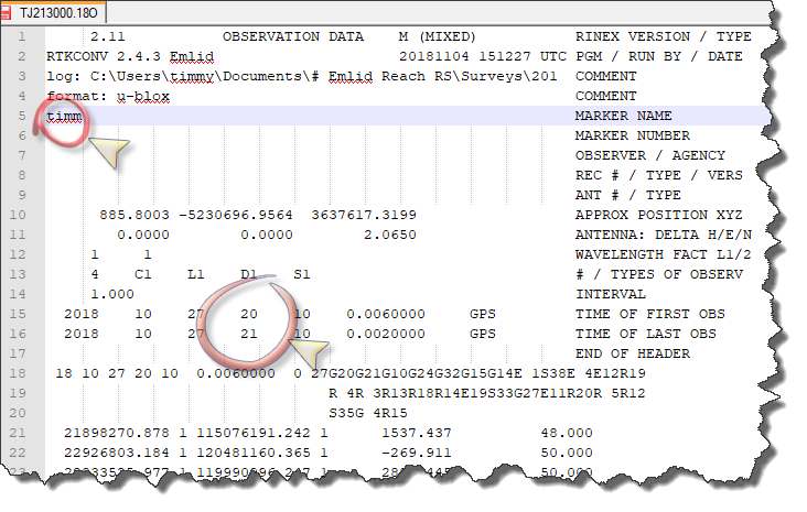
I was missing one very critical element. The RINEX converter 
I will look for a link. If you have one feel free to share!
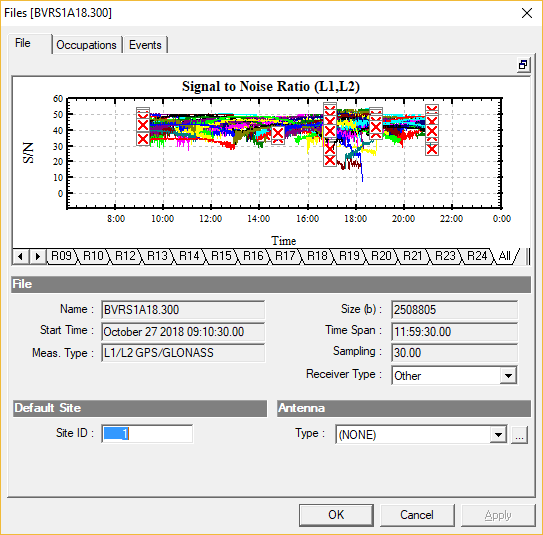
I could only see files that end in .300 that GNSS created. Thanks a bunch!!
Tore,
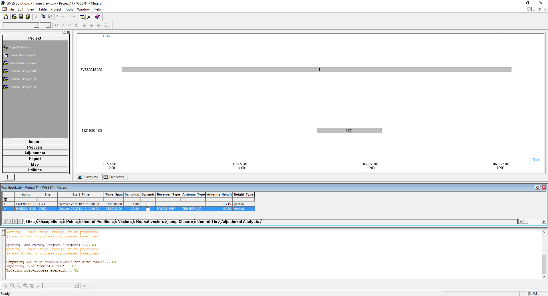
Here is a screenshot:
I went to this website which is supposed to be an online converter:
https://process.gps-solutions.com/index.html
And it gave me an error when I uploaded the BVRS1A18.300 file.
The link from your original post at top no longer works. It had to have worked originally because I am pretty sure that is where I downloaded the GNSS software from. So not sure where to download the converter that is needed to create the Rinex file for a reference base.
Yeah, i noticed. Not sure its free anymore. Great piece of software
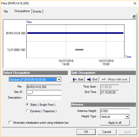
What should the Antenna height be? When I import the created VRS into my software for processing and use the VRS as a base reference, the antenna height is set to 0.00. Should it be set to what ever the same height as the original Reach RS used to create the VRS?
My logic tell me to use nothing or none.
Antennas may have offsets etc that could throw your position of. At least for the phase and local adjustments.
For height above sea i tend you use the same as my raw file
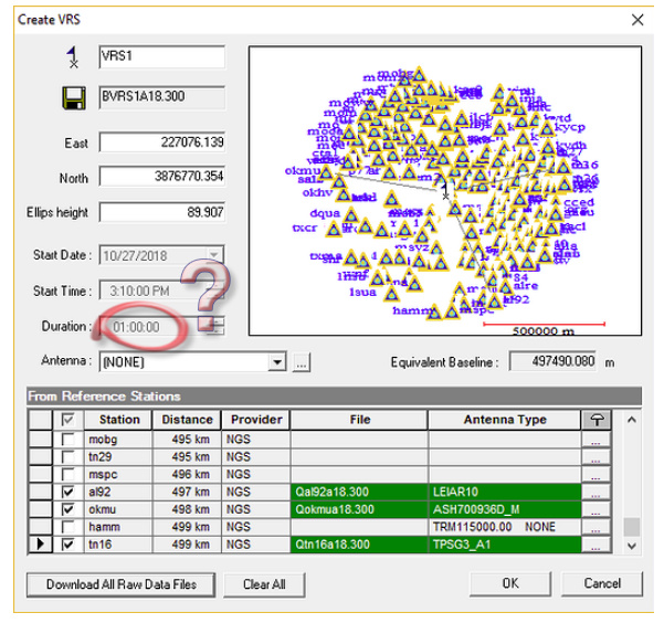
Also, there is a problem with my Ellipsoid height of the VRS. It is way off. In the image below, I have the VRS that was created, and the Reach RS base that was used to create the VRS. You can see the huge difference in Ell Height.
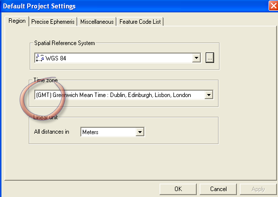
I was using WGS84 by mistake. The screenshot below (latest VRS) I switched to Datum NAD83-CORS96, There is also a NAD83-Mississippi. Should I be using that one?
I am attaching my UBX file in case one of ya’ll can create the VRS (.300 file) and I can then compare what you create to what I come up with. I have to be doing a little something wrong.
Attached files:
Original UBX file.
The .18o rinex file that was generated using RTKconv.
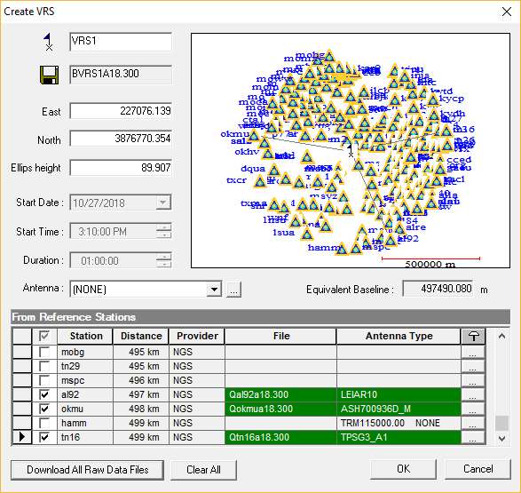
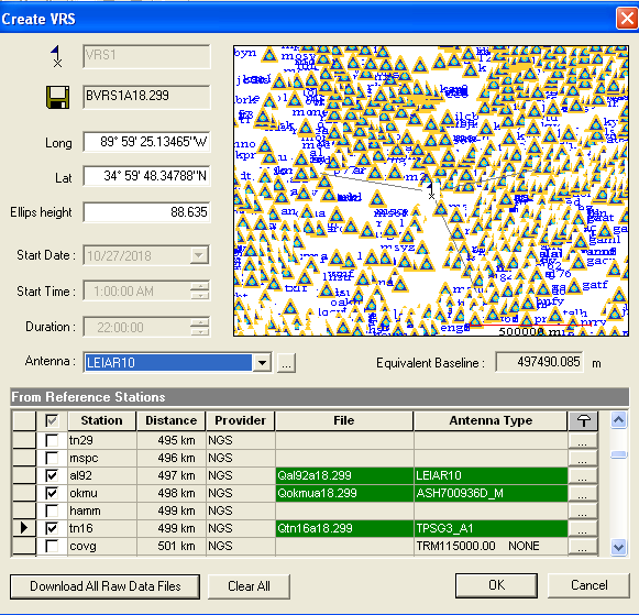
Screenshot of the Reference stations I was using (distance right at 499km away). I used the Auto “download all Raw Data Files” button.
RTK Converted.zip (1.6 MB)
raw_201810272008_UBX.zip (3.2 MB)
Link to GNSS Solutions Project 45
Data sheet of known point (Reach RS base positioned over this point for attached UBX file)
https://www.ngs.noaa.gov/cgi-bin/ds_mark.prl?PidBox=AJ2658
I know ya’ll are busy. If you get a chance to look at it and see where my error is I will be thanksful.
To compare with my calculations:
Land Survey Overview2.pdf (156.0 KB)
Land Survey Overview1.pdf (305.2 KB)
Ryszard,
Thank you for that info! If you ever have time, could you do a screen recording of your steps to post up? That would help me see what you are doing and compare it to what I am doing so that I can find my error(s).
If it would be better, I could record my process and program settings, and maybe you would see where I am making a mistake. If you don’t have time I understand. Thank you for replying and thank you again for the info.
I use a program called Cyberlink Screen Recorder. They have a free trial. Very easy and works like a champ.
Your session is a good example because in the area of high-density CORS points. By the way, I checked that Tore overstated the title tread ![]() . If the shortest vector will be 1000km it will be difficult to have ‘fixed’ but as here 500km is OK.
. If the shortest vector will be 1000km it will be difficult to have ‘fixed’ but as here 500km is OK.
I use the ‘tools’ tab from our program for another receiver, so the tutorial is not a good solution here (it’s free,link under Preprocessing 1.9.2.0 - this is the answer to your previous question).
It’s best to compare reports here. If you attach a report of your calculations, the comparison will show possible errors. The report is just the F9 key. There is probably a trivial error.
.
Just now I found one mistake.
1h with an interval of 30 seconds is 120 epochs and this is not enough
As long its “only difficult” and not impossible, i am ok ![]()
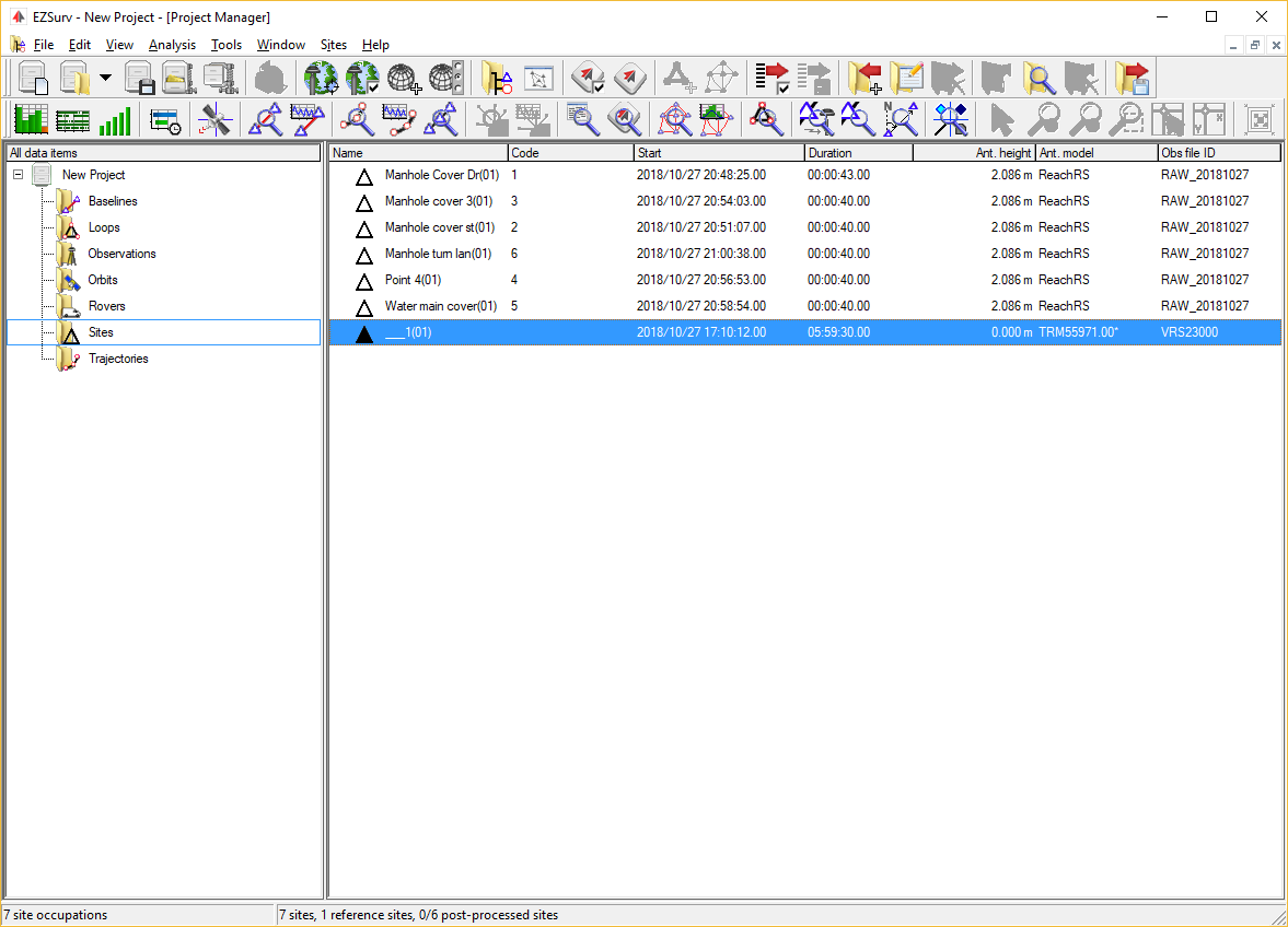
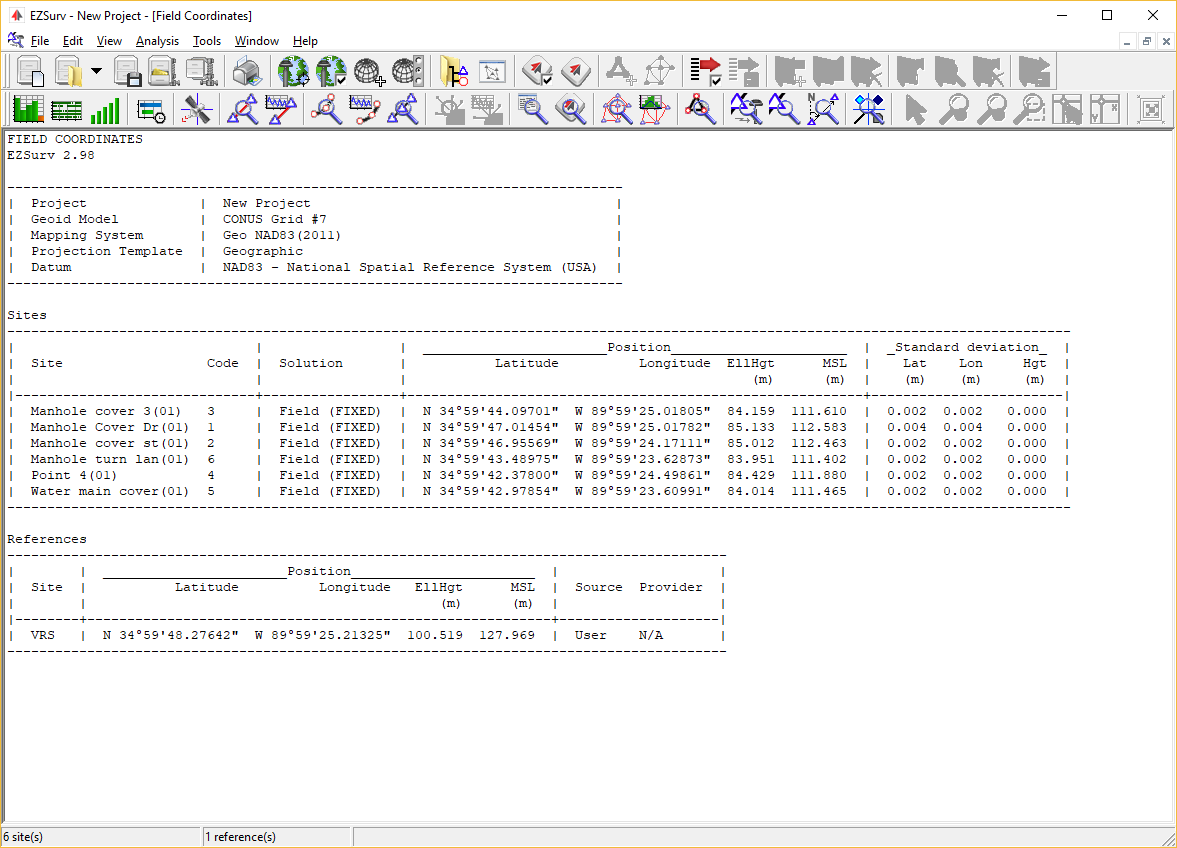
Here is my report. I did a screen shot without changing time. My purpose there was to show which stations I was using for the my VRS. However, I should have set all settings to be correct for screen shot
Land Survey Overview Project 51.pdf (151.2 KB)
The problem still exist that the elipsoid height is way off.
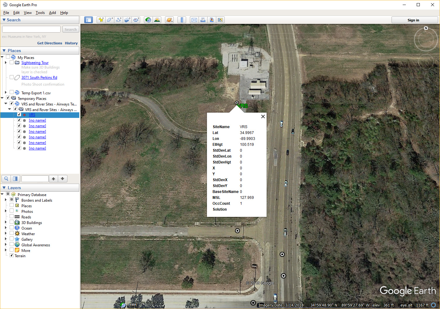
What I can not figure out is why the Ellipsoid height of the VRS is way off. The ellipsoid height should be around 83-84m but it is 100.519. That is not right.
Let me know if I need to record the whole process and show all details.
Hi timmyd,
Land Survey Overview_H.pdf (77.1 KB)
Land Survey Overview_ellips.pdf (150.7 KB)
vrs12990.pdf (1.2 MB)
Three errors: