I’m trying to set up a base station in my backyard and trying to find the exact coordinates over a spike soi can easy setup my reach to communicate using my home network.
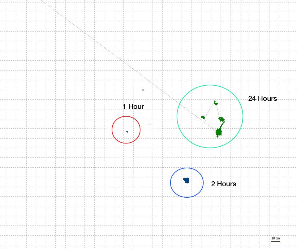
I set up my REACH RS and let it log for 24+ hours. Following the GPS post-processing tutorial and using a local DMV observation post (5km away) as my base station. I got a close Grouping (see below). I then decided to test it against 2 other logs i ran before 0:00 UDT (1hr and 2hr) (didn’t touch tripod between logs) when I plotted them together my error went from 40cm to over 120cm (see image below).
Here are the 5 raw files (3 raw REACH RS files and 2 days of Observer Files)
Hope that helps. I re-ran them setting position mode to “static” and they made small groupings but where still 1m apart.
Did you convert basestation files?, if so then dont.
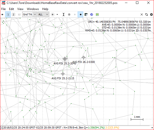
I used rinex header for base coordinates on all three measures and got almost bang on point every time. See screenshot below
Well… i think this looks right, but i could be wrong of course. What do you think?
The obs file has the coordinates located inside and with rinex header i get the same. The last digit is a bit of, not sure why
What do your results look like now? Did the time differences make much of a difference? I imagine the groupings will all be tight, but do you think the longer time logging improves absolute position much?
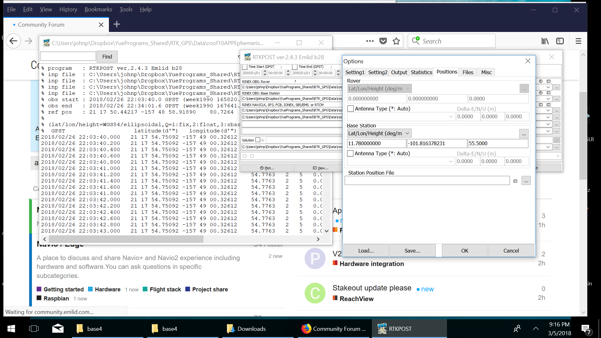
RTKPOST seems to be ignoring my input coordinate completely. Here are some ss I took of the setting and result. I put a random llh coordinate in setting and it is giving me same ref pos as “Rinex Header”.