Hi all,
has anyone had any difficulty getting Emlid Studio to output photos that are compatible with DroneDeploy? I have finally got my PPK setup working with 100% fix, but am stumbling at updating the EXIF data.
When I update the data after PPK, Dronedeploy will not accept the photos. Has anyone else had this issue? Dronedeploy say its an Emlid issue and havnt heard back from Emlid yet.
At this point in time I not really sure. At least I see a change from your raw to your corrected, which it seems Dronedeploy just ignores completely instead
Actually, upon looking into metadata, it seems that only the height has changed! So maybe it is indeed an Emlid Studio issue.
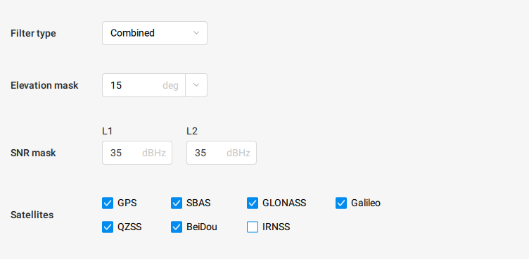
I’ll see if get some time to run it through EzSurv for camera-positions.
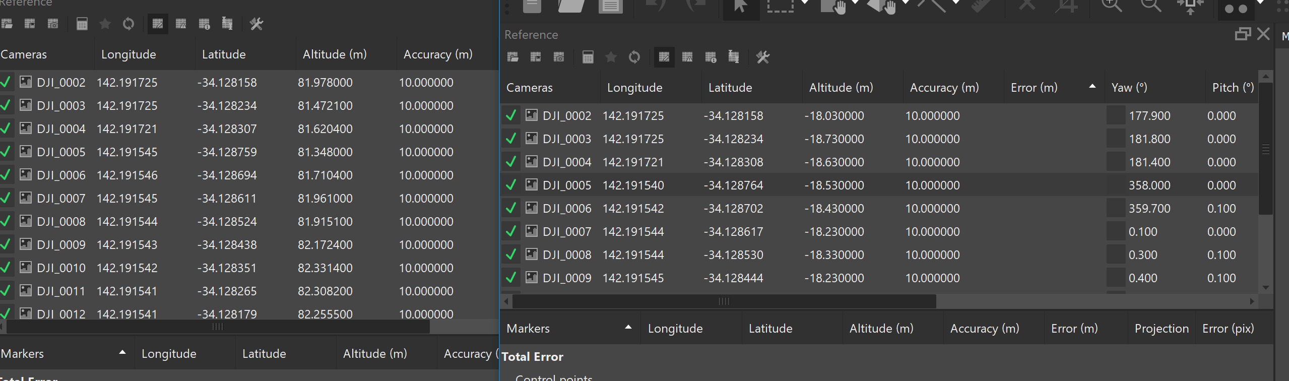
I am getting 752 trigger events, but only see 523 images, so more or less impossible to check precision as well, as I can’t retag the images correctly?
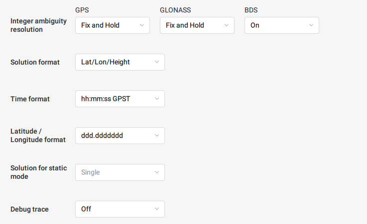
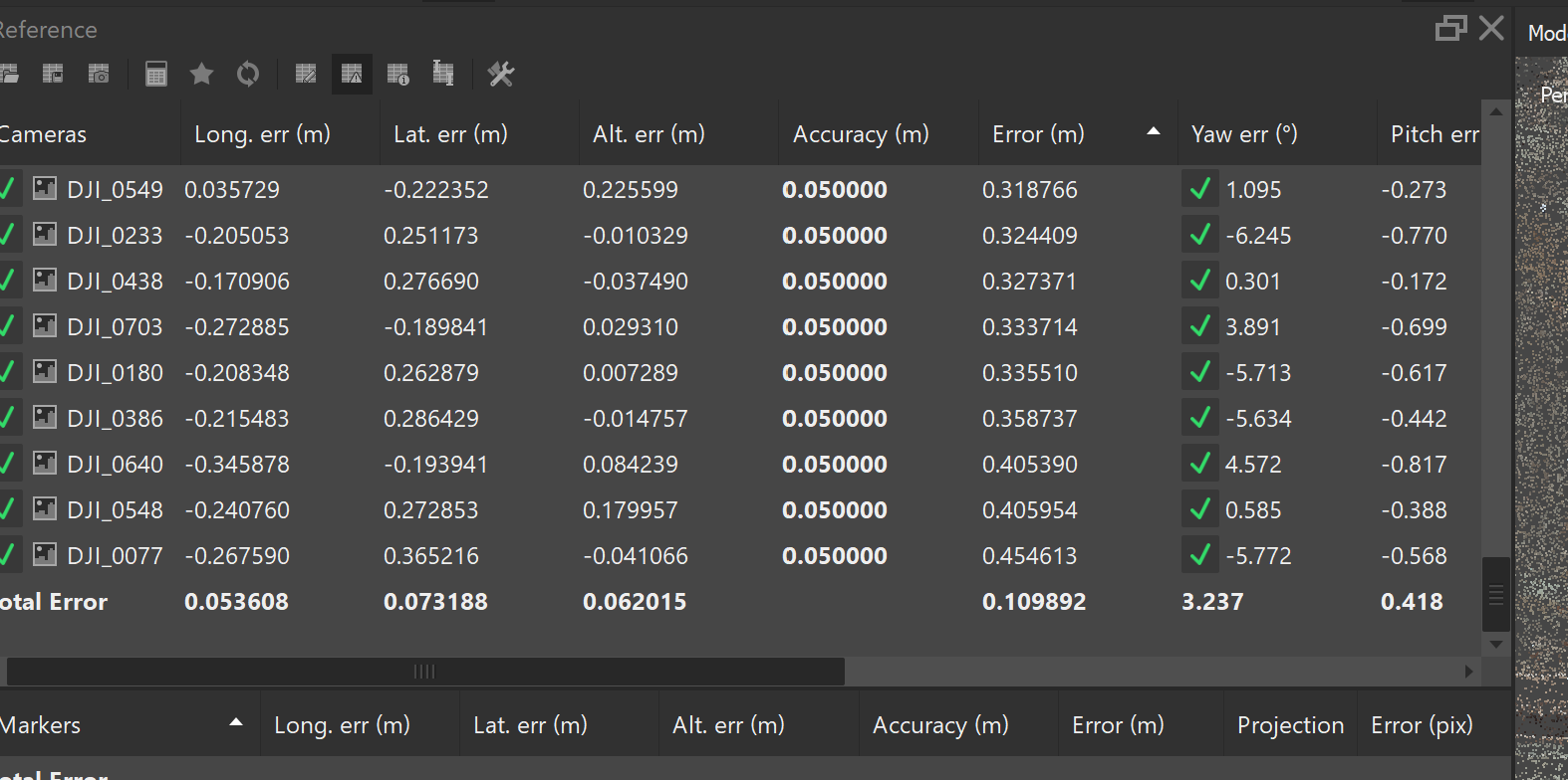
Alright, So EzSurv changes the all of them (visible from Windows File Properties), but for some reason Metashape only sees the changes in Lat/Lon, not in height.
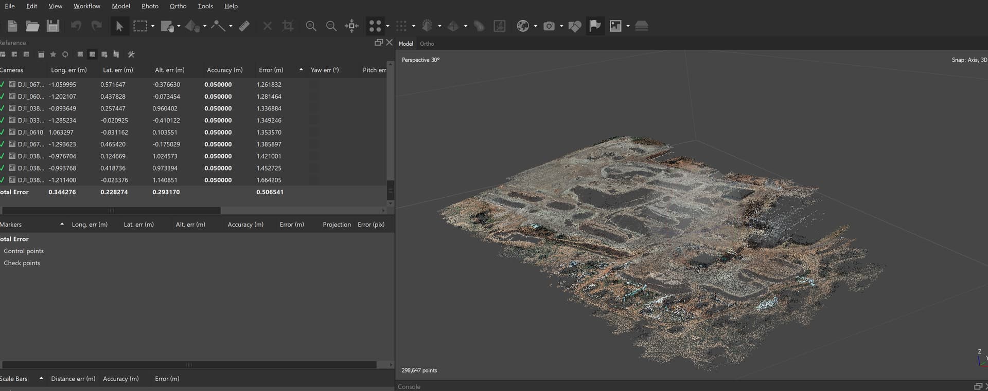
So, instead I did a CSV import of the camera-locations which gave me a 10 cm average error. Could have been worse, but still not really great.
ah i missed your GCP question. No, it was too boggy to drive into.
I only needed the volumes so didnt bother, but I will need it to work on Tuesday.
I’ll have one with lots of GCPs on Wednesday.
Well I never fully got the bird ready so my flight didn’t happen but they are both aware of the issue and in contact so hopefully we’ll see something next week. I know DroneDeploy has some initiative to have a PPK workflow themselves and this is the most likely mechanism in my opinion.
I’m looking into your data to see if I can notice something unusual from the Emlid Studio side. Also, I’m in contact with DroneDeploy regarding your case. I believe we’ll figure it out. I’ll write you once we find something or in case we need any additional details from you.