-Reachview3, Civil3D 2022, Revit 2022, QGIS 3.24, Bluestacks, Epic Games Twinmotion
I am working on designing a new religious, agricultural communal village in Southern Alberta, Canada. Buildings have to be constructed, roads built, and services and utilities provided. This is a multi-year project and will be done in several phases. For measuring the topography I used a Phantom 4 Pro V2 with GCP’s surveyed with Emlid Reach RS2’s. The project benchmark was established by post-processing logs from the Reach RS2 and data from a nearby station that provides free logs after a 24-hour period.
Stitching imagery and integrating GCP’s was done with OpenDroneMap. https://www.opendronemap.org/
I generated points from the resulting DEM and used them to make a surface in Civil 3D, this surface was transferred to Revit for visualization and for helping designing the buildings.
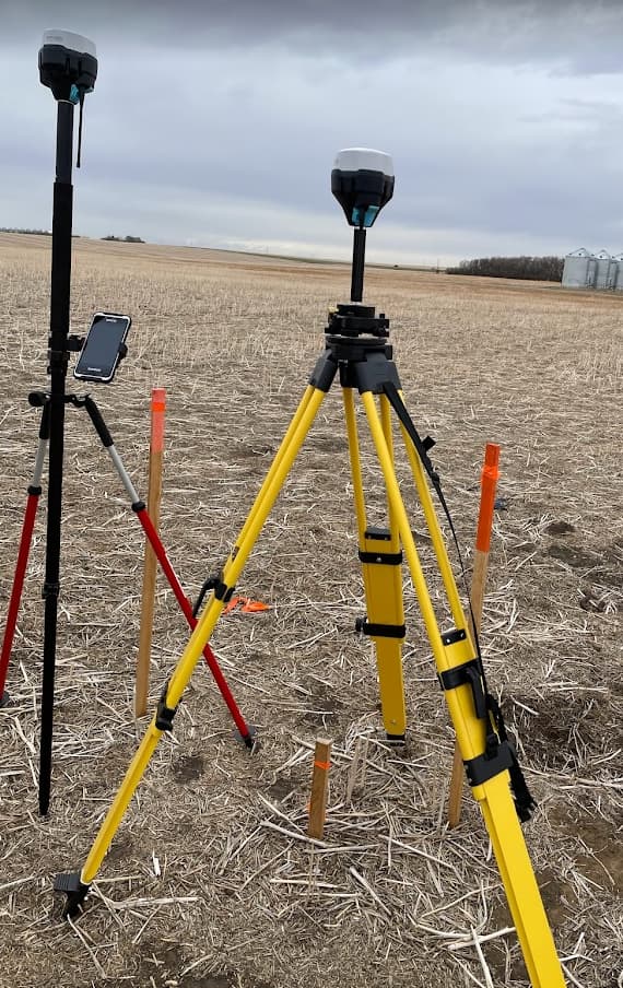
The object is some distance from my office and the customer would like to do some of the surveying themselves (for the fun, I think) but they say it’s to save money. They don’t have experience using GPS equipment but are fast learners and ready to try something new. They purchased a new complete survey setup using Emlid RS2’s.
They were not familiar with GIS and using software to create linework or points seemed too advanced for them for the start. How could I easily create points in the office on my desktop and transfer them to their Handheld Nautica X6 running Reachview 3 so that I can do the technical work and they can just worry about surveying?
The latest release of Reachview 3 provides a simple project synchronization system that I welcomed with great enthusiasm. Now I can do all the point work on my computer and create projects on my desktop that with one click can be synchronized on the construction manager or customer’s device. No more emailing points or using Dropbox to try to transfer them!
Thanks to the Emlid crew for continuing their innovative work!
Please follow a brief overview of my workflow in case it helps you. I am sending the client the points for marking out the initial topsoil stripping so they don’t seed it with crop this spring.
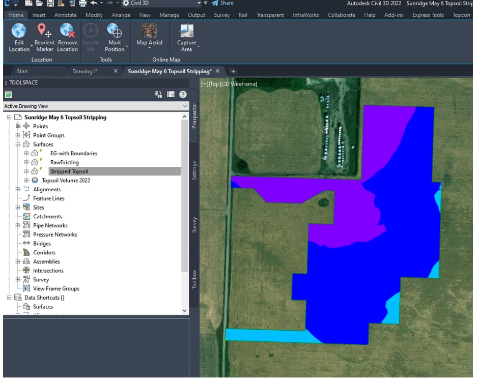
Phase One Topsoil Stripping Area - Civil 3D 2022
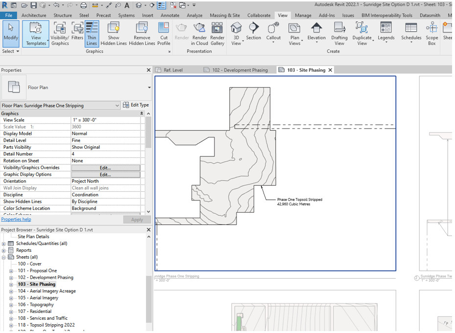
The same surface directly transferred to Revit with Autodesk Desktop Connector
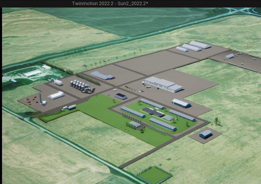
Revit to Twinmotion Plugin for Live visualization during project design.
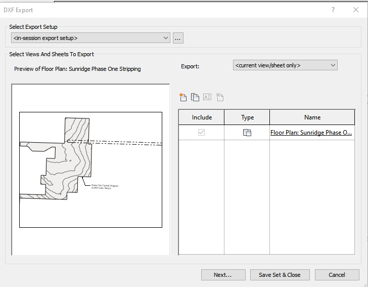
Linework Ready for export from Revit in the .DXF format.

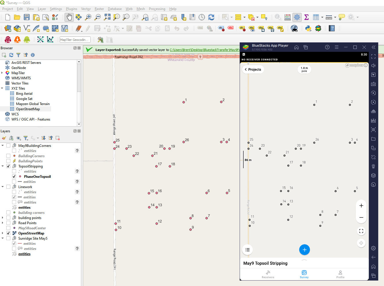
Linework in QGIS. Points Created and Ready to export for Reachview3. I usually export them as .DXF points.
Using an Android Emulator, Bluestacks, I can open Emlid Reachview3 on my desktop!
First of all, I have to save my points on to my emulated device.
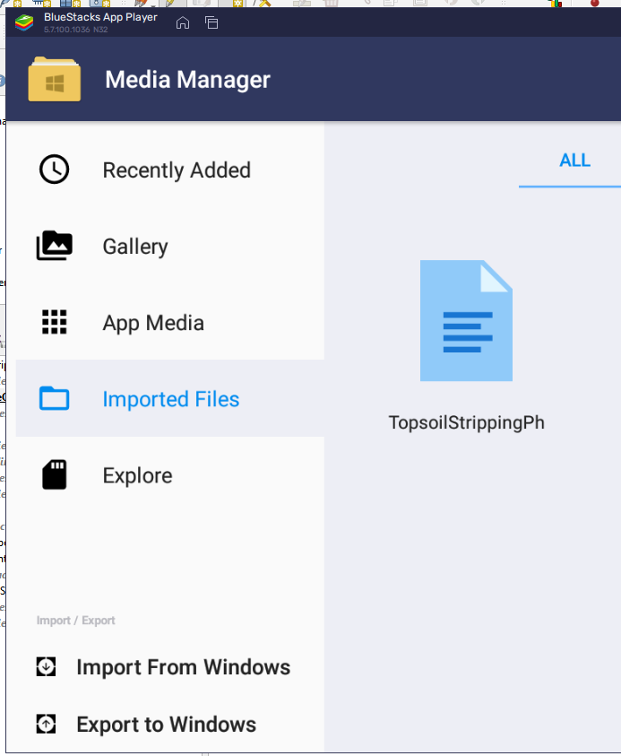
Then I can import them into Reachview3 and see my numbers are the same in Reachview as in QGIS! and now… the magic…!
By going into the profile on my emulated Reachview3 App on my desktop I can view my account details.
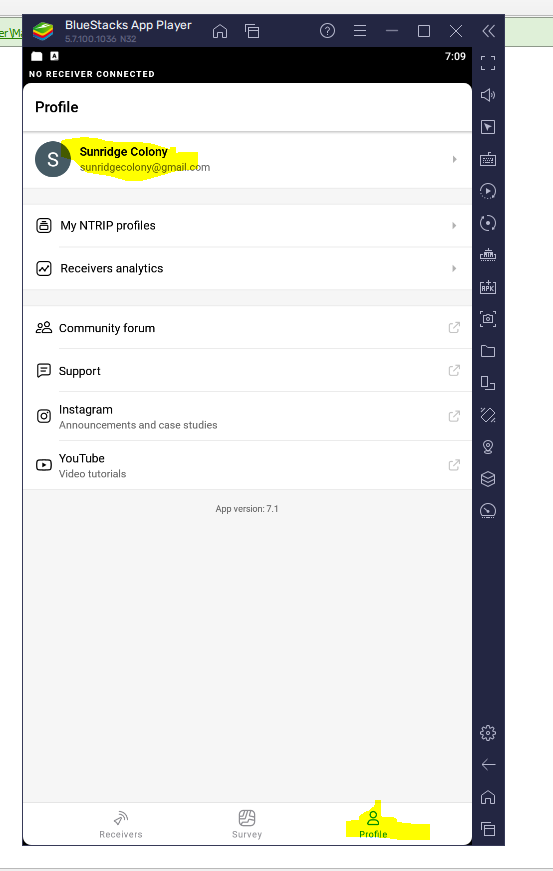
After signing in with the same account I created on the client’s device I can synchronize the projects across all devices. Here we can see the words “Last Data Sync”. The date is current. As soon as the client opens this page on his mobile device (if he has an internet connection), the Phase One Topsoil Project will be directly available for layout on his device.
Next I will do another account with building corners and they can get to work for days!
Hope this is helpful!
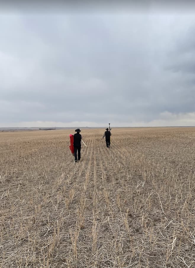
Customers at work, using ReachRS2 and, in fact, GPS equipment for the first time!