DJI MAVIC PRO with REACH M+ integration

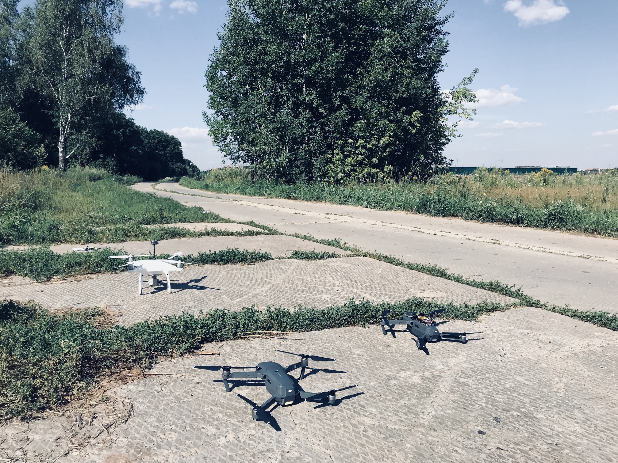
Good day to all! I want to share the results of practical application of upgraded drones by Topodrone team for high-precision UAV survey, cadastral and geological work, highly detailed 3D modeling.
For the first time modified DJI PHANTOM 4PRO RTK PPK with Reach GNSS receiver on board took off in the sky in February 2018, from that moment already more than 30 survey teams all over the world use our drones in work, the geography of their flights is quite wide: Russia, Canada, Finland, Greece, Spain and even Samoa)).


The first flight in February 2018, we carried out at an altitude of 200 meters and achieved an accuracy of 13 to 20 cm without the use of ground control points (GCP). After adjusting the hardware and software, we precisely capture camera events and substantially improved accuracy, now the DJI PHANTOM 4PRO RTK PPK allows to obtain an accuracy of up to 3 cm from a height of 60 m, 5-7 cm from a height of 120-150 m and of the order of 10 - 12 cm from a height of 200 meters. As it seems to us, this is a very good result, which makes it possible to use low cost copter to solve many types of UAV survey.

We continue developing and today we want to represent the most affordable drone - DJI MAVIC PRO PPK with an additional geodetic GNSS REACH M+ receiver integrated with the camera 12 mp, which allows you to save the coordinates of the images with centimeter level accuracy and create high-precision and detailed three-dimensional terrain models and orthophotos.
After tested flights and field works , we confidently confirm that at 80 meters altitude our solution provides the accuracy of of 6-8 cm without using GCP !!!
For testing, we selected an area with well recognized ground control points measured by survey grade GNSS receiver for further accuracy estimating. Flights at a height of 80 meters were performed with double grid routs.


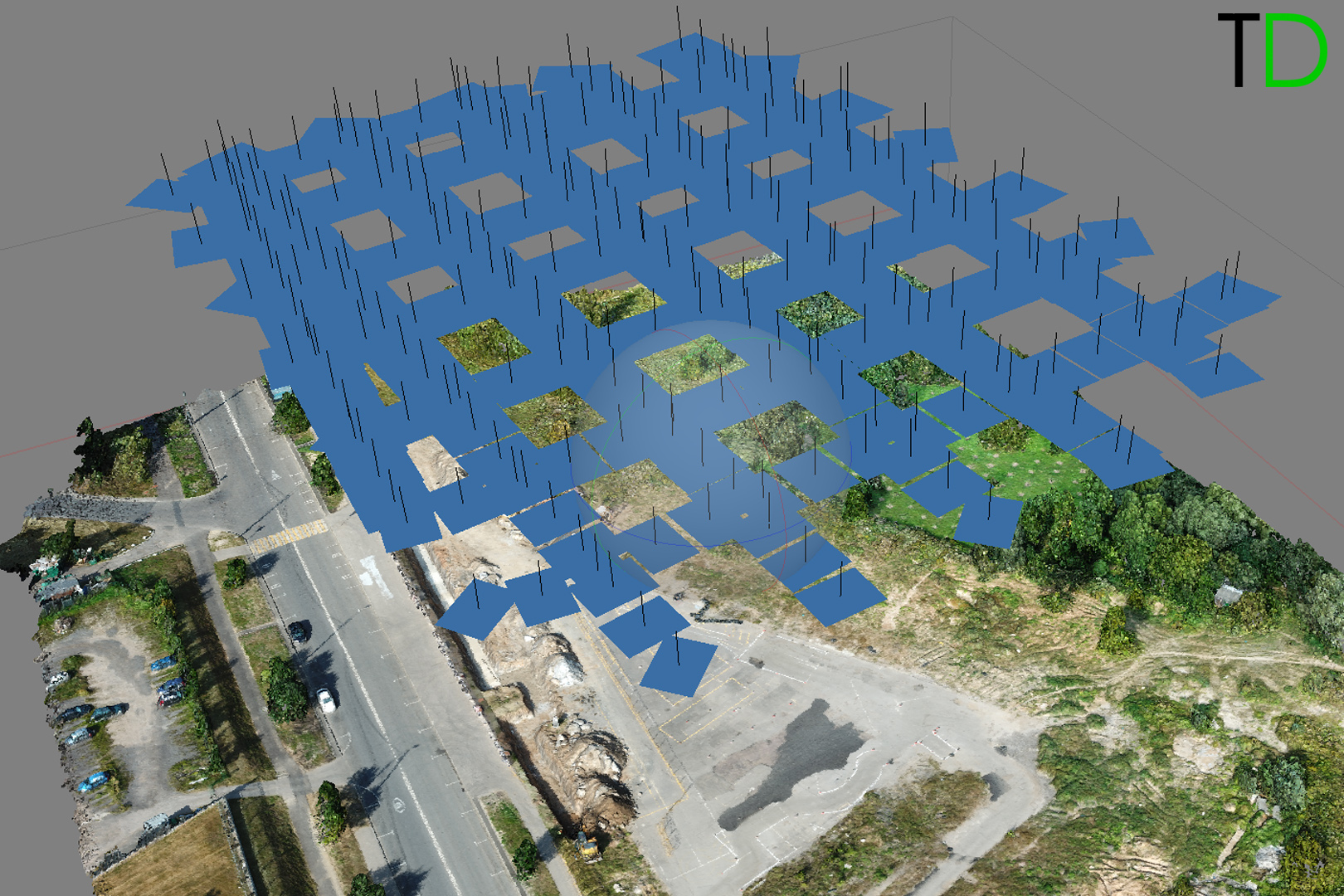
Pic. 1 Photos locations

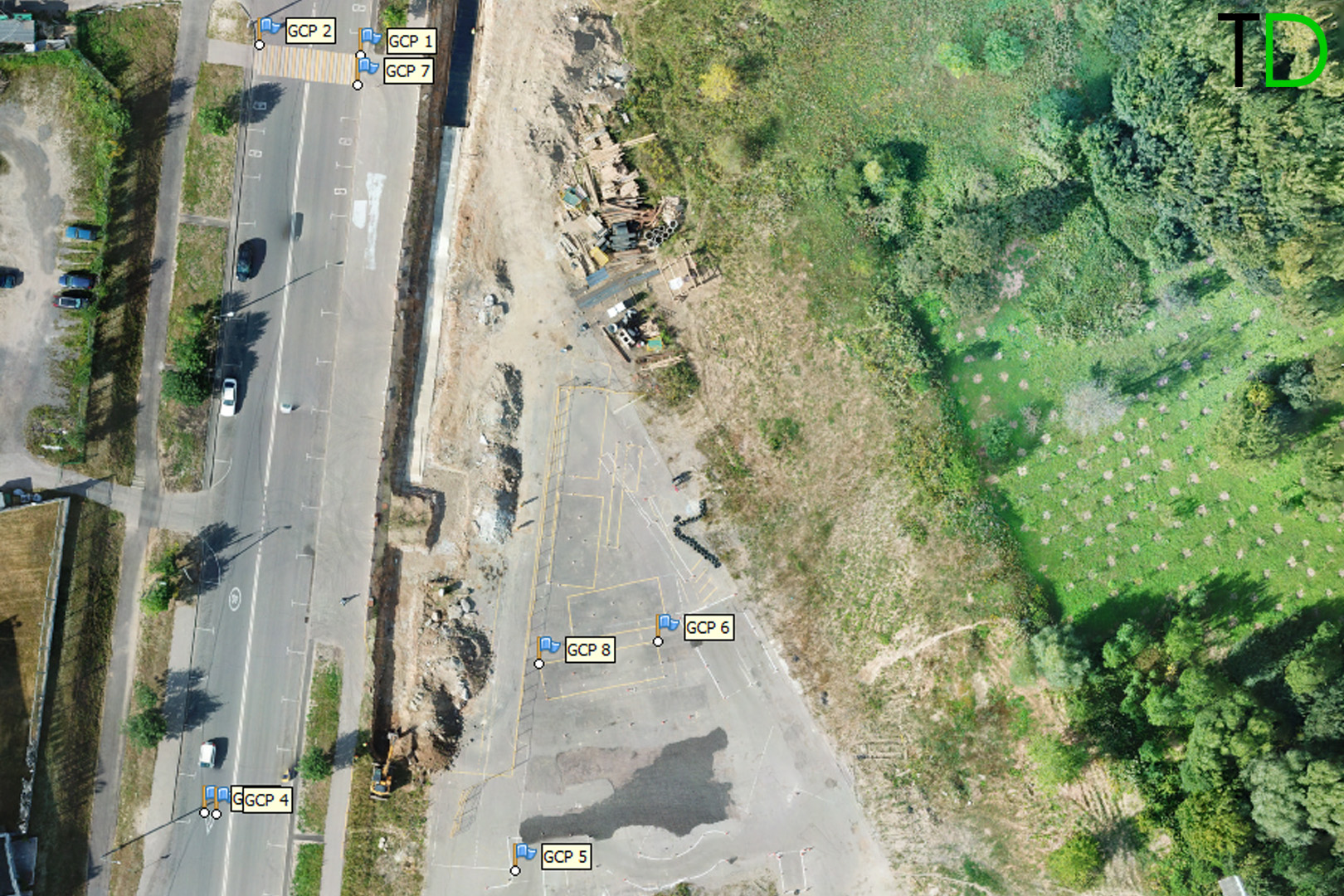
Pic. 2 GCP locations

After phogrammetric processing with using only accurate images locations captured by Reach M+ and postprocessed by RTK LIB we imported ground control points (Fig. 2) and determined their location on the images, in Table.1 you can see the accuracy report.
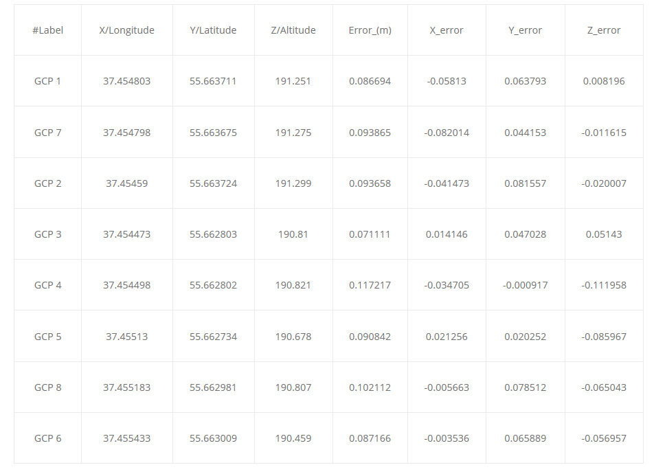

Table .1

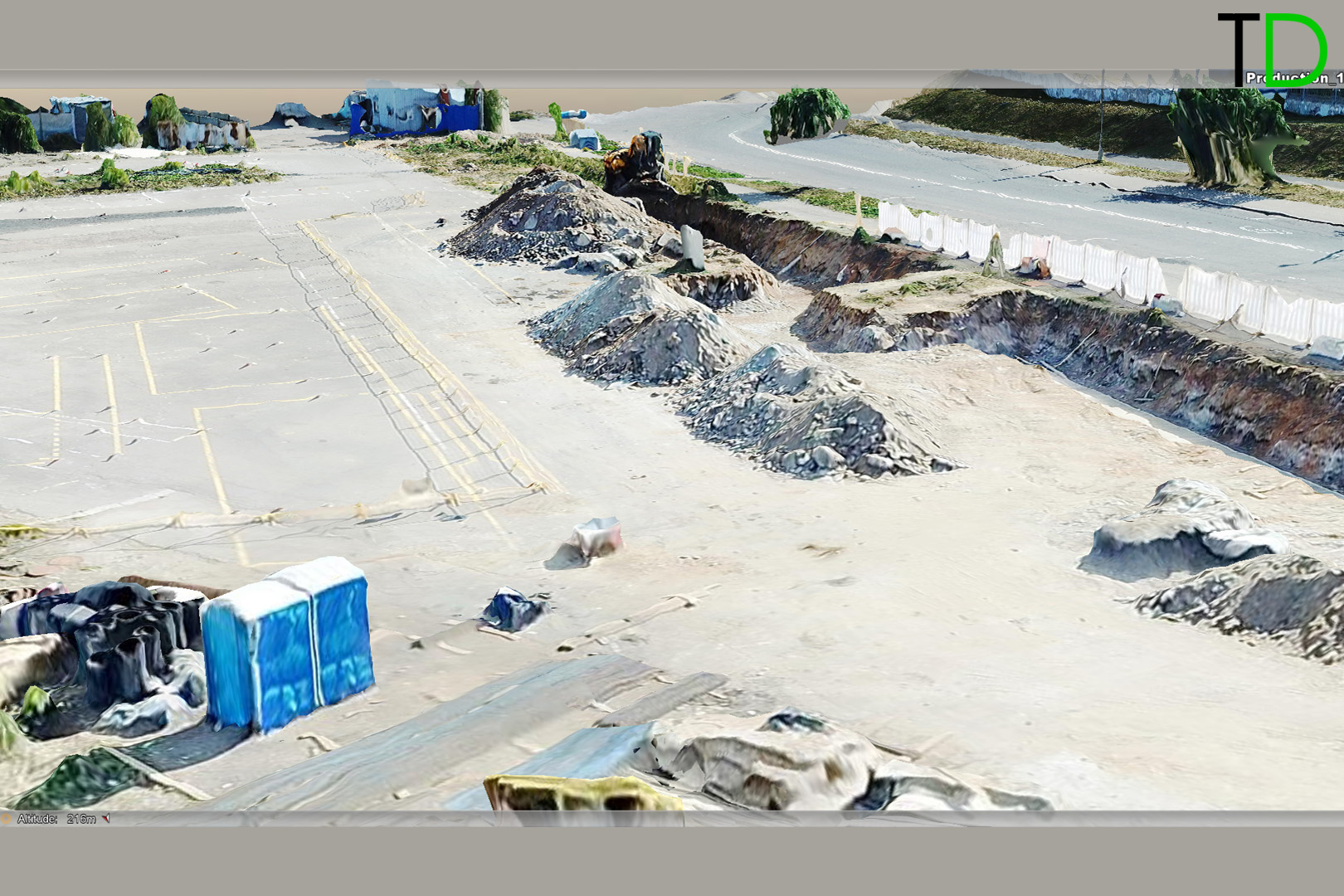
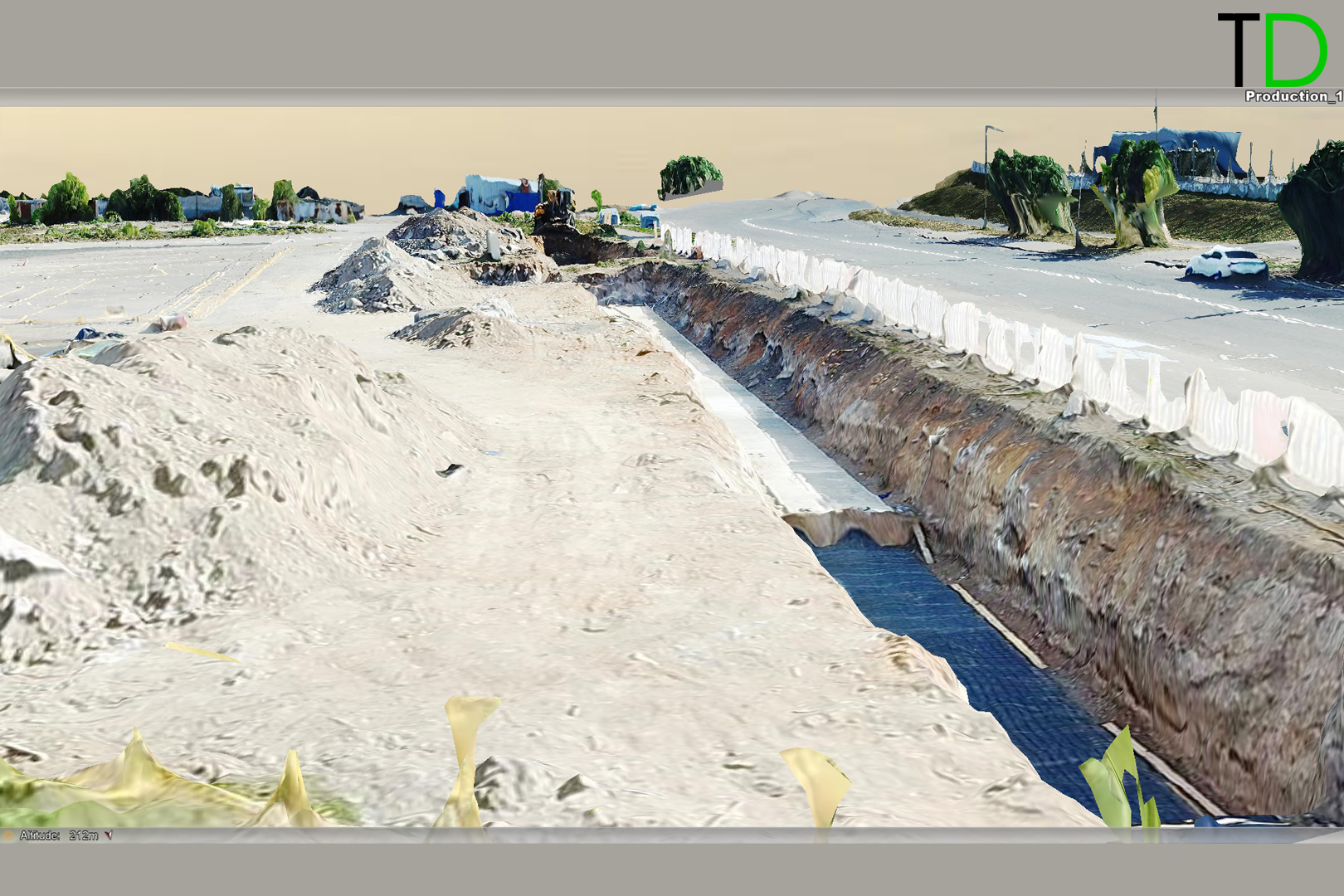
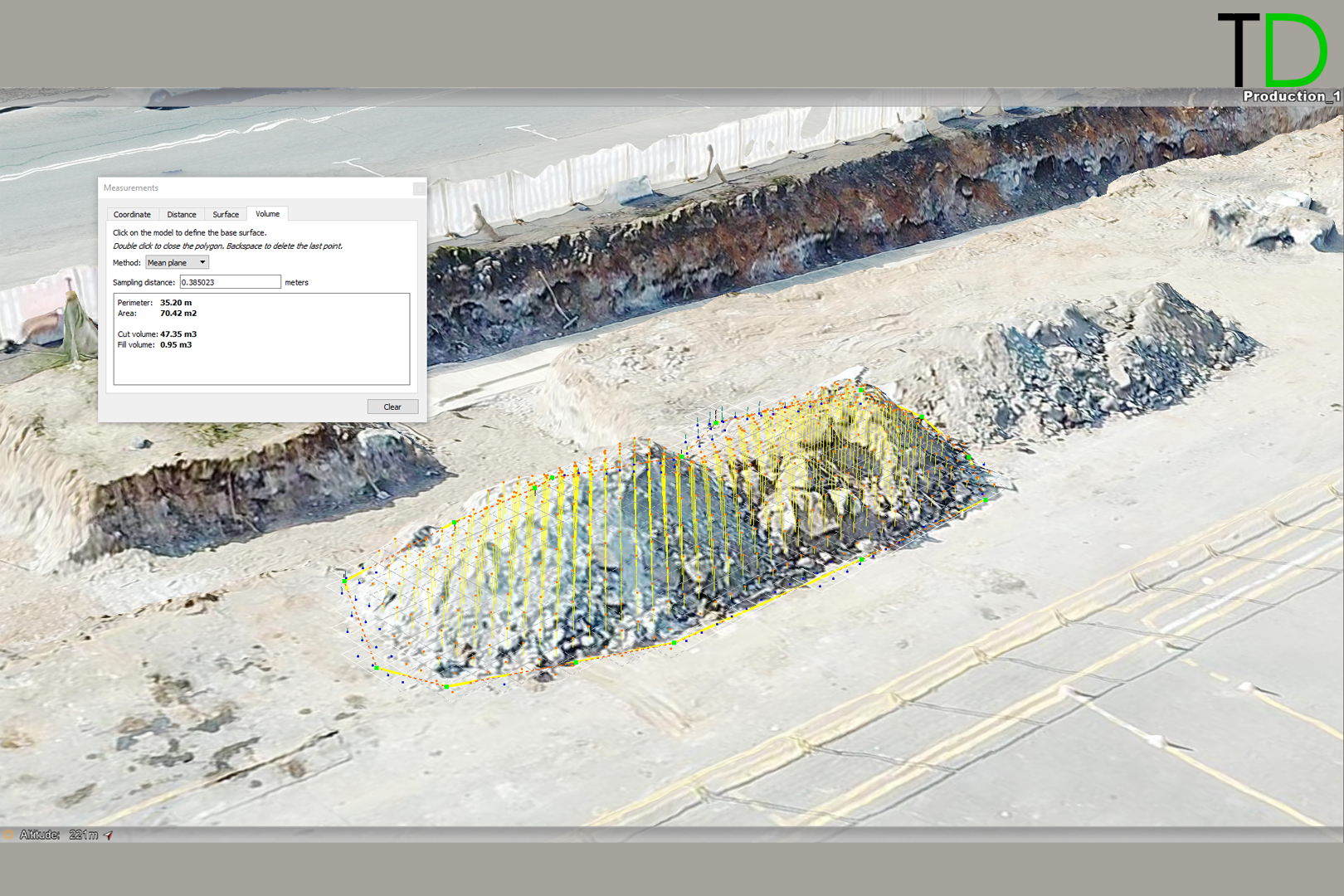
After building a dense points cloud, orthophotomocaic and a three-dimensional terrain model were created, it is possible to determine the coordinates of any object, as well as to perform the necessary calculations, for example volume calculation.


Key futures and major advantages of DJI MAVIC PRO PPK with Reach M+ by Topodrone :

  • impressively portable , when folded down, measuring only 83 x 83 x 198mm – more than compact enough to slip into a small bag;
  • long-range remote control up to 7 km;
  • battery delivering around 27 minutes of flight per charge;
  • Advanced obstacle detection system. Mavic Pro can automatically rise in front of inclined objects such as mountain slopes. In total, there are des 2 sonars and 5 simultaneously working cameras;
  • Survey grade GNSS GPS/QZSS L1, GLONASS G1, BeiDou B1, Galileo E1, SBAS receiver integrated with 12 MP camera allows to capture photos events with centimeter level accuracy and automatically process data in any photogrammetric software;
  • low cost and ease to use extends the possibilities of its application in various sectors of UAV survey.

DJI MAVIC PRO upgraded by Topodrone, having all the above advantages and technological innovations, creates a new trend in the direction of unmanned aerial vehicles for geodesy, and makes them essentially an indispensable tool that every surveyor, mine surveyor, cadastre engineer, archaeologist or geologist will carry with him soon.

Please see more info at
www.eng.topodrone.ru

5 Likes

I would be afraid the added weight on such a small drone could cause flight issues. But that’s clearly an opinion.

We have tested this solution and it is very stable in the flights and easy to use in deed.

1 Like

What are flight times now?

1 Like

Hello! This is quite exciting news! Is it possible to use an existing Mavic Pro? I already I own one. Where do you mount the antenna and ground plate?

2 Likes

Due to the lack of a mechanical shutter, it is not recommended to use the Mavic for mapping work. If you do, fly slow, as in very slow!
Many programs like Photoscan have built-in correction for this, but not for this magnitude.

at a shutter speed of 1/500 s and a speed of 10 m / s, lubrication is obtained 2 cm. This is not the value that is worried about.

1 Like

Yes, Mavic camera has rolling shutter and we know that this drone has not been recommended for mapping before, but with our technology and precise images locations we can achieve very good results for mapping in terms of accuracy.

Not many times you can obtain a shutterspeed of 1/500 on nadir images, in my experience. Especially given that best conditions for mapping is overcast.

Also, unlike with the mechanical shutter, the shutterspeed does not dictate the readout speed. The readout speed should be around 47 ms for the mavic. At 10 m/s you are looking at 0,47 m. A considerable distance pr image!

Sure much can be compensated in post, but takes even more time, and the result is still poorer than with a mechanical/leaf shutter solution.

Your kit what does include?

Reach GNSS receiver which is connected to the camera, mount kit for DJI. We don’t use any additional power supply like power bank.

Hi tinab…there were come mavic 2 pro with 20MP 1"
I believe you can do the same thing on this drone

I came here to check on the progress of development of this kit for Mavic 2 Pro as well. It has a mechanical shutter too so accuracy should improve.

Mavic 2 Pro has mechanical shutter? realy?

No, the Mavic Pro 2 doesn’t have a mechanical shutter.

Tried the available dataset from topodrone in Bentley Contextcapture and results were really poor. Also road marking are not indications of accuracy as they are also surveyed by same GNSS kit. We need real GCP for comparision.

Hi, Oto

Could you send to me more details which dataset did you use and what kind of camera model was used for processing?

We already processed Mavic dataset in contextcaptur as well and it provides accuracy within 10-12 cm.
Photoscan provides better solution for rolling shutter.

What do you mean «Also road marking are not indications of accuracy as they are also surveyed by same GNSS kit.»?

I used this one - https://cloud.mail.ru/public/6n12/ktTYzemYc/

Yes horizontal accuracy was around not even close to 10cm but there were strange results for vertical with drifting in meters with different approaches. Also as there are no other GCP to check against(like manholes) was not sure if it is issue with program or dataset.

Tried the available CITY dataset in ContextCapture Upd10 and I don’t get even near the results as from Agisoft or Pix4d.

With RTK pos only:

- RMS of 3D horizontal error: 0.535 m
- RMS of 3D vertical error: 4.740 m

With RTK pos and rotation from EXIF (18 photos lost from results):

- RMS of 3D horizontal error: 0.080 m
- RMS of 3D vertical error: 0.120 m

With GCP(category full):

- RMS of 3D horizontal error: 0.028 m
- RMS of 3D vertical error: 0.008 m

With GCP(BASE point only horizontal adj):

- RMS of 3D horizontal error: 0.026 m
- RMS of 3D vertical error: 0.007 m

With GCP(BASE point as check point):

- RMS of 3D horizontal error: 0.104 m
- RMS of 3D vertical error: 0.186 m
BASE XY error: 0.559m & Z error:0.491m

So it seems at least with this dataset and DJI camera results using REACH RTK in Contextcapture are poor. It may be related to fact that dataset has poor overlap and also that Contextcapture doesn’t handle rolling shutter distortion.

If we are talking about city dataset, that we already tested in ContextCapture and we achieved better results then in Photoscan as soon as because this area was surveyed by P4PRO. Later I will post here processing workflow of this project in ConextCapture.

P.S. we have tested a lot of project and found out that contextcapture provides the best accuracy for P4PRO in comparison with photoscan