


Hi Israa, Under options in RTKpost what do have under ‘position mode’ (try Static). Also, your base obs file says camo3209.18o I’m not sure what the 9 signifies ? - you could try a asterisk * instead to bring in all the camo320 obs files.
Dave.
Hi @ik281,
There’s no physical difference between Reach rover and base, so you could setup any of your devices over the point.
The base will be your NTRIP station. The rover will be your Reach.
You should enable all logging triggers and record logs for a few hours as you mentioned right.
Yes, it’ll be OK to stay for 2 hours if you want to this point it over and over.
You should choose the nearest station and select the similar time period for on the rover.
Otherwise, you’ll not be able to process as the satellite data will differ for base and rover.
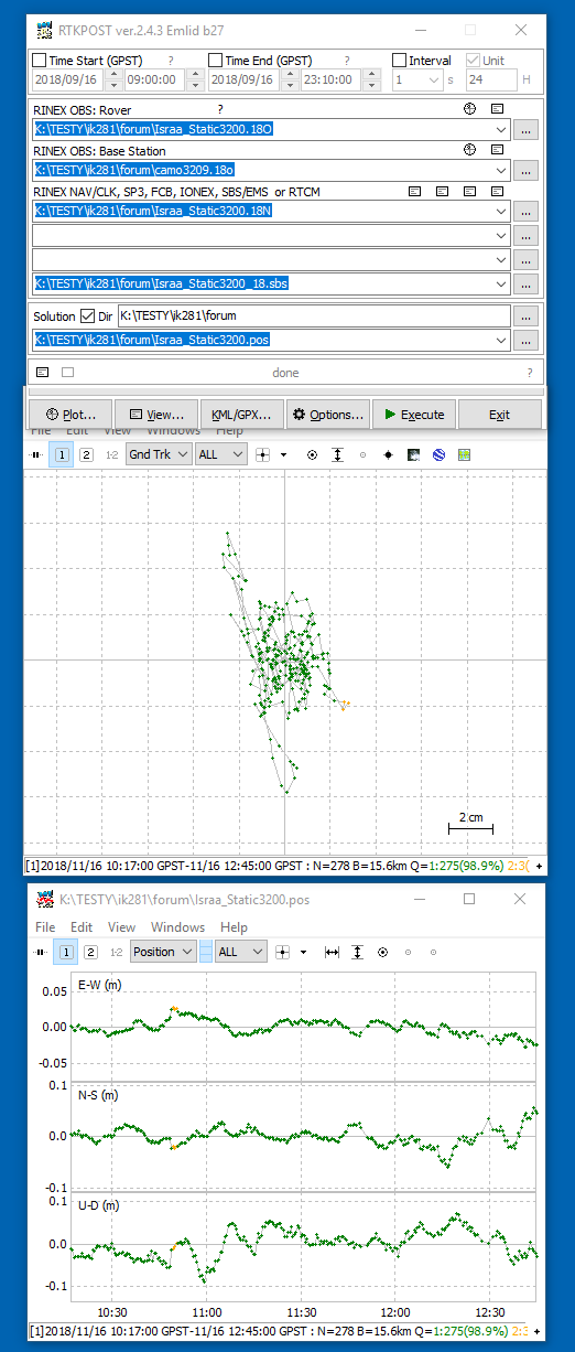
You will get .pos file after processing your base and rover .obs files with RTKPOST.
Please, look through this tutorial and follow each step to clarify most of the points and finish post-processing successfully.
Israa here is just one mistake.
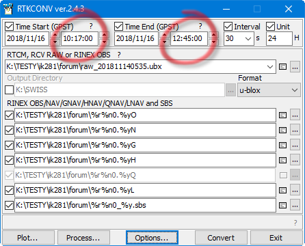
From your raw data, you must separate only the static part.
forum.zip (477.6 KB)
Have you checked it before writing? ![]()
[quote=“r.pazus, post:44, topic:12127”]
My tips are as follows:
- do not start computation without analysis, i.e. pre-processing,
- do not make such measurements with an interval of 0.2 seconds, if you have done preprocessed by RTKCONV for 30 seconds,
- you need to combine your base reference hour sessions into one RINEX file (teqc.exe)
The following graphics explain everything. You have the rest in the attached files.
[ik281.zip ]
As before. Have you checked it before writing? ![]()
camo RINEX as #9 session was attached
regards for all ![]()
Yes, I use it all the time. Have you tried ?
You don’t have to pay attention to what hour the files are, just download them all from that day, use the wildcard, and RTKpost will automatically grab the files it needs from that folder.
And yes, I have tried it with @ik281 's data as well, and yes, I get good results.
Yes, You are right. I made a mistake while testing this option in ‘Miscellaneous’ part for ;Base Stations’ list. With a blank list, it’s OK
On this occasion, I extended postprocessing to LIAR station. and add the adjustment by GNSS Solutions. (UK/OSGB 1936 (ENGLAND)/British National Grid)![]()
Report_ik281.pdf (427.8 KB)
forum.zip (485.9 KB)
This topic was automatically closed 100 days after the last reply. New replies are no longer allowed.