I’ve spent the afternoon in the community posts, so I know there are adjacent answers out there, but couldn’t find something that exactly answered my question.
I am using 2 RS+ to survey GCPs for a structure-from-motion survey of a rocky coastal platform (excellent open sky). In the field, I don’t have known coordinates for a base station but am able to send RTK corrections via LoRa and successfully get Fix status in my survey. I saved raw logs for my base and rover and corrected my base position with a nearby CORS site, but did not write down the averaged base station position measured in the field. The CSV from the rover survey shows excellent lateral RMS (<1 cm) relative to the base station.
My understanding given the above is that one approach would be to calculate the shift from the averaged base station position to the corrected base station position and then use that shift to shift my rover points.
My questions are:
Where can I find the averaged base station position? Is this in the XYZ file that I logged with the RINEX file? What are the columns of the XYZ file?
Does the averaged base station position change over time or will this correction remain static through the duration of the survey (i.e., can I apply the same shift to all the survey points)?
I’m not sure on the first question. For the second question, if you established an averaged base position when you started your survey, it will stay the same until you either reboot the device and it automatically establishes a new averaged position if that is how you’ve set it, or, alternatively, until you manually tell it to establish a new position if you used that option.
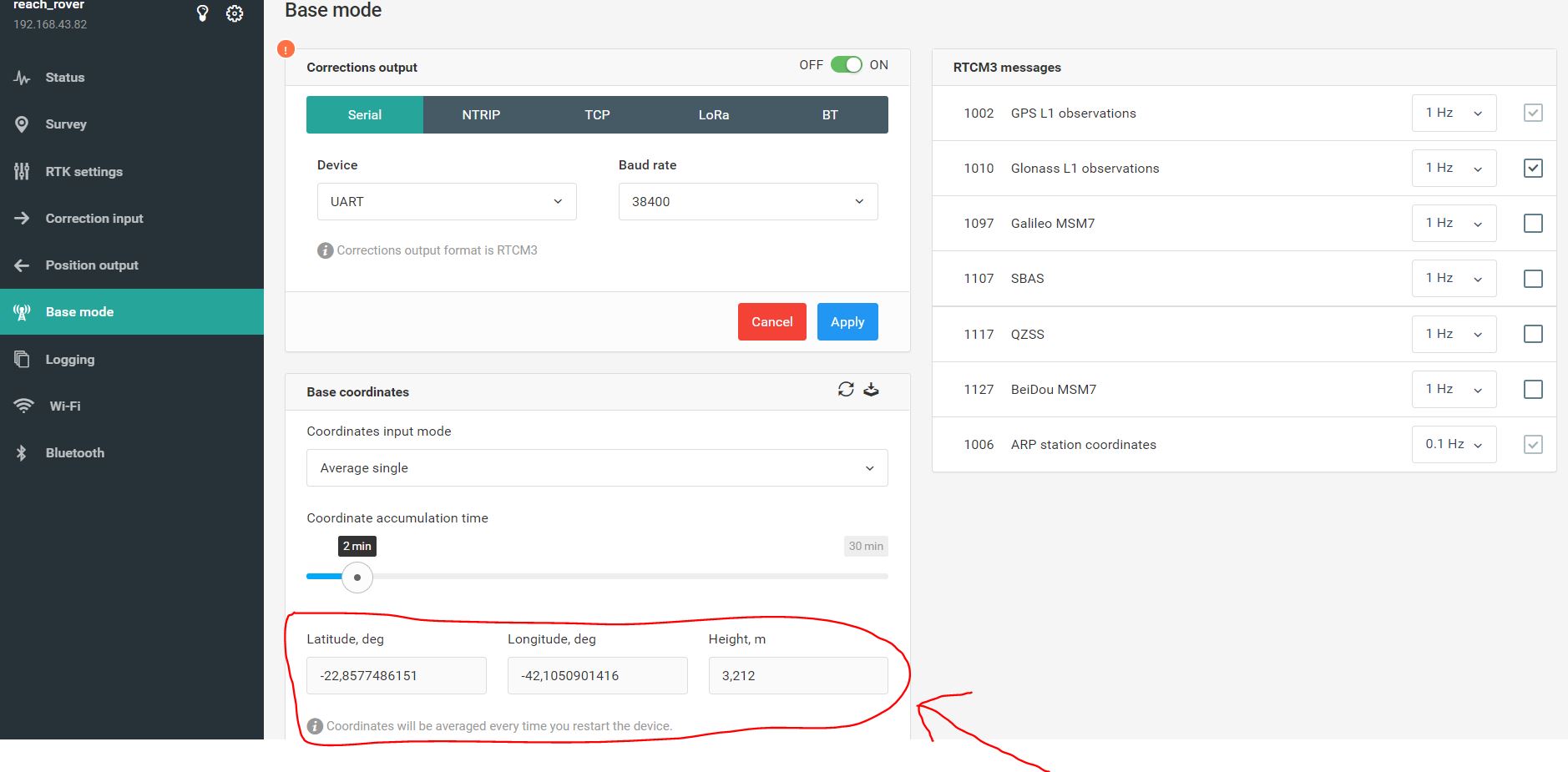
Na imagem em anexo mostro quais serão suas coordenadas médias , o equipamento irá utilizar elas como referencia durante todo o levantamento , para uma precisão mais aproximada deixe rastreando 30 minutos e para uma precisão final precisa realizar o PPP .
The easiest way would be to save the averaged position from the ReachView 3 app in the base mode section. You can copy it to any of the notes on your smartphone.
The averaged position is also saved in the RINEX header file of raw data log recorded on the unit. So you might use it for further processing as well.
As Derek mentioned, this position stays the same until the reboot of the unit. After that, the averaging happens from the start. So you can apply the same shift to all points collected while surveying with the same base.