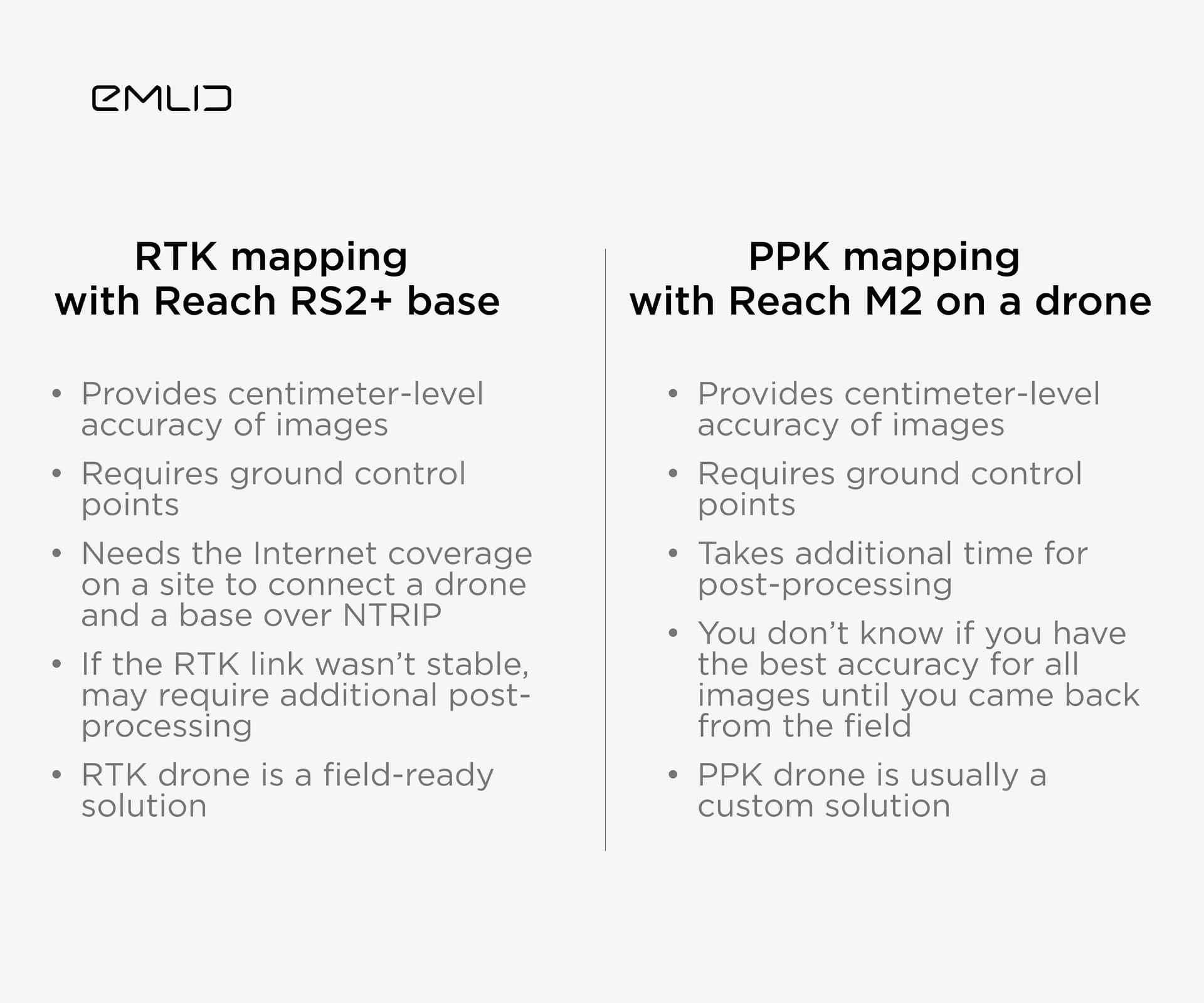
We noticed you really like posts which help you to choose the best setup. So, in today’s one, we decided to compare different drone mapping technologies: RTK and PPK.
With our products, you can do both: install Reach M2 on a drone to do PPK mapping or use Reach RS2+ as a base for your RTK-capable drone. But what’re the main points of both of them?
Makes sense but you forgot RTK via local NTRIP. This kind of negates the requires internet line. Also it may be a terminology thing but I don’t think either require GCP’s per say. We only use checkpoints.
Including 1 gcp on an RTK project usually makes a noticeable difference in z for me. You can probably just shift the surface by the averaged CP z error and end up at the same place, though.
We use no less than two and sometimes use three checkpoints if the project is big enough or oddly shaped. We find error that puts us out of our tolerances. There’s no way to know which end of the error spectrum you should be trending towards. I see a lot of cases where one point has an error of -0.05ft and the other two are at +0.08ft. If I only had an 0.08ft point and adjusted my vertical accordingly then that -0.05ft becomes -0.13ft and out of tolerance. If someone wants to get something close then your method is obviously working but when you are scrutinizing it in specific areas we have to abide by tolerances across the board and cannot afford to fail an inspection.
Just to put some scale on it 0.10ft over 20 acres of home pads is over 3,000cy = 180 trucks = $36k.
Don’t you find that if you have 3 points to work with, if you set one as a GCP, the error reported by the remaining 2 decrease. That’s what happens for me generally. I usually set at least 4 or 5. If I process with all as checkpoints, and then reprocess with 1 as gcp and the remaining as CPs, then the error of the remaining CPs decrease. Not in every case, but more often than not.
I haven’t tried one GCP because our processing software won’t allow for it so you might be right. I just know that GNSS can float +/- 0.10ft and when you are scrutinizing every hundredth it does make a difference. In our workflow it really doesn’t matter but for those that don’t have inhouse infrastructure to handle this kind of data it could be a serious problem. I have a peer at another company trying to use a single point vertical calibration with an M300 and he does need the data done without any post work and is having hell with it. We pretty much narrowed it down to the combined error from Survey level-looping of the local benchmarks and whatever error the drone introduces.
That’s true! But I didn’t mention it on purpose cause it doesn’t work for all RTK drones models. For example, for some DJIs. But it’s a good option, I agree.
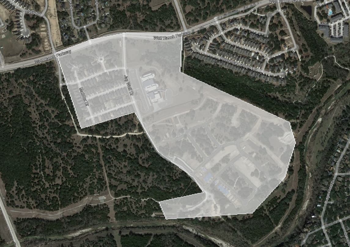
Sites over 100 acres and pretty much all corridors longer than a mile. Sites under 100 acres that are basically corridors, oddly shaped or have a lot of relief are also candidates. This one is 80 acres with 140ft of relief down to the river.
PPK and RTK. I’ll submit a 4th that we all started with! No controls. I will say that with today’s processing softwares you can get 1ft/1000 relative horizontal accuracy so for some it still works.
For a small area, completely agree. But for anything larger than say 100x100 meters, it can easily start to warp. Especially if using non-mechanical shutters, and even if not using a pre-calibration file.
Agreed but I am speaking more in terms of a small 2D map. Especially when they only want to “fit” the CAD overlay. Requests like this are maybe 10% of our flights and being able to turn around 5 acres (our cut) in 2 hours it’s pretty handy. DroneDeploy live map can turn around that size in about 20-30 minutes but at 4-6in/px. I’ve gone to a site at golden hour and turned around a ortho CAD overlay for an Owner’s meeting by 1pm. A live stream would be cooler but construction schedules don’t work like that here, lol.