


Just a note for all users, CHC Geomatics Office 2 PP software accepts native .UBX files from receivers. I’m testing the software and considering buying. Haven’t done any work with the software yet, but just successfully imported zipped archive of raw .UBX file
Bought this afternoon for $620.00. My software evaluation ended today. As reported above, imported zipped .UBX file and also CORS data and everything looks good. However, I can’t PP till my USB lock arrives early next week.
1 Like
Can it process in kinematic mode using multiple bases against a single rover and get the best result from the 2 trajectories? Thanks.
Hi Bryan,
Thanks for sharing the tool you’re working with! It’d be great to check out the post-processing results it’d be possible to get with the software 
Will do… I’ll get the USB lock maybe today, probably tomorrow. I’ll post results
1 Like
Hey @EBE111057. Just wondering if you got the CGO2 to process the emlid rinex files? Does it read them natively?
Yep, got the USB lock late yesterday. As I said above, the software accepts the native .UBX zipped archive from the receiver. No unzipping or converting to rinex required. I also imported the CORS data and everything is ready to process. I let everyone know sometime today on processing. Just got in office and already need to put out some fires !!
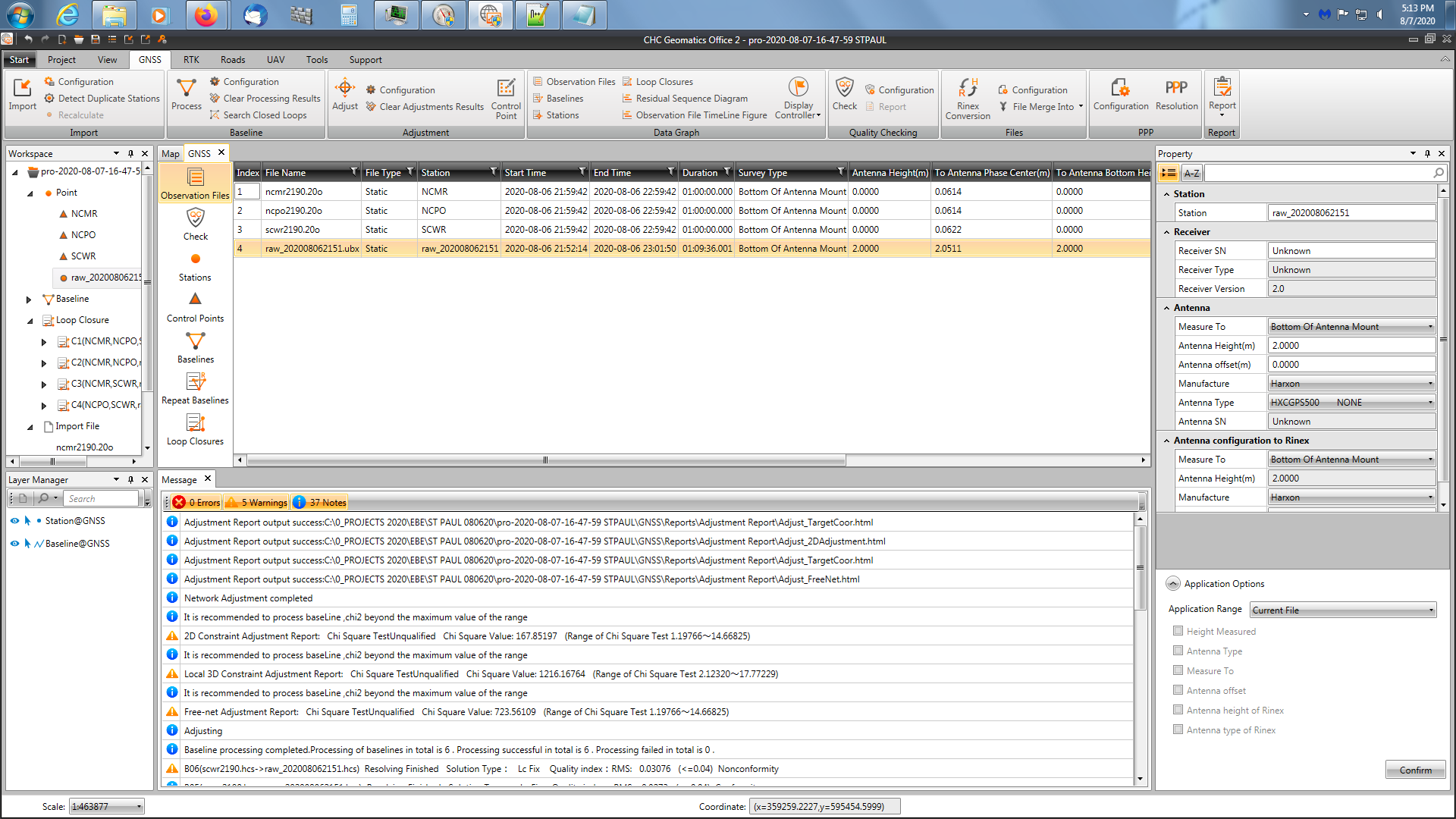
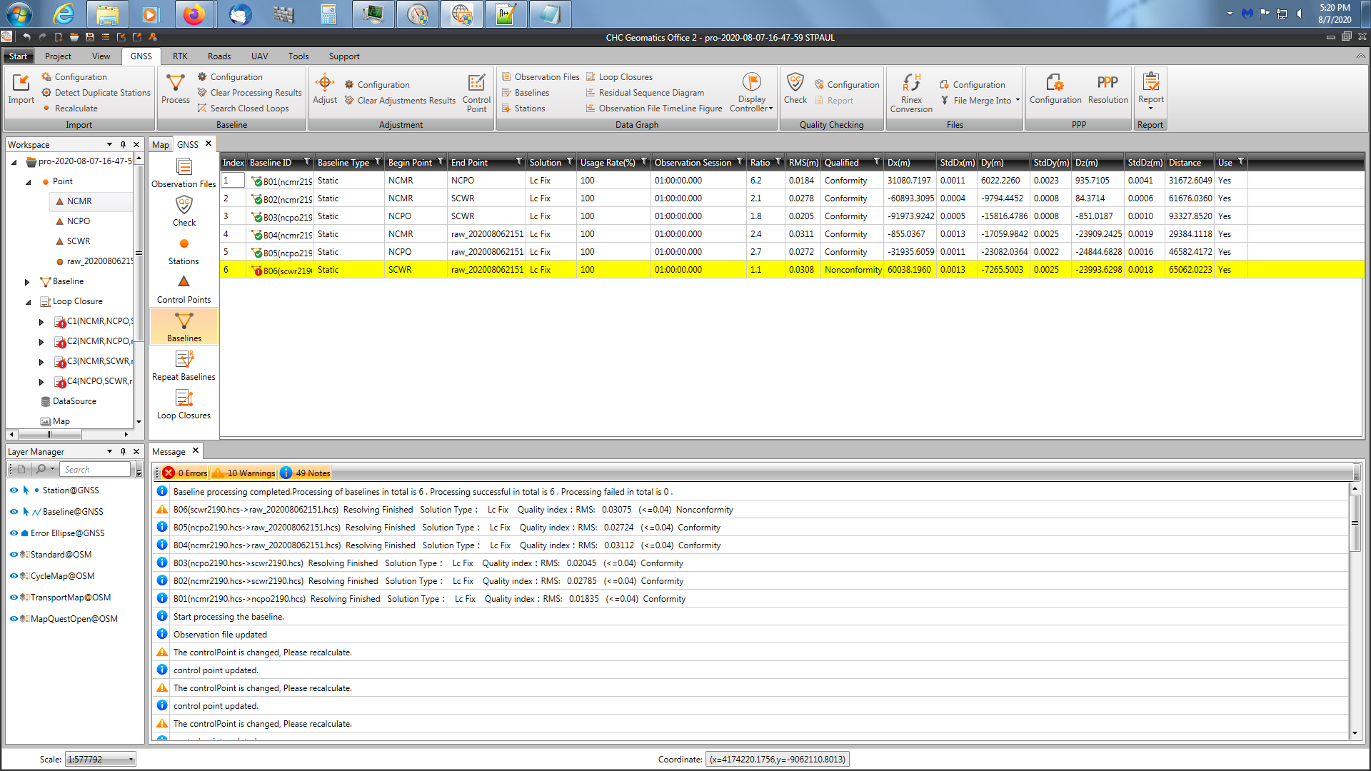
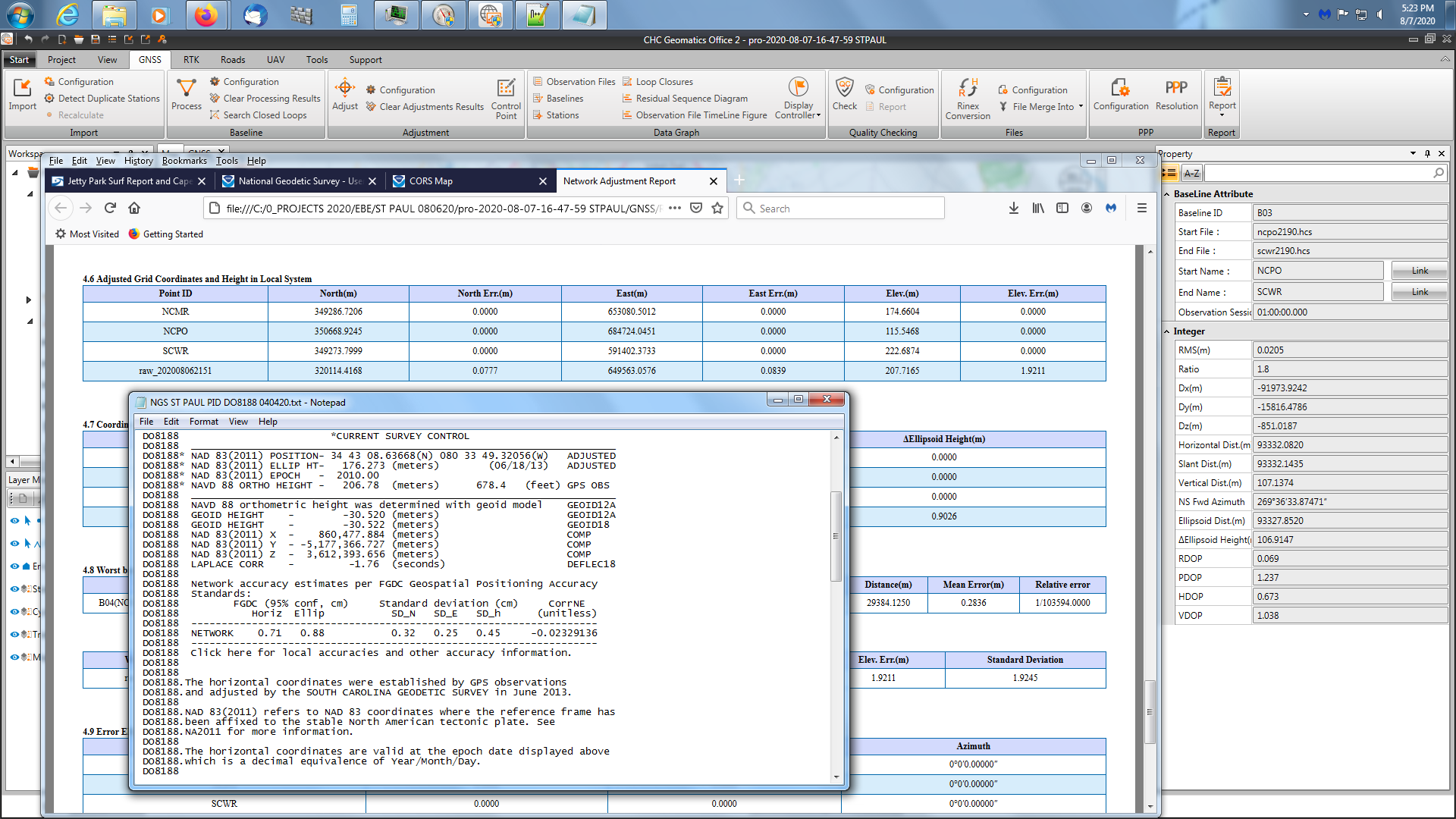
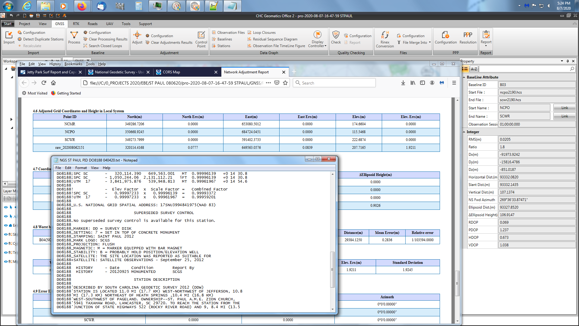
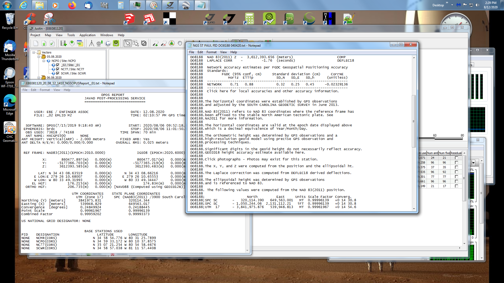
Okay, here are some results occupying NGS Saint Paul for 1 hour with M2 and Harxon GPS500 antenna at 2.000m height. I really haven’t had time to fully understand the transformation methods, GEOID interpolation and setting the adjustment parameters, but importing the raw file “raw_202008062151_ubx.zip” as is and the CORS data was very easy. I went ahead and PP the data and used the automatic “3D constraint adjustment” to my local system NAD83(2011). The error’s were 2.0 cm north, 5.66 cm east and the vertical was way out… 0.94 meter. I think the vertical error can be attributed to the interpolation method of the geoid file. I don’t fully understand what method to use. It’s a little different from the other PP packages I have.
Overall, I’m pleased with the software for $620.00, but I’ll have to do more investigation on the various setting for PP. For those using any kind of PP software, you need to occupy a known station to verify your results until you are familiar with the software.

3 Likes
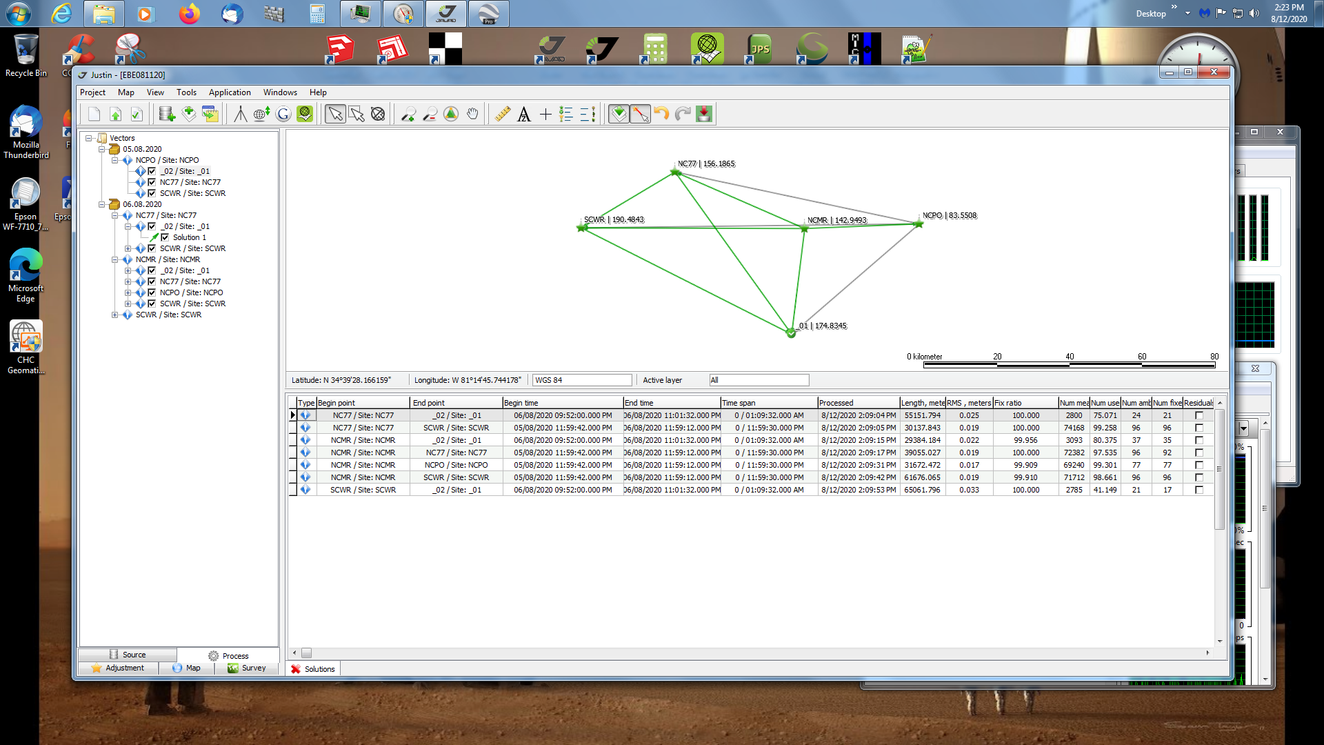
As I’ve been testing the software, I also benchmarked the observation file against JAVAD Justin PP software. With CHC, I’m encountering some vertical accuracy problem with the geoid file or maybe its just the PP, don’t know yet but the horizontal accuracy is fairly good +/- 0.03 cm. The vertical accuracy I’m encountering with CHC is approx 1 meter. I didn’t have that many sats (GPS, GLONASS) that were in optimal positions in the sky that eve. Also, there is a county radio tower within approx 100’ of the station. I’ve PP using JAVAD Justin, vertical accuracy hits within 0.045 cm, horizontal accuracy North 0.046 cm, East 0.016 cm. Pretty good for 1 hour observation near a radio tower. Below are screen shots of JAVAD Justin PP results.

I will endeavor to persevere with the CHC software. Honestly I think it’s good software, but it may need longer observation times especially near a radio tower. Here’s the raw file if anyone wishes to PP. I used the rinex version in the JAVAD Justin software. M2 1 hour occupation, arp is 2.000m Harxon GPS500 antenna (HXCGPS500-NONE)
raw_202008062151_ubx.zip (3.2 MB)

4 Likes
I like using the JAVAD Justin PP software as the computed position report is a mirror image of OPUS report .
1 Like

Here’s a pic of the radio tower in question. Looking NE from NGS station ST PAUL.
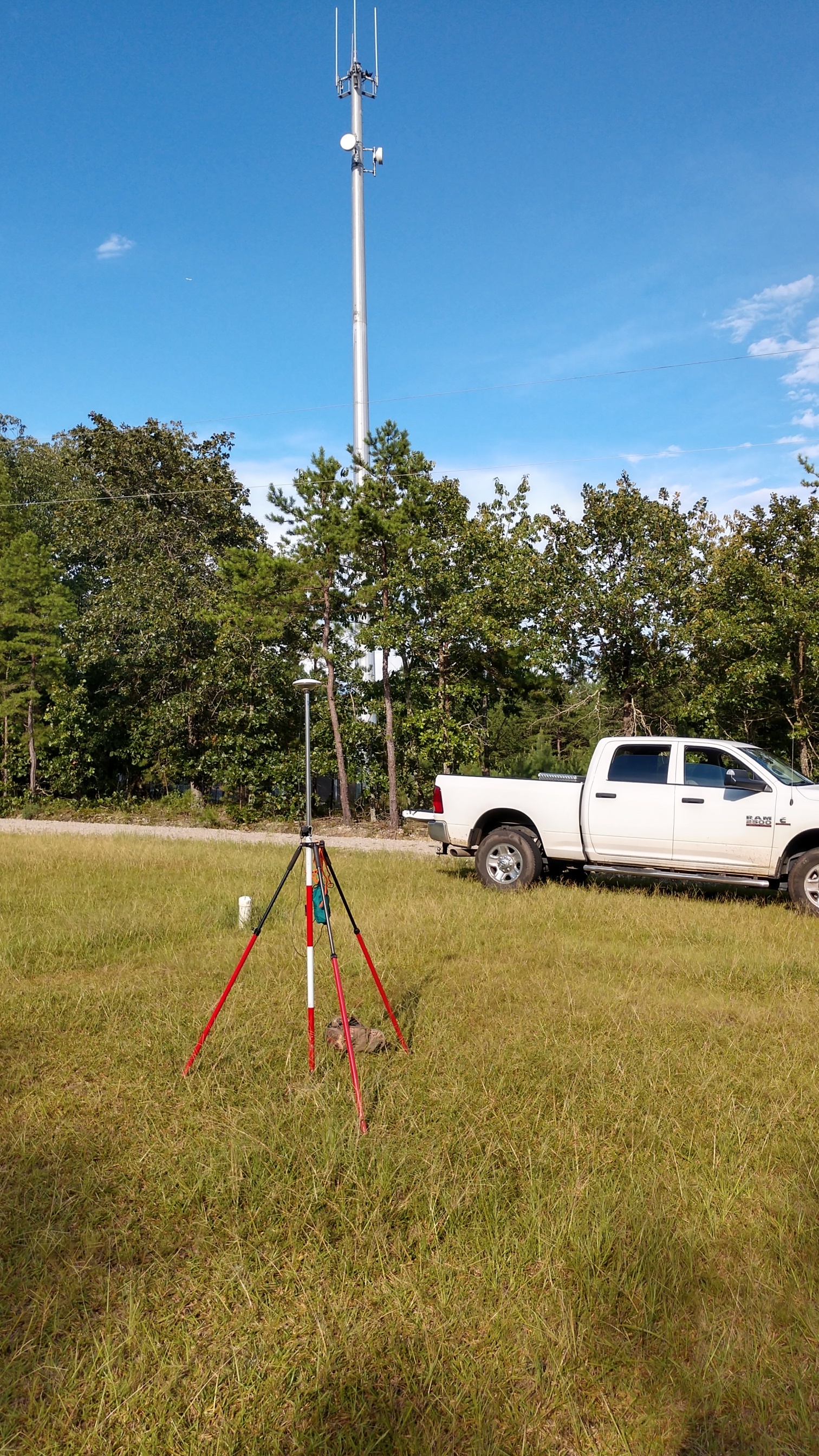
I’m sure there’s some kind of radio interference
2 Likes
The antenna was placed there approx 3 years ago after ST PAUL was established
1 Like
Okay, I’ve gotten pretty familiar here lately using JAVAD Justin PP package. It’s an excellent processor and was written by the guru himself, Javad Ashjaee. What a loss…
https://www.javad.com/jgnss/products/software/justin.html
I would highly recommend the software to any hobbyists, professionals and also the current development team. I used the the above M2 data in rinex form (GPS, GLONASS only), excellent results, fully adjusted. As I have posted in other topics, the report mirrors NGS OPUS computed results. See the highlighted areas in the report and also the NGS datasheet (units in meters). Pretty good results near a county radio tower.
I’m still using and fumbling in CHC Geomatics, but most of my energies have been directed towards Justin software.
NGS ST PAUL PID DO8188 040420.pdf (22.5 KB)
1 Like
Hi Bryan, did you happen to run it through RTKLIB QT program to compare the results with the Javid & CHC programs? I tried running it using the file that you uploaded (raw_202008062151_ubx.zip), but with no results, either with RTKLIB QT b33 or the RTKLIB_demo5_b33 version. I’m sure I’m doing something wrong. I used the CORS NCMR station as the base.
No, I haven’t used rtklib in years, since I bought ublox L1 only chip in 2010 (?). Not sure… I found rtklib okay for experiments, but you can only process a single baseline at a time. It’s not suitable for professional work as it has no adjustment routines either. The file was observed on a known NGS station. See attachment above. I’m not sure, but to use in rtklib, you’ll have to unzip.
I’ve been concentrating on Javad Justin due to projects I’m currently working on. It’s pretty easy once you PP a project, the manual isn’t very user friendly in my opinion. I think the software is very robust and better than anything out there including online OPUS. I used the rinex file created in the M2 for Javad Justin. I didn’t use rtklib for conversion of the raw ublox file.
The CHC software reads the archived raw ublox file directly. I haven’t really had much time to use, it did process the file and horizontal position was pretty close to published mark, but elevation was approximately 1 meter off. I’m not sure if I’m doing something wrong in using the geoid model or not. It may have to do with the county radio tower nearby, I don’t know. Javad Justin PP the file fine.
I’ll have to explore the CHC software more. I think it’s promising for the cost I paid for it, $620
Bryan, Thank you for the explanation. I’ll have to look into the two software solutions mentioned.
1 Like
Mark, the Javad Justin is $1990 and the CHC is $620. I bought the CHC about a month ago. You can download and request a 30 day fully functional trial.
I bought the Javad Justin about 6 months ago and have been pretty pleased with it as we have all Javad machines here.
Just for the fun of it I ran the rover file through RTKPOST demo5 b33b2. I used basically the default settings for a static baseline - GPS only, L1/L2, fix-and-hold, no atmospheric corrections, 10 degree elevation mask. For the base I used NGS’s User Friendly CORS and grabbed a 3 hour block of the CORS station NCMR as is.
The RINEX Header was used for the base coordinates. That’s essentially the June 2019 published position.
The result:
34 43 08.6369 -80 33 49.3204 176.296 RTKPOST (single baseline - NCMR)
34 43 08.6367 -80 33 49.3206 176.273 Published (2013)
34 43 08.6359 -80 33 49.3205 176.267 JAVAD (Network NCMR/NCPO/NC77/SCWR)
No major differences. The latitude difference for the JAVAD software seems a bit high. It does yield a closer ellipsoid height, but we are really getting into the “noise” at this point.
There are many issues which come into play at the cm to mm level. Just to pick one here the coordinates of SAINT PAUL were published in 2013. There’s no way they could have known about the 2019 NCMR coordinates so for a single baseline using the published 2011 NCMR coordinates would be the better choice. They don’t change the lat and long much, but do drop the ellipsoid height by 1.3 cm to 176.283 meters. A better match, but again there are a variety of issues which can cause differences at this scale.
1 Like