


One of the first things we loaded was the “anotherdxfimporter” plug-in which allows visual configuration to be adjusted so all the linework doesn’t come in same layer and/or color. We have a CAD standard that determines all of the coloring and lineweights of layers and we’re then able to import everything as it was seen in CAD.
4 Likes
Hi Michael,
I use two RS+ units in a somewhat similar fashion to you. I record data in NAD83(2011) / UTM zone 11N format. Those are X, Y, Z coordinates, which can be directly imported into CAD. I export the CSV file, and the create a DXF file from the CSV file using Pointor software (www.ransen.com/pointor/). It works seamlessly for me. Note that I’m not overlaying on Google Earth, or a specific map for my purposes, so if you’re doing that, then maybe my suggestion won’t work for you. The RS+ is great, and is all you should need for your described purpose. Kind regards, Don.
2 Likes
Frank, I think I found my problem. I only have one map option. “OpenStreetMap” how do I get Google Hybrid?
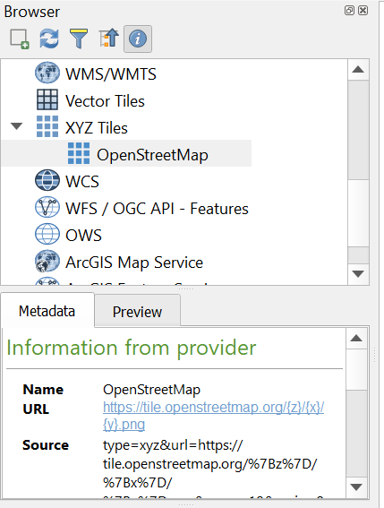
I had to download them. Don’t remember but do a Google for Loading XYZ tiles in QGIS. Not at my computer now.
Thanks, I’m doing that now.
This video shows three different ways to load base maps.

Maybe this will help as well.
Got the maps installed, thanks everyone.
1 Like
So we’re all quite curious, did you get your points to import and show up on your map in the proper location?
1 Like
Sorry, got pulled in three different directions.
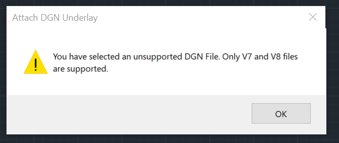
I was able to save the file as an ESRI Shapefile but when I try to insert it I get this.
I tried KML but it only lets me bring one point in.

Are you working with Microstation? The files being referenced are dgn and only work in Microstation.
1 Like
Where were you trying to insert it? What software program.
1 Like
Why not bring the points in from the CSV?
I’m working in Autodesk AutoCAD 2020 and I have now Downloaded Autodesk AutoCAD 2022 and I get the same results. The only way I’ve been able to import the point at a DXF or to insert multiple points.
I believe you are not setting the correct coordinate reference system. I have an RS2 and I’m in Florida and I use the FDOT- FPRN and I’ve been using my Leica Total Station and my RS2. So far all my distance measurement are right on. I convert from grid to ground which Traverse PC does, and I combine my field data from Total Station and RS2. So far everything has been smooth.
3 Likes
Frank, how did you get the points into Autocad Map 3d?
Autodesk Map 3D, Civil 3D and Carlson products are made specifically for Engineering, Construction and Surveying and have specific geomatics functionality to handle “coordinate files” and points routines. This is what people have had to figure out to hack with standard AutoCAD that does not have that functionality.
2 Likes
@maustin
I just dropped back by to see how you’re doing. I’ll be happy to walk you through this, but you will want to reply to my posts if you want me to get an email, otherwise I may not look in on the forum for a month or more.
Did you ever get QGIS to work following the guide I put together for you?
Have you downloaded AutoCad Map3d? If not you will need that piece of software on your computer. The attached file will open in Map3d and have your proper CRS. It is confusing at first but it will come together. Get back with me when you have Map installed. By the way, Map3D is part of the Autocad suite so there is no additional charge, you just have to download it.
Texas Quarry.zip (97.7 KB)
You do have to set the CRS in AutoCAD Map/Civil 3D for the purpose of bringing data in. Without that it will drop in according to the yxz coordinates that exist but anything else you bring in cannot be transformed or use a scale factor.
This topic was automatically closed 100 days after the last reply. New replies are no longer allowed.