


For the locations where I use Reach I had no way of obtaining a reference location to setup the base unit. The best I can do is derive something from google maps but that is not accurate and for my app its a waste of time. All I need is to be able to get measurement in an x,y,z coord system with the base at 0,0,0 .Is there a way that I can use Rover to generate solutions relative to the base but not geolocated? I’m doing this currently with an Arduino Due and the sketch coverts the llh output to xyz then zeros the base to 0,0,0 and then the resulting Rover solutions are relative to the base at the origin of the coord system. It would be great if Reach could do that so I could ditch the Arduino as well as wasting time looking up base coords for each location
Sound like a reasonable request. We are working on surveyed-in base coordinates and that should solve most of the issues.
Any time scale on this? also interested here…
@Eric in what country could you not get a reference location?
Would be a nice feature. 
I am learning about RTK myself, so consider this as a blind person helping another blind person.
-
Start with the following, it seems there is a RTK server in Utha. You can get corrections without a REACH base unit. If they charge a lot, go to step 2.
You are being redirected... -
Look at these sites for reference points
National Geodetic Survey Data Explorer
ngs.noaa.gov
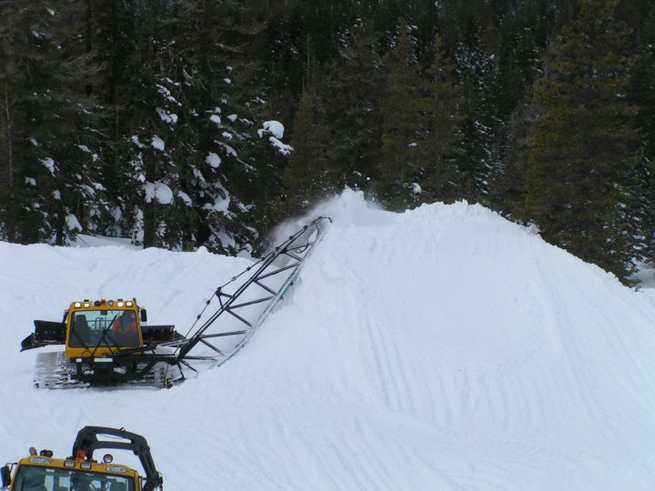
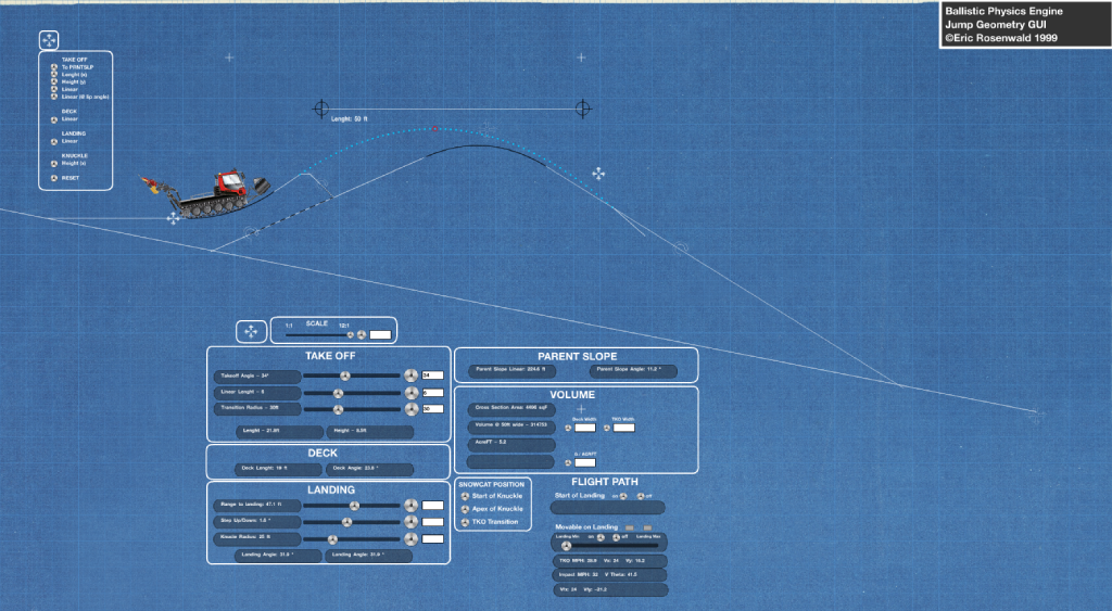
I’m using this in mountainous terrain in the US. Usually no internet connection so I find myself looking up an area I’ll be working on google maps at home and trying to locate a rock, bush or tree, then in the field find that object and setup the base. Quite time consuming and hard when working in snow. I’m using this for both navigation and automation of heavy equipment and exact geo located coords are not required. All that is required is the base at 0,0,0 anywhere in the work area and the rover outputting relative x,y,z…it’s for simple path following and automated grade work with zero need to be geo located on a map. I’m using RTK in a manner more closely related to the way on would use a laser system. I place the base, program a shape or grade in the app and then just get to work!
I forgot to mention one of the reasons I would like Reach to output x,y,z relative to base. Currently output is earth centered coords…that’s a big number when converted to cm. The Due has to use a double float to handle that large a number. Would be great to not be using double floats!