


Hi I also work in Italy for aerial photos I ob ob obvious with a wms layer of my region (Tuscany) with a gsd of 20 cm better than what was released with mapbox, directly inside the emlid app
1 Like
I have used my RS2 with SurvCE and SurvPC. It works quite well. To make things easier to set up, I have found the following:
-use your data collector (ie. the RT4) for the internet connection for RTN corrections
-if your version of SurvCE is too old to have direct support of the RS2, use the Generic NMEA for Equipment and connect via Bluetooth
-if using NMEA, you will have to create your own antenna with offsets (ie. Placing the base | Reach RS2/RS2+ so I made mine 134mm for L1 and L2).
As always, checks into known points are always suggested to make sure things are working correctly.
As long as the software supports generic NMEA, you should be able to use it. The only caveat with SurvCE/PC is that when using the Generic NMEA, it does not pass the GNSS Base Point (BP) coordinates. This limits some of your options, say with Starnet, when it comes to adjustment options. I have never tried, but I have also been told that Carlson’s Hybrid mode is unlikely to work with said BP info. YMMV.
4 Likes
We’ve added the ability to calculate area squares in the latest version 9.9 under the Survey plan:

If you’d like to give it a try, you can get a free 30-day trial of the Survey plan. We’d love to hear your feedback!
4 Likes
As a third party software for survey I used surpad 4.2. It is not expensive. Only USD280 from Acnovo for a full licence.
Its quite good. But I have only recently purchased it. I hope Emlid flow gets to that level soon
3 Likes
I prefer MicroSurvey FieldGenius for WINDOWS the absolute best as FULL FEATURED comparable to Trimble and Leica software. Their Android version is still Work In Progress (WIP). Waaaay too slow finishing this Android software, so won’t move to it until Robotic Total Station support is implemented which may be a while, and they may deprecate older instruments and if so, won’t ever move to it. Hopefully MicroSurvey makes the right choice. Don’t like Carlson software at all or SurveyPro.
That being said,
SurPad is becoming VERY VERY popular, especially being SOOOO AFFORDABLE.
Not sure the cost and or full support, but I think SurvX and SurPro are the same or very similar and rebranded? SurveyMaster and Tersus seem possibly the same too???
Either way, I don’t use SurPad as I need Robotic Total Station support also, but it is very good and full featured for GNNS support.
Unless Emlid wants to be a full survey software company, they might want to ramp it all up to get to well established survey software. They may want to just provide the essentials and focus on hardware as they have the edge with their products and community ecosystem. Let’s see L5+ support next very soon hopefully. It’s a must for difficult areas.
1 Like
Thank you for sharing, Petros. What are the features that you use in the SurPad? Is it COGO?
2 Likes
Just implement everything of all these typical features of these apps as they have already had these for years. Add specialty Emlid only features in addition to add value and distinction. Yes, COGO is standard.
I would assume Emlid has already downloaded all these competitor apps as demos like most of have also to test them at least? They all have the essentials plus.
2 Likes
That being said,
SurPad is becoming VERY VERY popular, especially being SOOOO AFFORDABLE.
Are there any privacy concerns with Surpad (or it’s numerous derivatives)? Just downloaded the demo version, and it is calling home pretty much continuously for no apparent reason.

.
2 Likes
Yeah probably… it’s Chinese. Can’t trust anything these days.
1 Like
I purchased it mainly for site calibration (before flow had that), COGO and the ability to stake from CAD.
I always revert back to flow when I have established my site or when I am doing topographic surveys and similar jobs.
2 Likes
What app do you use to log that traffic or is that in the surpad app
2 Likes
ability to stake from CAD
Did I understand correctly that you use the ability to stake out surfaces (like polygons, for example)?
1 Like
The screenshot of traffic was from an app called Rethink.
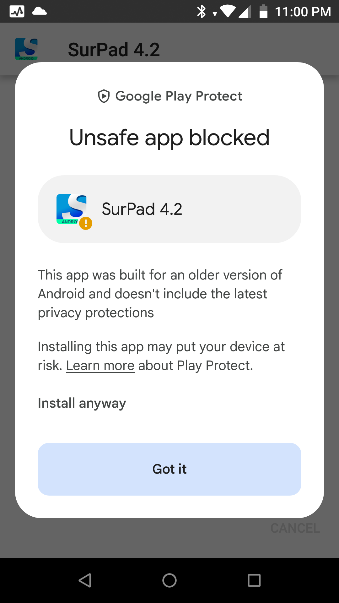
I did get the Google Play warning as well.
2 Likes

Yes. When I am placing cadstral boundary beacons or relocating / seaching for pegs.
Makes life easy when you can see from the diagram to peg you are placing
4 Likes
Thank you for sharing! Added your request as +1.
Tim, what tablet are you using? I want to start using Field Genius but the selection of Rugged Windows tablets seem to be all over the place with most having poor reviews. This one with only 8 reviews is $900 and is running a an old celeron processor. Any suggestions will be appreciated.
https://www.amazon.com/MUNBYN-Windows-Sunlight-Readable-Industrial
1 Like
Mesa3 Juniper
2 Likes
I just use some Microsoft Surface tablets with rugged cases which is overkill and $$$$. I never got around to looking for field style tablets as what I use are sufficient…but probably too delicate in the field for most.
Key things you will want to look for in Windows tablets, rugged, brightest screen possible, light, longest battery life and best thermal dissipation. Good luck! Each of those counteract each other. ; ) That’s where the Android tabloids may shine… but have to use Android software.
I think @EBE111057 has shared a great Android tablet he found, but I think around $1000 too?
You may want to contact Microsurvey to see if they are close to releasing their Android FieldGenius yet that is FULLY FINISHED in case you need Robotic Total Station (RTS) support and/or all the other features as in the Windows version. If you don’t need RTS, then there are lots of Android options available.
2 Likes
Obviously like any software, use at your own risk…especially APK files from sites unknown, not-official or outside of the Google Play Store.
1 Like