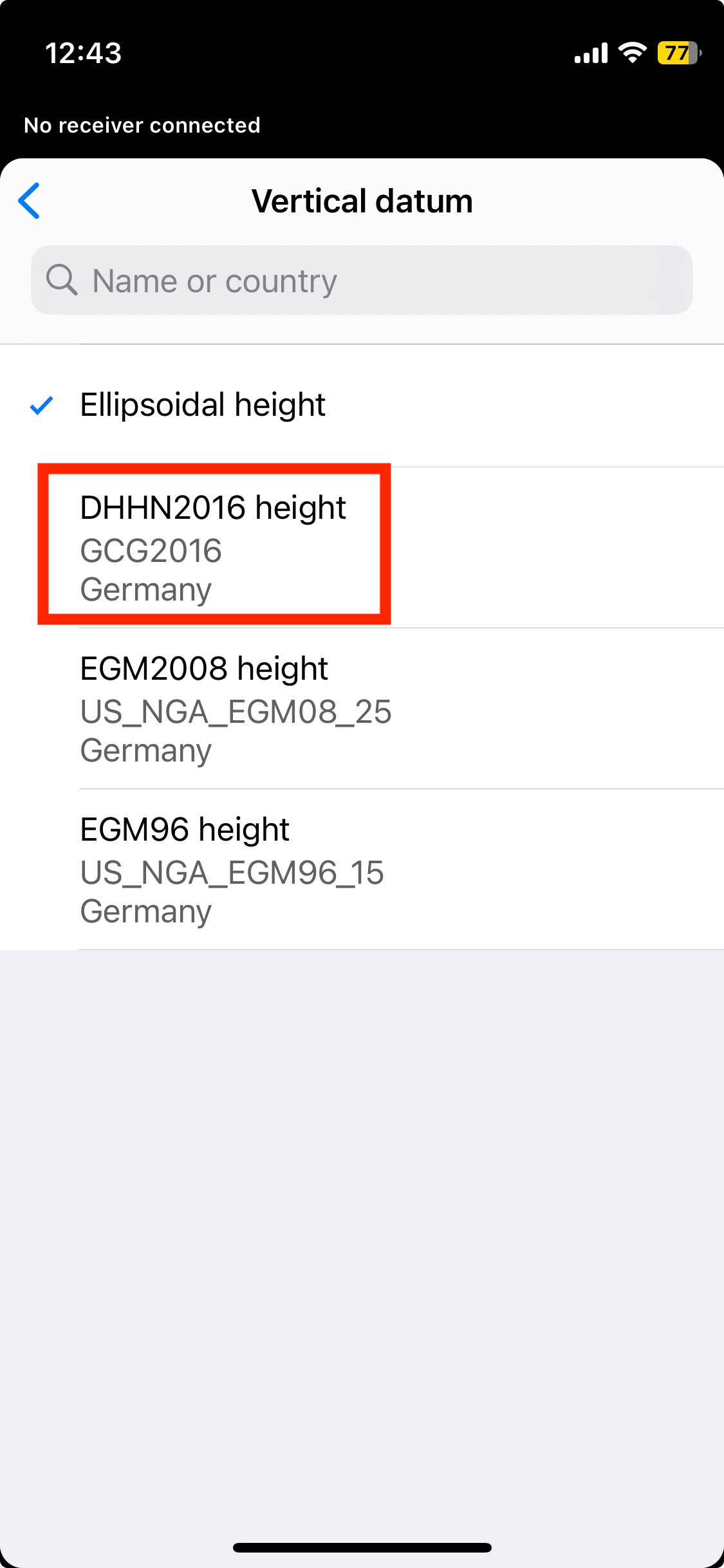
I am using the Emlid Reach rx in north germany (Soltau, Niedersachsen) and am getting incorrect heights. The Geoid is currently the DHHS20216 but I am pretty sure I am using the wrong one. My height data is 10 cm too low.
Which geoid should I be using for height above sea level?
First question. Which correction source do you use?
If it is not SAPOS, AXIO, EUREF or any other reliable and controlled provider, it is highly likely that the data you receive is faulty.
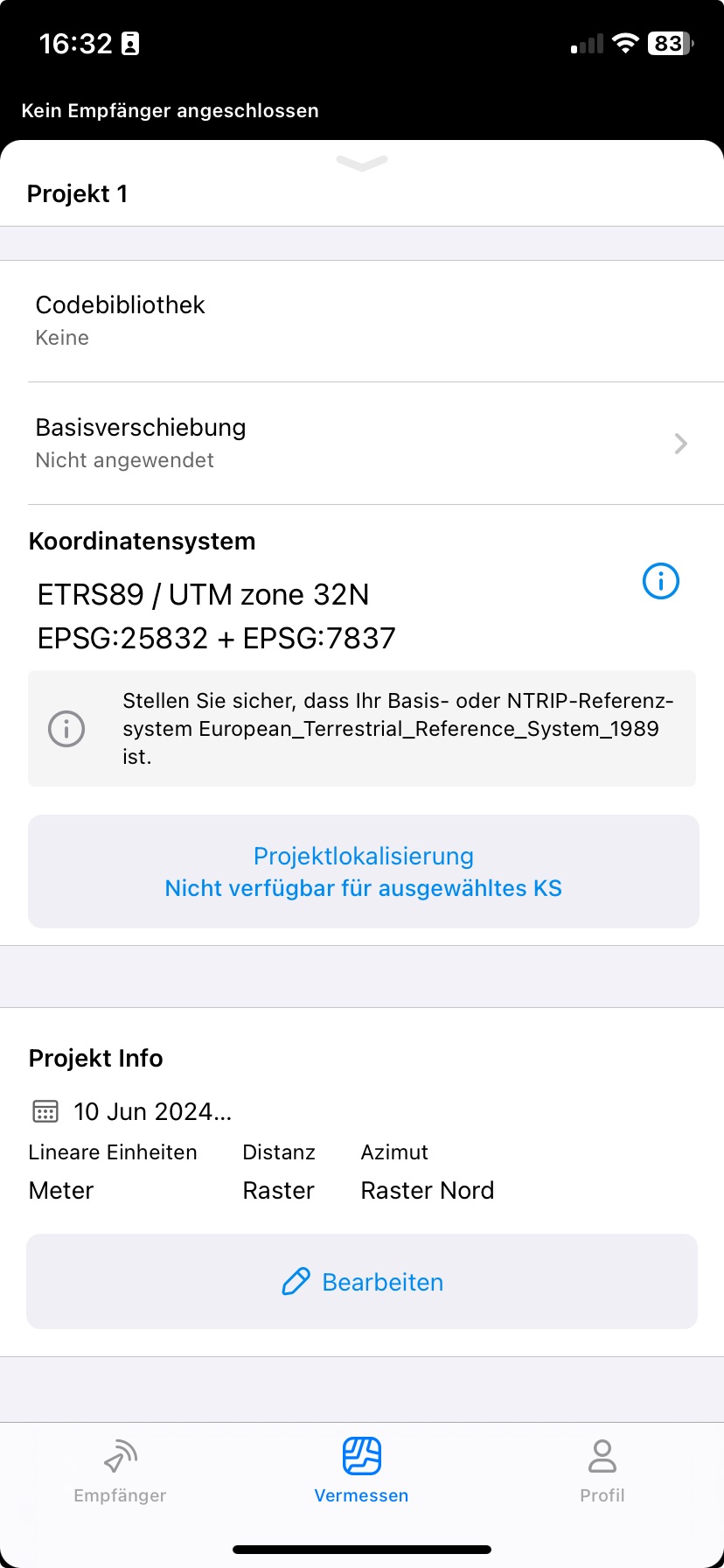
(EPSG 25832 and GCG2016 is the correct setting for Flow.)
The height accuracy of the point was very good. However the GPS was 1M too far east and nearly 4 meters to far south.
I was expecting cm accuracy with the easting and northings so i’m wondering what is wrong now. I had over 30 satellites and a green light on the reach rx.
Can you share your data with us, along with the known points against which you’re comparing your measurements? It’s possible that the wrong datum and projection were used and that the known points are in different CS than the measurements.
Since it contains sensitive information, you can email us at support@emlid.com. Thank you!