We are using 2X Reach RS+'s to gather GCP locations for use in drone mapping. One base, one rover. The base is running averaged single, standalone without additional corrections.
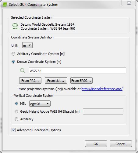
When selecting the GCP coordinate system in Pix4D, we select EPSG 4326.
What should we select for the vertical coordinate system?
I think EPSG 4326 and WGS84 (what the Reach RS uses for BOTH Horizontal and Vertical coordinate systems) are the same. The same ellipsoid height.
I have never used Pix4D, but it may allow you to select other vertical coordinate systems or Geoids if need be? But seems EPSG 4326 / WGS84 would ideal for the most part since it matches the Emlid Reach RS’s?
Maybe the folks at Pix4D can help with the correct settings for your application, as I am not the one to ask about Pix4D “YET”. When I ever get time, I’ll be looking into all that, but don’t currently have a use for it.