Hello All,
New to the forum, I appreciate any help on this topic.
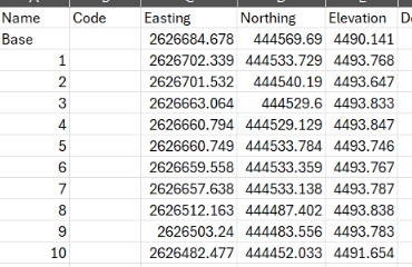
What are the Easting and Northing numbers referencing? My understanding is it is a location based off a reference point, but where is this reference point and what unit are the numbers in?
When setting up the survey, I set the units to US Survey Feet, does this mean the elevation is in US Survey Feet or is it in another unit?
Those are the distances in whatever units you are using from the origin point of the coordinate system you are using. Elevation (Z) is defined by a separate vertical datum that references either the ellipsoid, a geoid, ground or local benchmarks.
The origin of geographic coordinates is the point where the equator and the prime meridian intersect. The prime meridian is the longitude that passes through Greenwich, England.
For State Plane coordinates in the USA each State has multiple zones and each zone has their own origin point.
Thank you, Mr. Lambert,
I appreciate the help, I have been trying to locate a document or map that shows/lists the origin points for the state plane coordinate zones but I am unable to find anything.
Do you know if this map/document exists and if so, where to find it?
This gets deep pretty quick, hence the complexity of the SPCS’s and why there are all these other things like scale factors and localizations. Basically the origin of a state plane coordinate system is the point where the zone’s central meridian intersects the y = 0. I’ve seen whole papers on that so i’ll leave it there. The EPSG.io website reports the center coordinate and bounds in both grid and geographic coordinates but I’ve never seen anything that reports where 0,0 would actually be.
In addition to what @michaelL shared, you should receive some documentation for the CRS (coordinate reference system) of points you are using. Where did you get the list of points in the first place? Or, if you collected them via RTK, you should have information on the CRS used by the base.
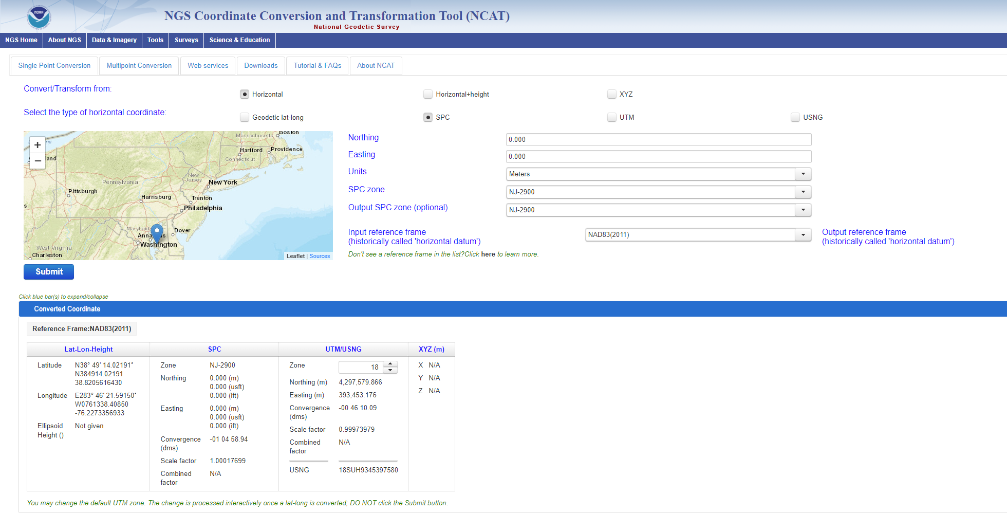
Choose SPC for State Plane.
Use 0 for both Northing and Easting.
Choose the correct state plane zone/state you need.
You will now see the origin point.
And notice how the origin is in the bottom left corner, hence the names Northing and Easting since your coordinates will be north and east of the origin point.
In the snip example I attached, I used New Jersey.
In the results box at the bottom you now have geographic coordinates which you can plug into Google Earth to view the origin. But keep in mind the outputs in NCAT are in NAD83 (Various Realizations) and Google Earth uses WGS84 so there will be a shift of around a meter or so. The origin in NJ State Plane is over the water in Maryland.
Easting and Northing are the distances from the origin point, as @michaelL mentioned. To figure out this reference point, we need information about the coordinate system.
I agree with @dpitman. You can find the coordinate system name and zone in the data. Is this an export data from your project in Emlid Flow? If yes, it should be in the CS Name column within the data.
Thanks, @jaja6009, for sharing the source and detailed steps to access the NGS NCAT!
Also, If you’ve set the project unit in the US Survey Feet, the elevation will be represented in the same unit.