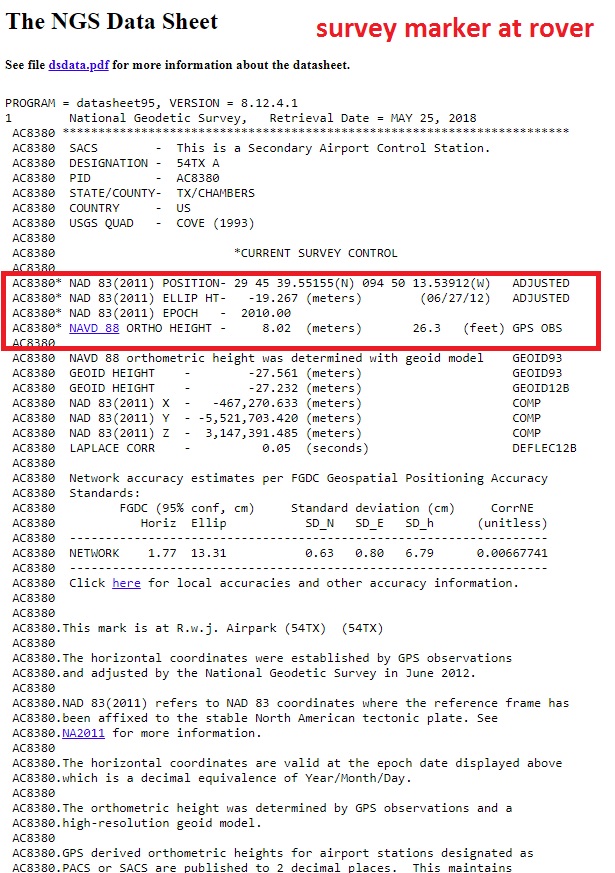
I am testing my reach unit for accuracy with survey/benchmark marker.
I am testing it using PPK and RINEX data from a local CORS station.
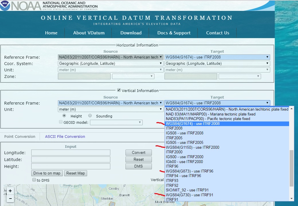
The CORS stations lists their “known location” in NAD83 format. (I just select RTKpost to obtain location from RINEX header)
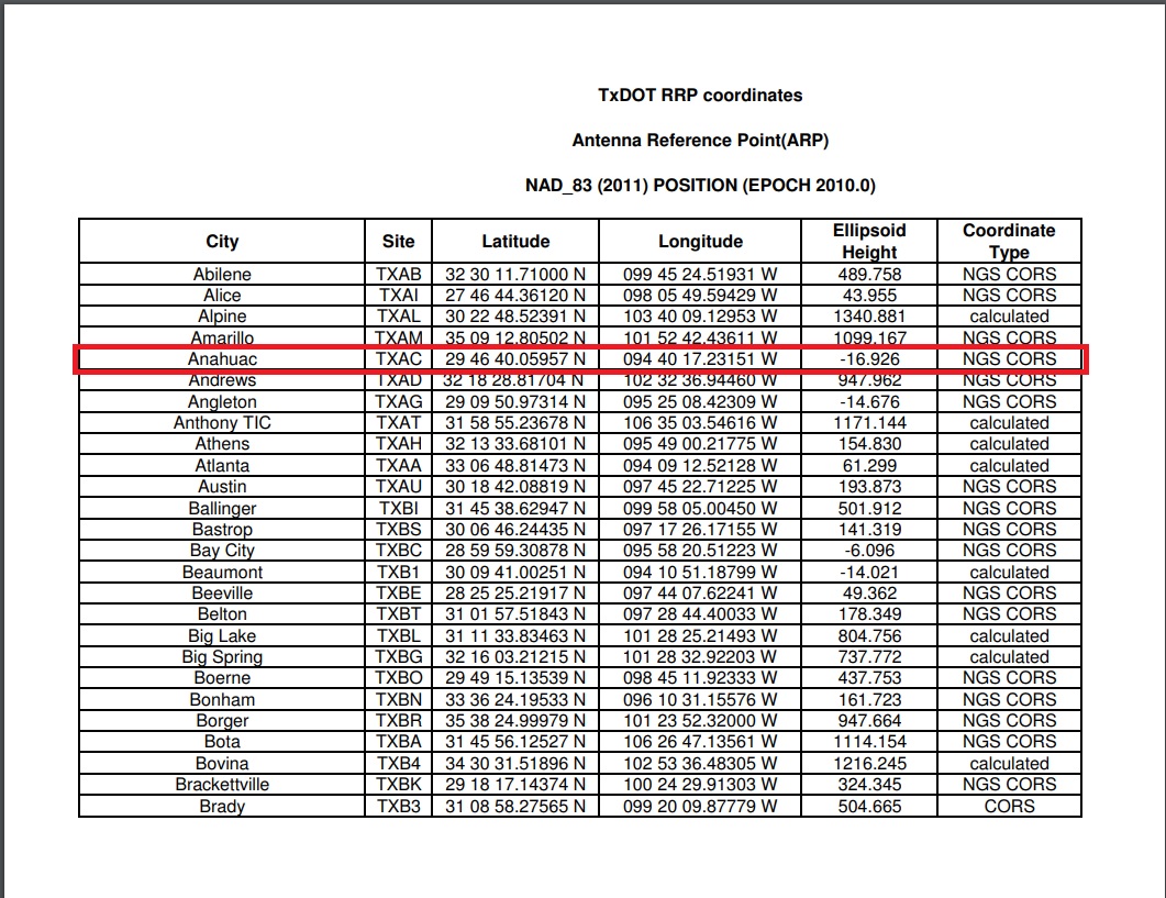
The coordinates for the survey marker are in NAD83 format.
I have read the reach units do WGS84. My question is… if the CORS station known location is in NAD83 would the resulting coordinates once processed be in NAD83 and match up to the survey marker (since they are listed as NAD83 also).
Or is there some WGS84 conversion that will take place in the reach units and throw it off?
Would it be more accurate to convert the “known location” of the CORS to WGS84 and enter that into RTKpost manually? If I leave it to pull from RINEX header it’s pulling the NAD83.
And then convert whats listed for the survey marker coordinates to WGS84?
Is the reach unit doing WGS84 in the raw files also?
The reference file just says nad83 2011 epoch 2010.
The website I am using to convert from nad83 to wsg84 has like 10 versions of wgs84 to pick from.
It looks like maybe the WSG84 has different versions based on the GPS week? G1150 for example.
Right now I am just playing with obtaining a “known position” using one reach unit and PPK.
I am using a north american survey marker for the rover location to test how accurately I can do this.
I am using RINEX files from a local CORS station. The CORS station known location is in NAD83 (2011) with epoch 2010.
garner5: So if I am trying to test how well I can obtain a known position. I place my rover right over the “survey marker” which is listed online using NAD83. The height seems to be listed as NAD83 also right?
Then I would do PPK using the CORS staition and my rover raw files. I would convert the CORS station known location to WGS84 (1150). and run the plot. But then convert that back to NAD83 to verify accuracy?
Have you had any success here? I am curious also about using NAD83, State planes, Geoids, ortho heights vs. Or coming from WGS84 and Ellipsoid conversions.
Trying to get a good workflow here using all of this properly.
I am using MicroSurvey FieldGenius which requires setting a coordinate system to work in. i.e. NAD83 or a State Plane. I am looking at some apps that can use UTMs also…such as MapIt and Mobile Topographer. MapIt looks promising with the extensions of course.