


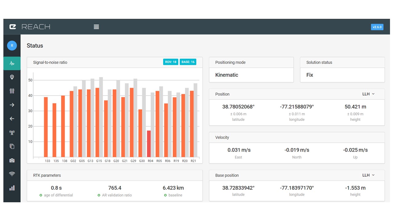
I am trying to learn the meaning of the Height value shown on my ReachView – Status tab, Position block. Is the 50.421 m referenced to the sea level? Why is the Height of my Base position a negative number (-1.553 m)? Why is there a big difference between the Base height and Rover height values? I am getting my corrections from a NTRIP server over Internet, located 6.423 Km from my Rover.
The altitudes you currently see in ReachView are relative to the WGS84 ellipsoid. The ellipsoid approximates sea level, but being that it is a simplified model of the world, in most places the ellipsoid is above or below actual sea level to some degree.
Your base thinks it is -1.553m which is below the ellipsoid. Your rover height of 50.421 which means it is above the ellipsoid.
Keep in mind that if you don’t provide your base a WGS84 height, then your rover won’t be showing height as WGS84 either.
2 Likes
There are many online resources to help you transform NAD83, NAVD88, Ortho and Geoid heights into WGS84 coordinates and ellipse height. If you need links let me know.
1 Like
I would love some of the links.
https://www.ngs.noaa.gov/PUBS_LIB/gislis96.html
https://www.ngs.noaa.gov/cgi-bin/GEOID_STUFF/geoid99_prompt1.prl
https://www.ngs.noaa.gov/cgi-bin/HTDP/htdp.prl?f1=4&f2=1
1 Like
I was wrestling with some of these same challenges pertaining to vertical datum mismatch today as well. Specifically, I wanted to compare the accuracy of data collected using the Reach RS module to points with known locations. However, the Reach output was in WGS84 while my reference points were in NAD83/NAVD88.
I ended up using this tool from NOAA (Online VDatum: Vertical Datums Transformation) to convert my Reach Z-values to something that was comparable to my reference points. Subtracting the height of my antennae (about 6ft or 1.82 m) from the converted output gave me a pretty close Z-value to my reference points.
I still haven’t figured out if there’s a way to apply those vertical conversions while doing PPK correction with data collected from a single Reach rover module and a CORS station, but it’s a semi-usable workaround for now.
This topic was automatically closed 100 days after the last reply. New replies are no longer allowed.