What is the most affordable VRS network in the Midwest? I was looking at Trimble VRS now service but Im unsure on what service is needed for drone mapping based on the solution below.
Base = The VRS Network
Rover = RS2
GCP’s will be used for RTK and PPK
These are the choices they have: (what base can I start with?)
If that is the terminology, it would seem that the cheap option would only contain the GPS constellation. That makes it quite unattractive for anything but old legacy receivers.
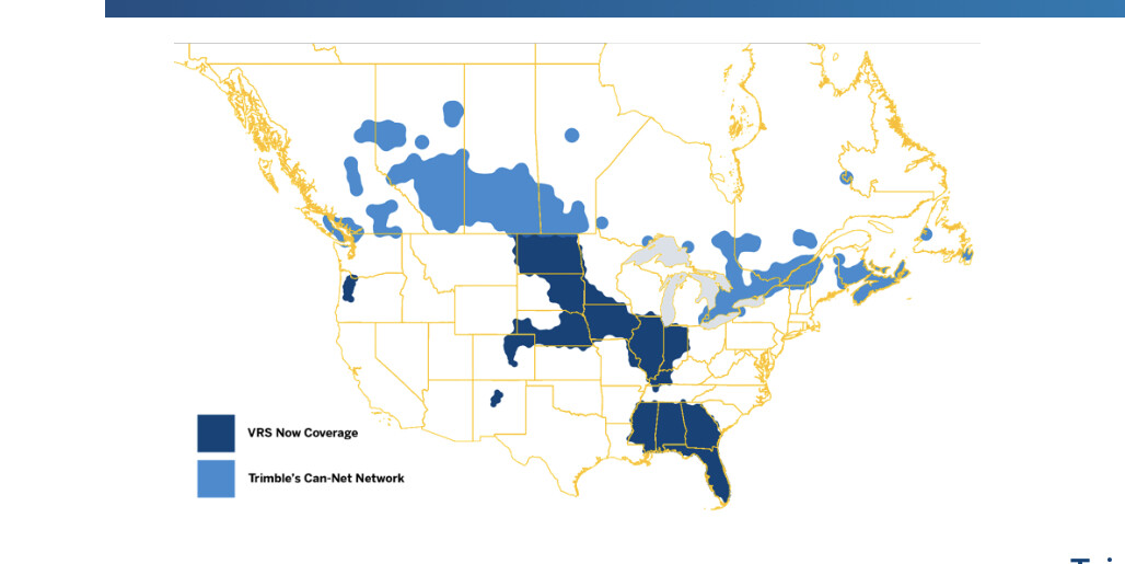
you want the survey regional GNSS. Be sure to look at this coverage map though because it may not cover your area. You should be able to get RTCM 3.1 out.
Why not contact your state 's Geodetic Survey division or state highway departments ? Sometimes their fees are considerably lower than commercial accounts and might be free with a nominal setup fee.
Our SC Geodetic Survey department maintains our RTN/VRS and the fee is $50/month or $600/year. Pretty low cost considering it’s available 24/7 and downtime is mostly nominal for software/firmware updates.
Also, I’d contact some local land surveyors as they probably have info too. Some may have local access to their own group networks amongst themselves.