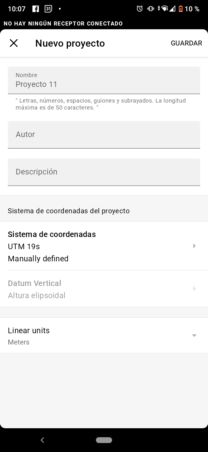
After update all vertical datum disappeared on android and IOS. Of I choose for example MEXICO ITRF 08 zone 11, I only have elipsoidal height available.
Thanks in advance.
After update all vertical datum disappeared on android and IOS. Of I choose for example MEXICO ITRF 08 zone 11, I only have elipsoidal height available.
Thanks in advance.
Same to me with mexico itrf 03 zone 13 n
Thanks
Hi!
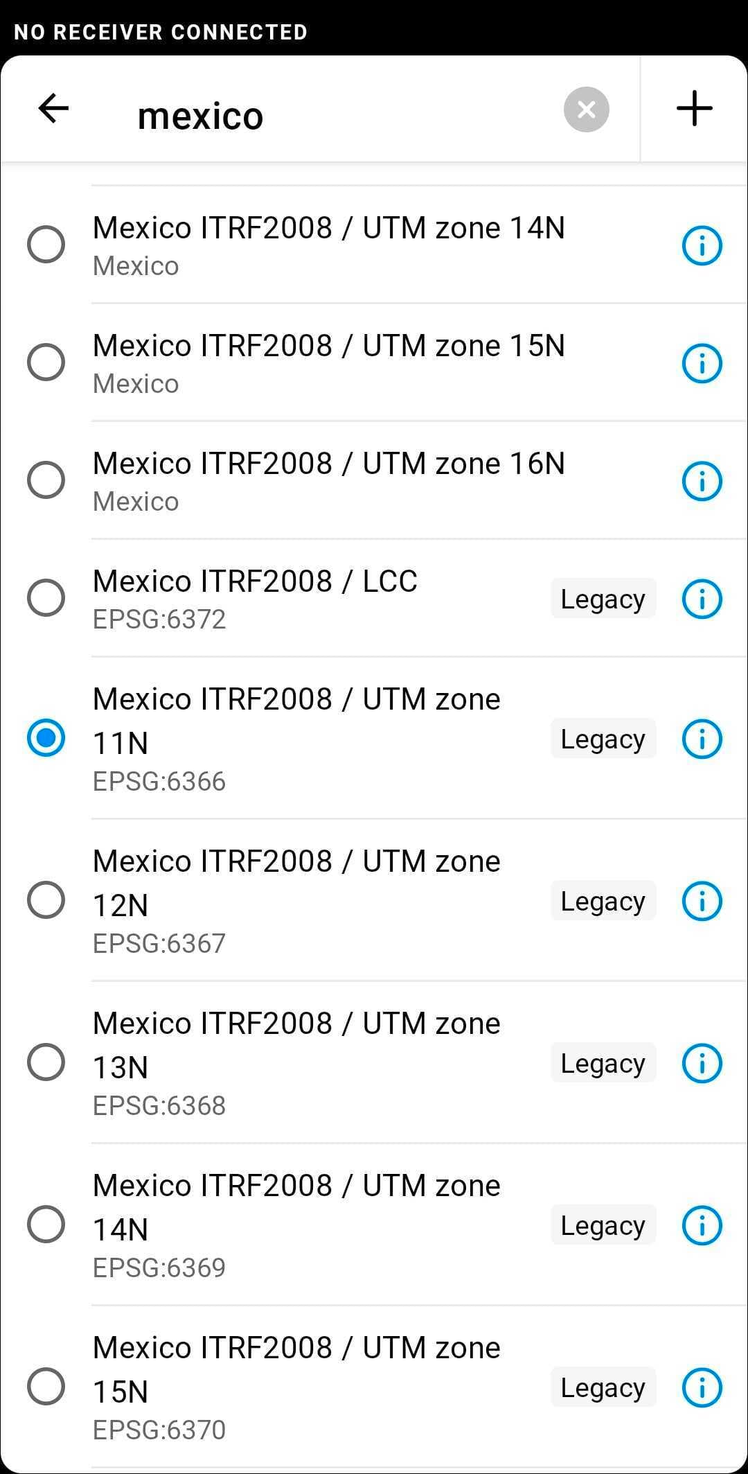
We are working on that issue. In the meanwhile, you can use coordinate systems with the same name, marked legacy.
Great, but this is a big actual issue. Please lets us know when fixed. Is there any way to get at least old version apk as I know that an older version in IOS is close to impossible?
Hi Guillermo,
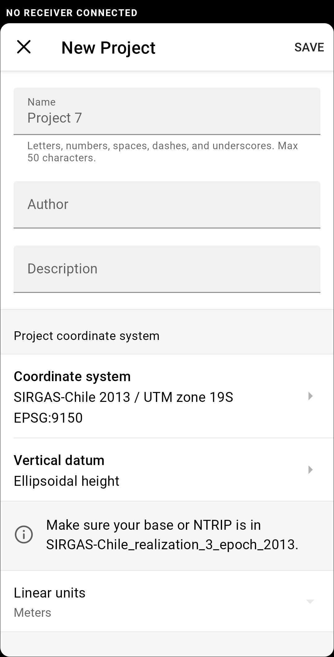
It’s still possible to use Mexico ITRF2008 / UTM zone 11N marked legacy and apply vertical datum. There’s no need to get an older version of the app, take a look at the screenshots:
Got it! Thanks ! But sincerely its ok but it doesn’t look good and its confusing at user level.
Agreed, working on the fix to that.
Hi everyone!
Pass this case with when I load my CS manually, Only see Ellipsoidal elevation in RV3 7.9
Hi Bernardo,
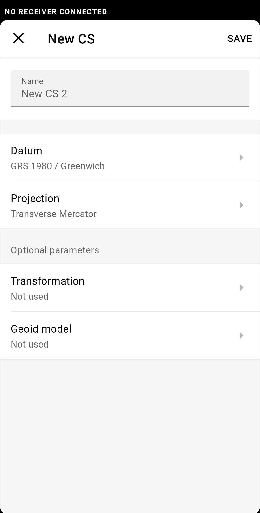
Do you mean Custom CS, or you choose coordinate system from the list in ReachView 3? If so, which one do you choose?
Hi Kirill
Is a Custom CS
Bernardo,
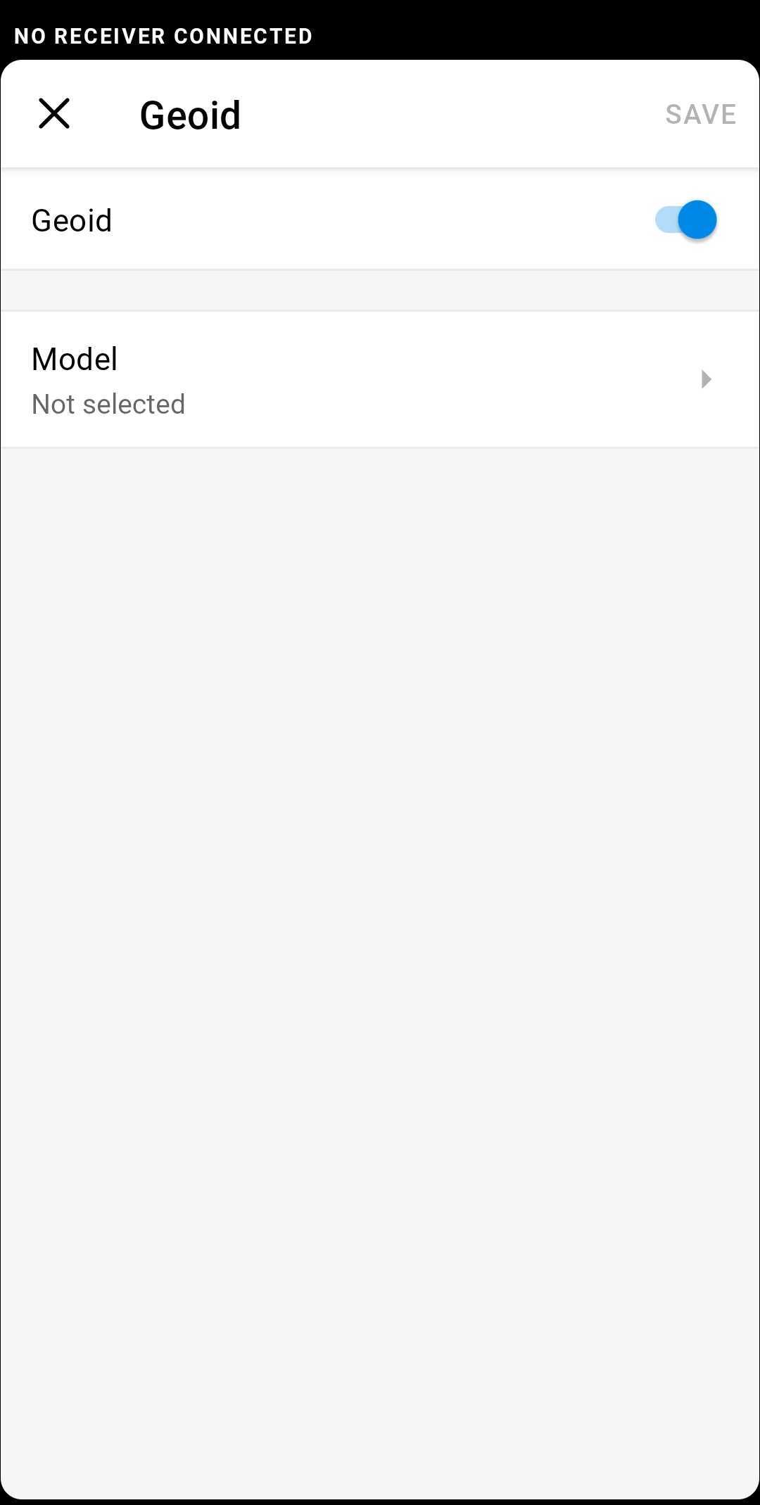
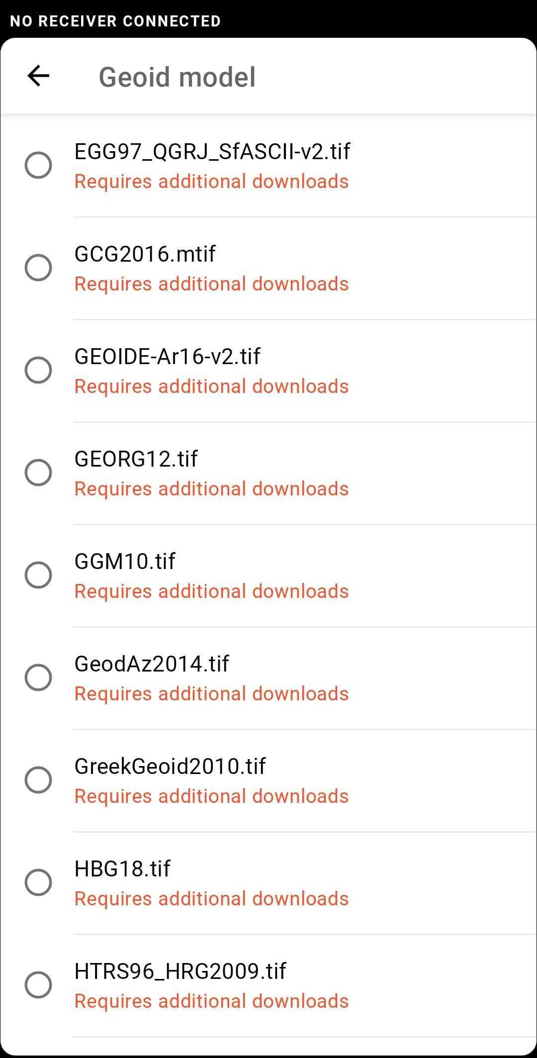
It sounds really weird because when you create a custom CS, you can choose the geoid from the list:
Don’t you see this list once you choose the vertical datum for your custom CS?
Yes Kirill I think the same
It sounds really weird because when you create a custom CS
Have screenshot to the APP.
I have Andoid 11, with Xiaomin
Bernardo,
I’m wondering whether it’s possible to use SIRGAS-Chile 2013 / UTM Zone 19S instead of manual CS?
You can’t change the vertical datum here because CS is already made. It’s possible only while creating manual CS. So, either create a new one, or try to use suggested CS instead.
Yea, I can use SIRGAS
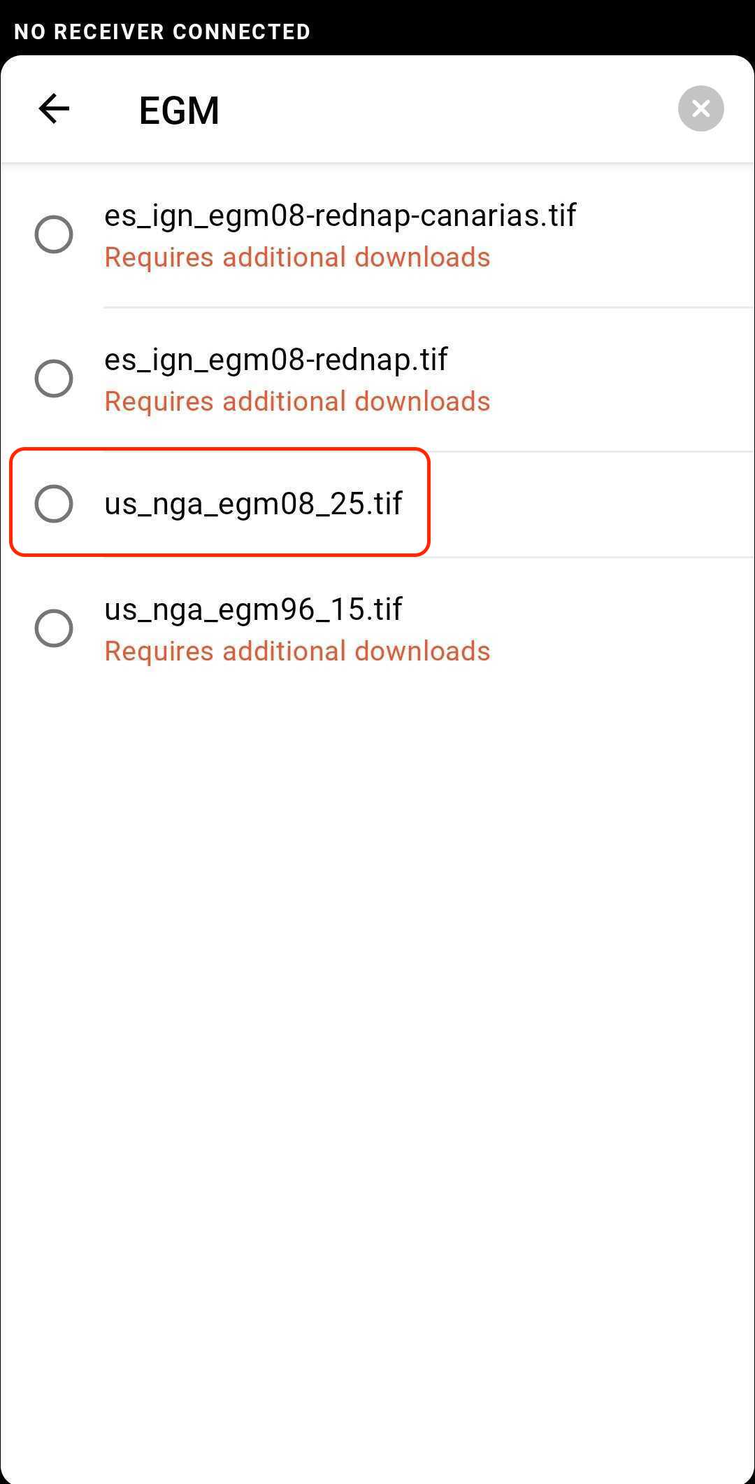
I have a Finally question, It Possible to include EGM2008 in the list for custom CS?
I have some work in Custom CS+EGM2008, but I can’t see EGM2008 (Gobal) in this list
Hi
Thanks for your answer.
These definitions is the same the global EGM?
Hi Bernardo,
You’re welcome!
Yes, they are. us_nga_egm08_25.tif is for EGM2008 global geoid, while us_nga_egm96_15.tif is for EGM96 global geoid.
This topic was automatically closed 100 days after the last reply. New replies are no longer allowed.