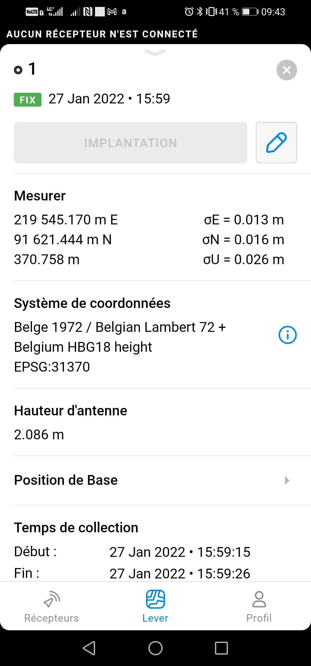
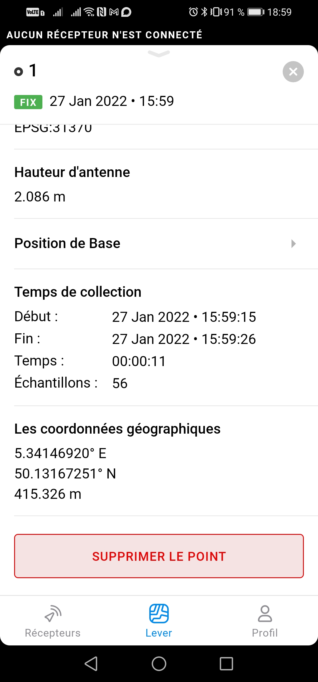
Looking at the environment of your coordinate, I would think that 11 seconds is on the low side using a single frequency receiver like the RS+. However, that shouldn’t account for 5 meter difference.
But, these errors are usually caused by user-error, if the receiver was fixed. Things like pole-heights etc.
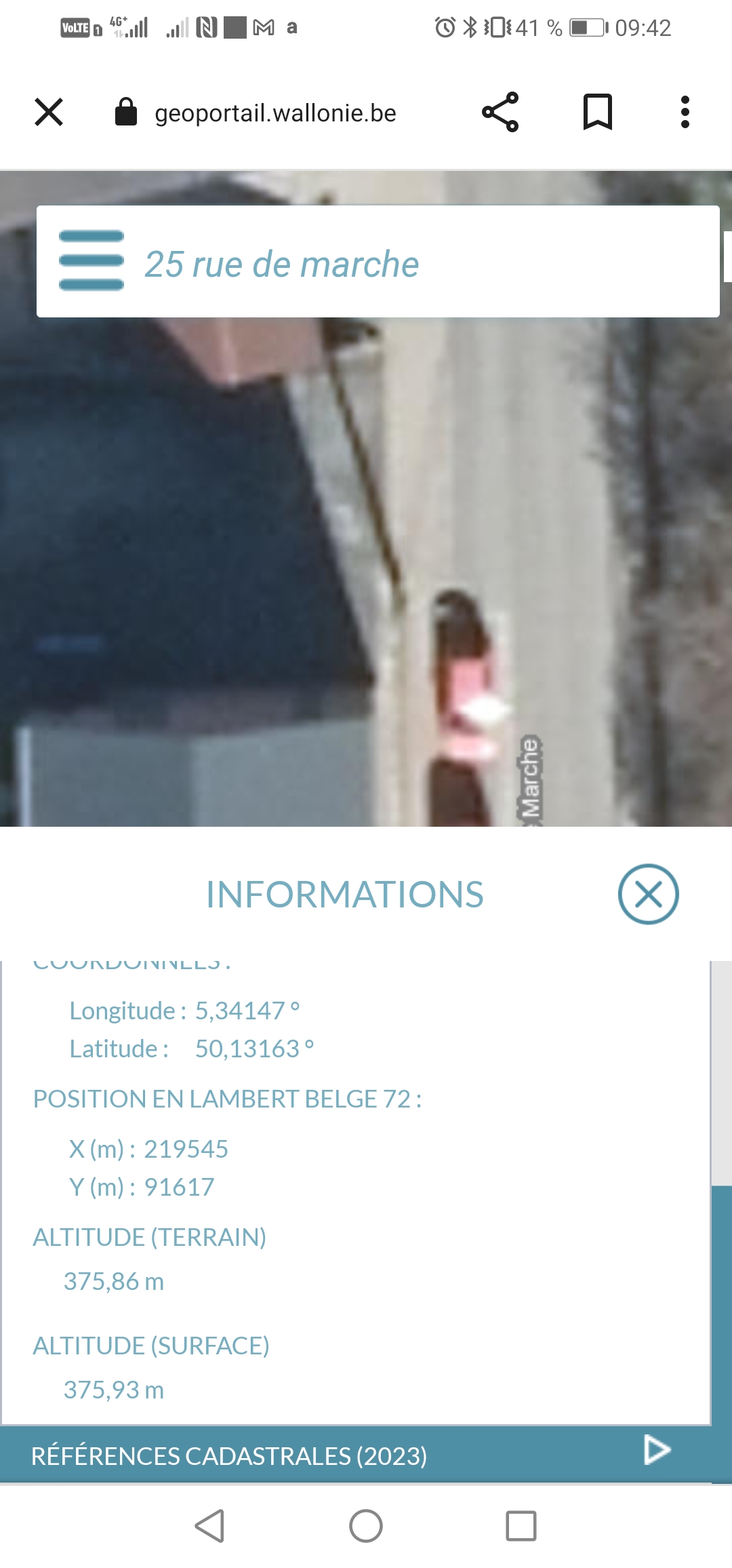
I’ve taken a look on an official map to compare roughly the values but I didn’t expected so much difference.
As I see from your screenshot, you averaged the base position via NTRIP. Then you checked it and noticed the difference. What is the official map you used for comparison? Could you share the source with those known points?
According to your description, you did everything right, and Reach calculates the solution correctly. I see no obvious reasons not to trust this solution.
As I got, this map doesn’t provide a list of benchmarks with precise coordinates. So, we can only compare Reach coordinates with coordinates of a pointer. This is a too rough way to draw any conclusions.
Also, I couldn’t find which vertical datum this map is based on. It could be a reason for vertical mismatch as well.
However, if you still have doubts, you can check Reach on a benchmark with known coordinates. And I’m ready to help you with that.


