


Prerequisite Information:
- Emlid Studio - version 1.7
- Raw data you use for post-processing - see links below.
- Detailed issue description. How does observed behavior differ from the expected one? - PPP & RTK results are different than static baseline results.
- Your step-by-step actions. - see below.
Hello,
I was wondering if someone could help me with 2 questions:
-
Is it possible to do more than a base - static setup? Ie. can one add 2 defined bases and 3 static observed points? So they could GPS traverse? Basically, I am asking if it is possible to add more than 2 RINEX files.
-
My static results differ from my PPP results by quite a bit. I have done the following:
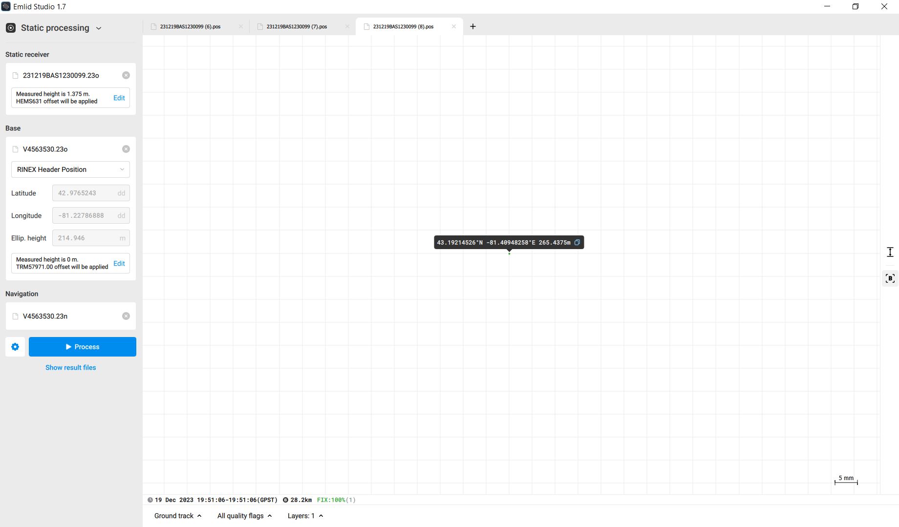
a. Downloaded my Carlson BRX7 static data and converted to RINEX. I imported it as my Static Receiver. I was very pleased how Studio recognized it as a S631 and its antenna height automatically.
L1 and L2 offsets on p. 68:
L1 70.1mm
L2 62.9mm
b. Downloaded the static data from a nearby Cansel Can-net base (ie. ON_London on Trimble’s North American RTN). I imported it as my Base and told it to read from the RINEX header. I was very pleased how Studio recognized it as a NETR9 and its coordinates automatically.
I cannot seem to find the L1 L2 offsets of the NETR9 easily (ie. Google Fu failure).
https://vrs.can-net.ca/Map/SensorMap.aspx#
| Station: | ON_London |
|---|---|
| Station code: | LOND |
| Lat: | N 42° 58’ 35.48748" |
| Lon: | W 81° 13’ 40.32797" |
| Height: | 214.946 |
| Sensor type: | TRIMBLE NETR9 |
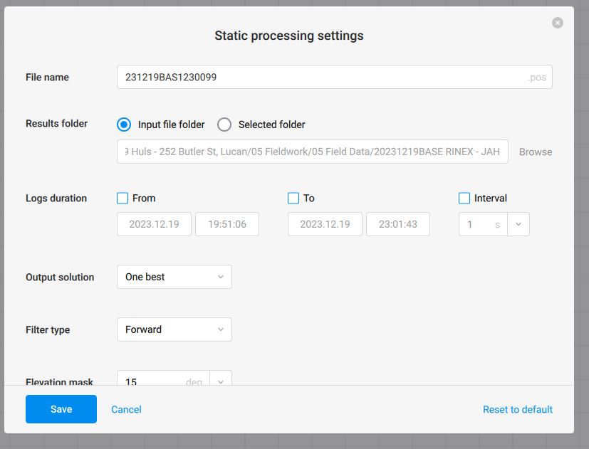
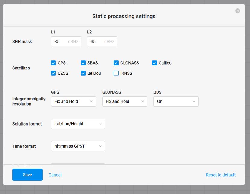
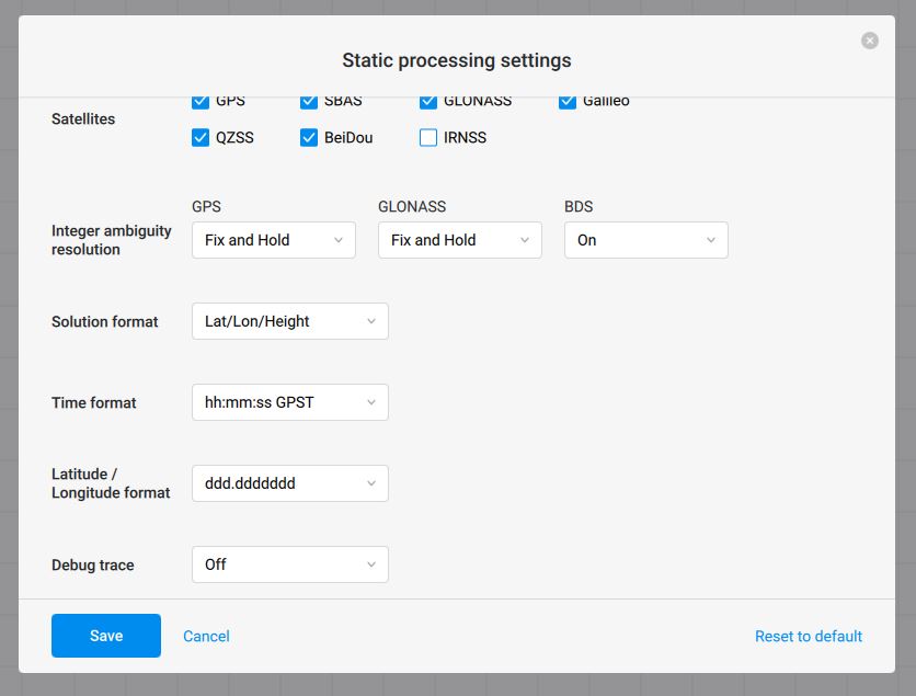
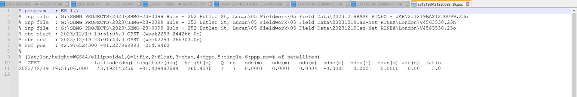
c. Process with the settings below.
d. Get my results.
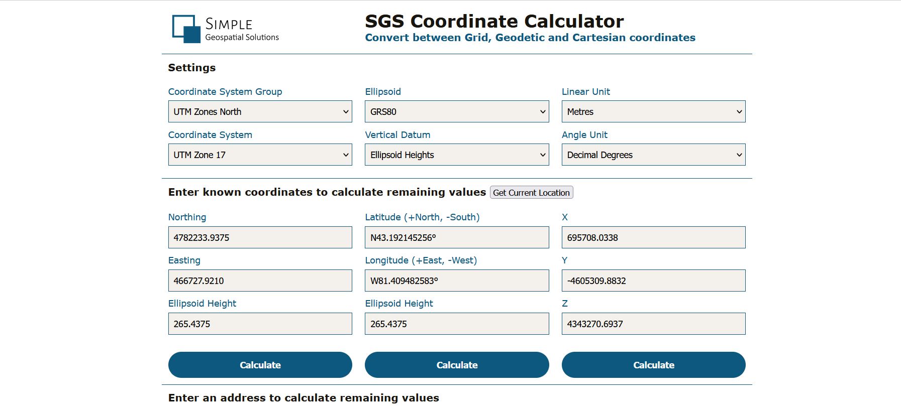
e. Convert said results to NAD83 CSRS UTM 17 North usings SGSS Tools for horizontal.
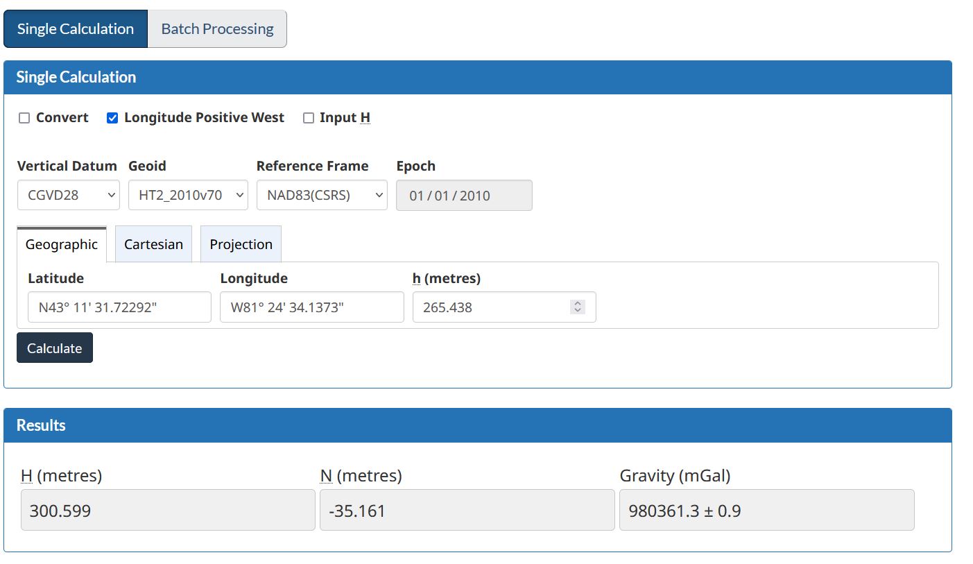
f. Convert said results to CGVD28 (ie. CGVD2018 to CGVD28 using the HTv2.0 algorithm) for vertical using GPS H.
https://webapp.csrs-scrs.nrcan-rncan.gc.ca/geod/tools-outils/gpsh.php
g. Compare those results to the PPP results.
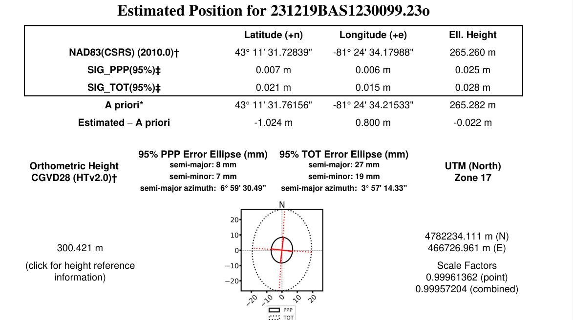
PPP Results:
N: 4782234.111
E: 466726.961
Z: 300.421 (HTv2.0 which is a translation of CGVD2013 to CGVD28)
Studio Results after SGSS Tools & GPS H conversions:
N: 4782233.938
E: 466727.921
Z: 300.599 (HTv2.0)
Diff of Studio to PPP:
N: -0.173
E: 0.960
Z: 0.178
Any idea as to the discrepancies?
The VRS RTN RTK value measured was:
N: 4782234.111
E: 466726.973
Z: 301.420 (HTv2.0)
This is within ~1" of the PPP result. I realize that I was not using an RS2/3 for the Static, but I was hoping it would be better than that after it picked up the antennas correctly. I have double-checked that I did not do a decimal degree (DD) vs degree minute second (DMS) error. I do not think that would explain the vertical bust, though.
RINEX files available here:
Cansel ON_London:
https://strikbaldinelli-my.sharepoint.com/:f:/g/personal/jhill_sbmltd_ca/EiU0srDnJq1DtJufglb7MHIBxRO-eoYVxTlSND4q_uA7yg?e=y9uGHD
Any input greatly appreciated.