


In March 2019, Mexican CoatzaDrone conducted a topographic survey of the “Las Choapas-Cárdenas” road section in Tabasco, Mexico using Reach RS+. The goal was to create a detailed 3D model and an orthomosaic as part of the road maintenance project.
CoatzaDrone surveyor is capturing a GCP with Reach RS+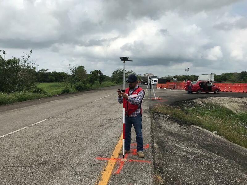
An area of 4.7 ha was mapped with a DJI Phantom 4 Pro and a Mavic 2 Pro.
The CoatzaDrone team set seven ground control points (GCPs) at the project site. All GCPs were captured with a Reach RS+ rover. Corrections were acquired from an RS+ base in RTK mode. This whole process took less than thirty minutes.
DJI Phantom 4 Pro lands at the end point of the mission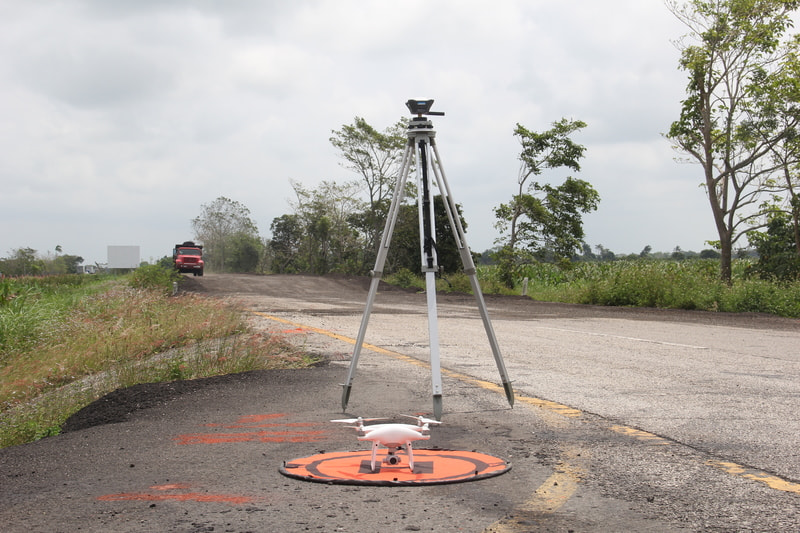
The raw logs were then post-processed using the geospatial analysis software. This was done in order to double check GCPs’ coordinates measured in RTK mode in the field.
Once the GCPs’ coordinates had been checked, CoatzaDrone engineers imported the point coordinates to Pix4D along with the images captured by a drone. Check the images of mapping workflow on our blog.
"There is a great advantage in using Reach RS+ for placing GCPs. It allows us to spend fewer man-hours than on a traditional survey. And because of optimizing the resources of the team, we can deliver the best quality data to our clients promptly. What I also like about Reach is that it’s very easy to configure and use.”—Alvaro Ruiz, Head of Operations at CoatzaDrone.
Watch the video of the process: https://www.facebook.com/watch/?v=301550697182231