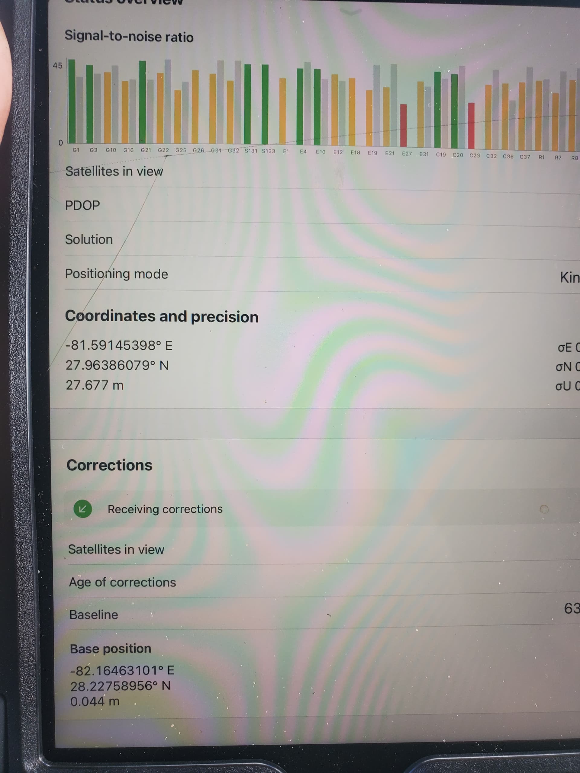
I’m typically floating in the field due to site conditions. I was kind of relying on the estimated accuracy measurement to judge when i was good to take a point. Now when i check the status on float it looks like the following image
Yes, the 27m is your ellipsoid or orthometric height depending on whether or not you are using a geoid. The residuals are on the right on your screenshot. E,N,U
I second Michael’s comment with one small addition: in the Status tab, you always see the ellipsoidal height of the receiver.
I see that your base height is close to 0. How did you set the base coordinates? Did you set them manually, averaged them, or is it data from the NTRIP Service?
I also just wanted to add that I still recommend you collect the points with Fix solution status only. Float means that not all ambiguities in positional calculations are resolved. So the position in Float is usually sub-meter accurate.
I am using data from an NTRIP service. I would prefer getting solutions using only fixed but sometimes I can be onsite for an hour and not get them. Am I correct in assuming that if all the numbers on the right side of the screen are all within 10 cms or so that my readings will at least be that accurate?
In theory, yes. But in practice, these values are constantly updating and the Float solution is quite an unstable one. It may vary from decimeters to 1-2 meters. And when you average the point, you can catch solutions with different accuracy. So, the final coordinates won’t be that accurate.