Understanding PPP results from Canadian Government

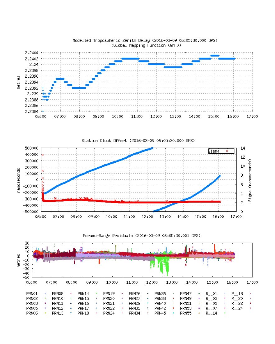
I’ve uploaded a few .obs files to a free PPP service here in Canada. It’s very automated and they email you a link to the results once processed. I’ve included a typical summary and images of the complete report below.

Here’s the upload page: http://webapp.geod.nrcan.gc.ca/geod/tools-outils/ppp.php?locale=en

My biggest issue is that the results are to NAD83 and not WGS84. The upload page has some other options such as ITRF but none are WGS84. I believe that RTKLIB and standard GPS units output WGS84.

They offer a service to convert between co-ordinates, but none are WGS84. It’s located here: TRX

I’ve found statements saying that the difference between WGS84 and ITRF is small, but that is very vague. Are they the same? If so, I could use the ITRF output directly in my base station. Right?

One other question, which height do I enter in my base station, the Ellipsoidal or Orthometric? The full report even has a 3rd height, Apriori.

Thanks.


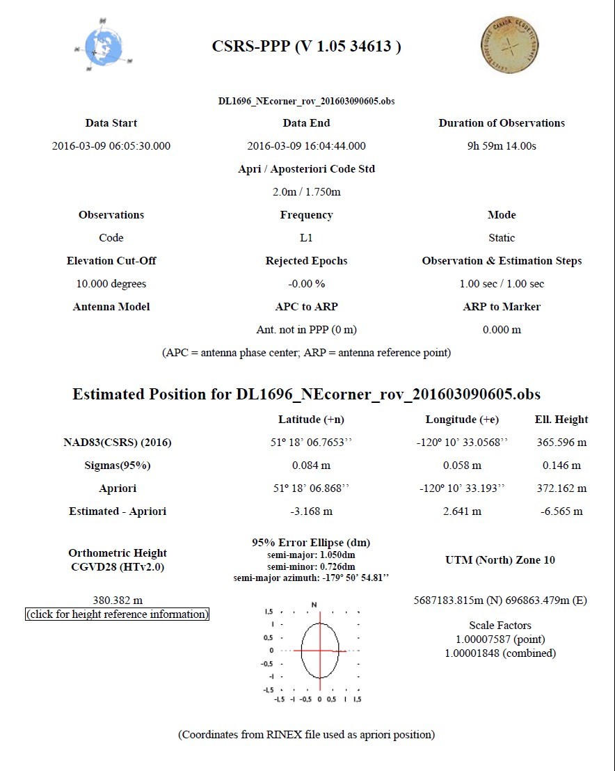
The estimated coordinates NAD83(CSRS) 2016-03-09 for the DL1696_NEcorner_rov_201603090605.obs RINEX file are as follow:
Latitude N51° 18’ 06.7653" ±0.084m (95%)
Longitude W120° 10’ 33.0568" ±0.058m (95%)
Ellipsoidal Height 365.596m ±0.146m (95%)
Orthometric Height 380.382m CGVD28
[51.30187925,-120.17584911,365.596]

UTM Zone 10 (North)
Northing 5687183.815m
Easting 696863.479m
Scale factor (point) 1.00007587
Scale factor (combined) 1.00001848
[5687183.815,696863.479,365.596]
Cartesian coordinates
X -2008663.893 ±0.076m (95%)
Y -3454578.704 ±0.097m (95%)
Z 4954896.455 ±0.129m (95%)
[-2008663.893,-3454578.704,4954896.455]

Orbits and Clocks Used: NRCan Rapid
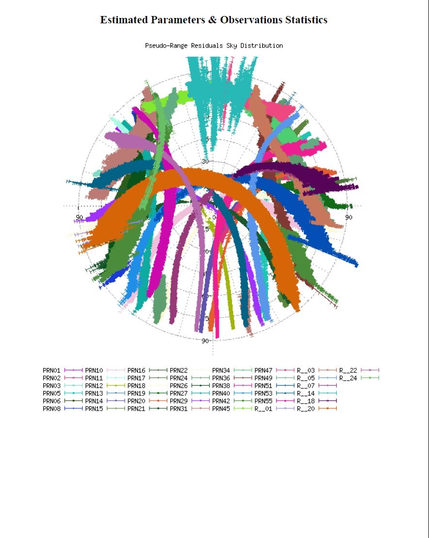
GNSS Data: GPS_&_GLONASS
WGS84 ellipsoid used for (x,y,z) to (lat,long,h) transformation


1 Like

Use ITRF, it is typically within cm’s of WGS-84. If you want it down to the mm’s google an ITRF to WGS-84 converter or shift and be sure you know the year of ITRF and WGS-84 datums you are using.
But your overall accuracy for your base station would be limited to 5-8cm for that processed observation. And, that would only affect the absolute accuracy not relative accuracy.

Don’t use apriori, it’s just an initial rough estimate. Probably do ellipsoidal since it has a statistical accuracy (95%)

1 Like

Agree with above, ITRF effectively is WGS84 for your purposes (to within 5cm at habitable longitudes). Technically, ITRF is more accurate to local features too (ie: The distance between any two points will more closely match physical, ‘tape measure’ real-world distance)

A useful tool, if you can get hold of it (or access to a machine running it) is ArcGIS - which I used for years to convert between coordinate standards.

And yes, the standards vary markedly between reference years. Double check this.

1 Like

I also submitted some observations to NRCAN CSRS-PPP.
GPS and GLONASS data, TW4721 on groundplane, ca 1:30h each, very good and medium satellite view. You have to supply RINEX 2.10 obs files.
The locations are official surveying points know with cm accuracy.

The results look similar, with horizontal 95% error in the dm range.
However, comparing the final PPP location to the known locations they are 2-3 m off.

I will try again with longer observation periods.

I also tried to replicate the results with RTKLIB static PPP, using clk, sp3 and ionex files from IGS. The offsets are similar, but in different directions.

I’m also thinking on using long baseline differential with ionex corrections and IGS station data.

Any hints on this are highly appreciated. It seems to be quite tricky to get good results with L1 PPP, Tomoji Takasu therefore does not recommend it at all.
But we’re surveying in remote areas with no SBAS, CORS or even mobile network, and have to get our base station locations.

Hi @robins, may i know, did you convert ubx file to rinex, or rinex provided by reach when we download rover log?
I have try but always failed. I have convert ubx to rinex 2.11, and rinex 3.01 convert to 2.11 but failed, the nrcan.gc.ca said that my this is not rinex 2.11.

Notice, i let the field configuration such as ant type, etc empty.

When you download from Reach it should automatically make the RINEX file. Set the version in the settings tab before starting.

I had a similar question and emailed the help line (which was very helpful!) at NRCAN.

The response from their Geodetic Engineer was:
"Indeed, the ITRF value is the estimated position and Sigma95% represent the confidence interval values.

The Apriori coordinates are normally those obtained from your RINEX header line “APPROX POSITION XYZ”. These values are used to calculate the correction (estimated-apriori) and to report the corrections displayed in the PDF report graphics. They are also useful if you are testing CSRS-PPP or your equipment over a point of known coordinates. The reported CSRS-PPP corrections in such a case would represent the CSRS-PPP or your equipment error.

Note that if the “APPROX POSITION XYZ” line is missing or the coordinates it contain differ by more than a 100m from a CSRS-PPP preliminary code solution, the CSRS-PPP code solution is used as apriori coordinates. The source (RINEX or PPP code solution) of the CSRS-PPP apriori coordinates is indicated by a comment at the bottom of page one of the PDF report."

I have been trying to get this working as well. I found that if I downloade the file as rinex 2.11 from reach and then did a convert in rtklib to rinex 2.11, this was the only way I was able to upload the file. And even the it takes usually 2 or 3 times submitting it to get the upload to take. Don’t know why this is.
Jim

That’s strange. I just used the Rinex 2.11 as downloaded from ReachRS. I don’t remember having any problems with that running in NRCan…

Hi all,

I’ve previously used NRCAN’s PPP tool with data obtained from an L1/L2 receiver, and am interested in conducting some tests of my own with the Reach. I was wondering if anyone might be share the ReachView settings they’ve found to work the best for this purpose (e.g. constellations, update rate, etc.). From researching the forums, I’ve come up with the following settings in the screenshot below, and just want to be sure I’m on the right track.

Cheers,
Adam