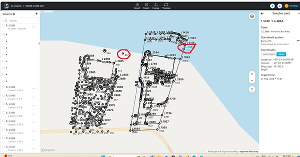
Hi everyone we are a medium sized design/build landscape buisness and we use an Emlid RS2+ for our base and an RS3 for our rover to do site measures of jobs. We then upload our emlid base measure from Emlid flow into a program called Dynascape (similar to Autocad) to prepare our design concepts. We then export from Dynascape into Sketchup to develop 3D versions of our concept. I have been playing around with exporting a dxf from our SKetchup concepts into Emlid flow to stake out our design concepts to give our clients some feel for the design. I have had some success. I can get it to upload but the postioning is a bit off. When I manually enter the global co-ordinates of a survey stake from the initial Emlid measure and use that as a location point in Sketchup (manual co-ordinates) to locate the drawing it seems to intrepret it slightly differently. Has anyone else tried this at all?
Hi @david6,
Welcome to our Community Forum!
Could you please share the full CSV file from your survey, along with the coordinates of the reference points where you noticed the mismatch? Additionally, it would be helpful to have the data you used to generate the files on Emlid Flow.
This information will allow us to better understand the issue you’re experiencing and assist you more effectively.
2 Likes
This topic was automatically closed 100 days after the last reply. New replies are no longer allowed.


