Hi,
We have recently aquired x4 Emlid RS3 rovers, + x1 Emlid RX unit and I am looking for a way to streamline the use of localisations between all of our site engineers.
I am familiar with creating a localsation using the pairing method between GPS measured points & total station points within Emlid Flow app. The results from this method allow us to tie into local site coordinates with superb accuracy.
The issue is, if I go out to a project and create a localisation and save it to my CoOrdinate systems library, I am not able to export this as a file for other users covering the same project to use.
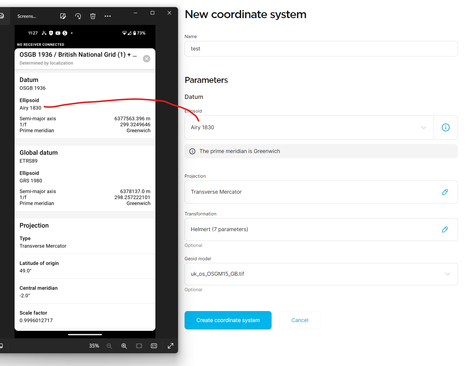
A workaround I assumed was creating a Custom Coordinate system in the other users account, using the results from the initial Point pairing localisation.
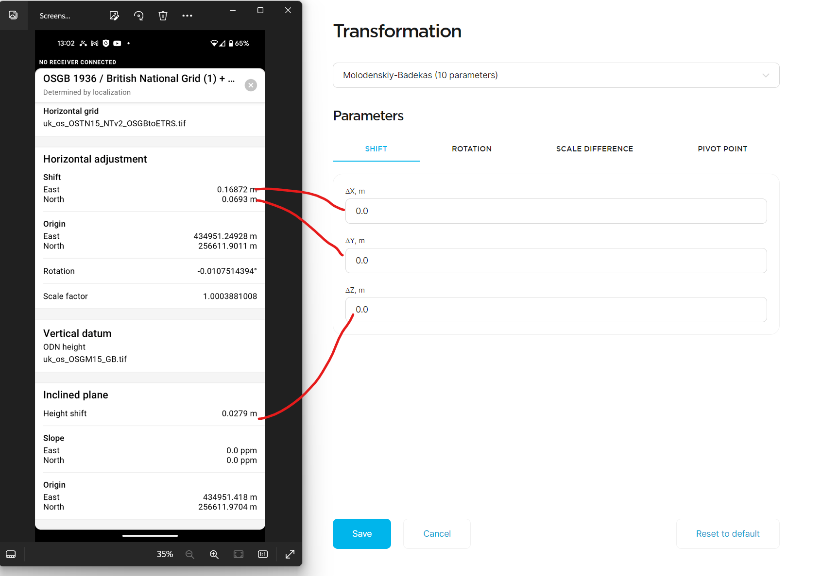
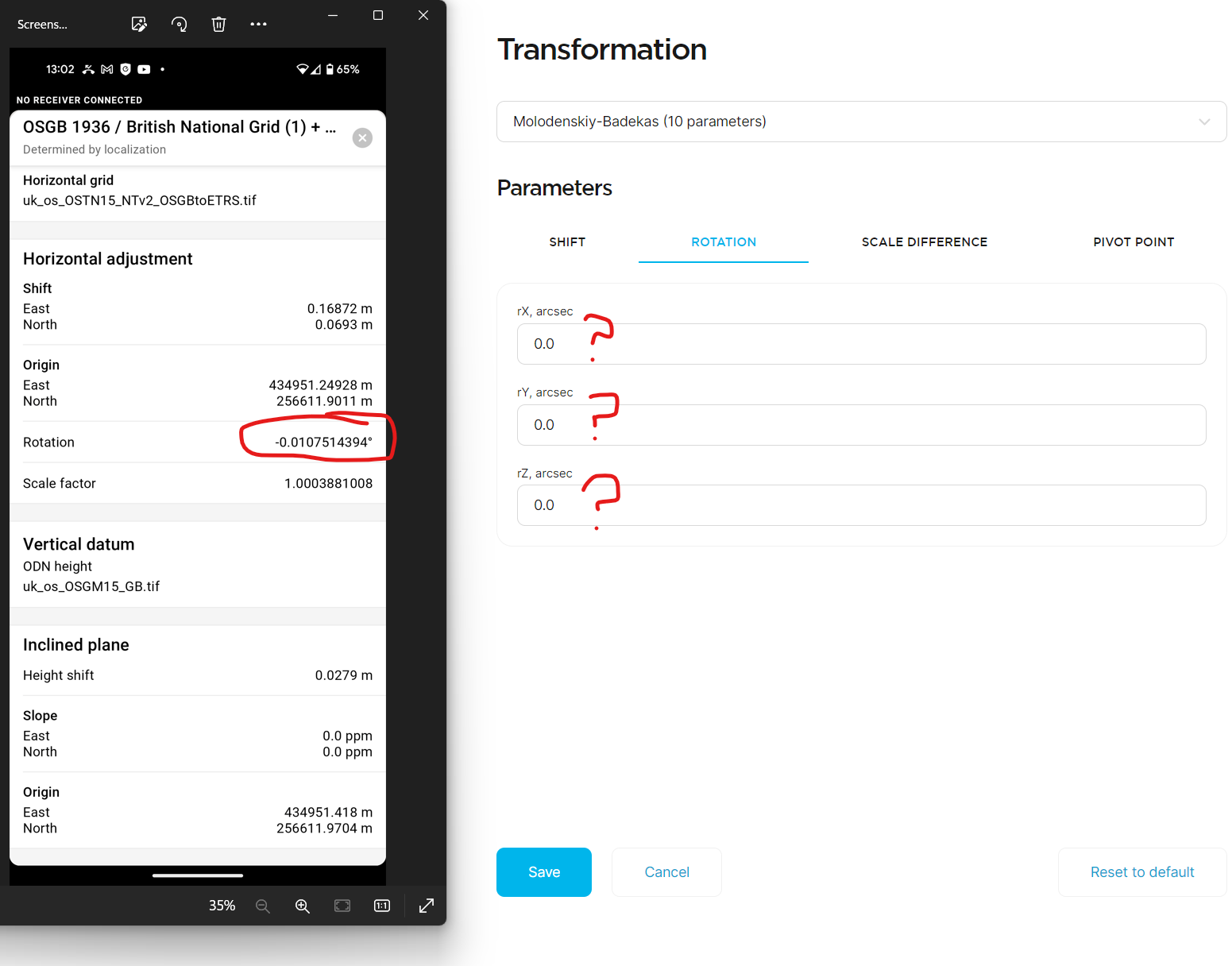
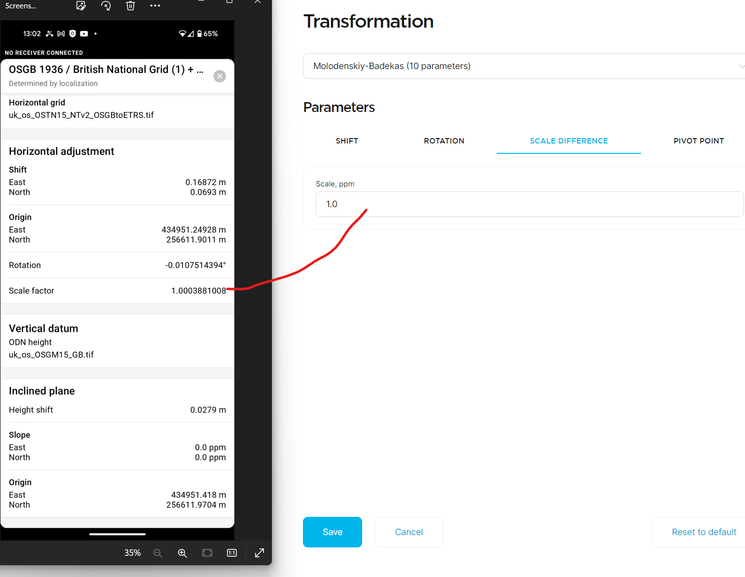
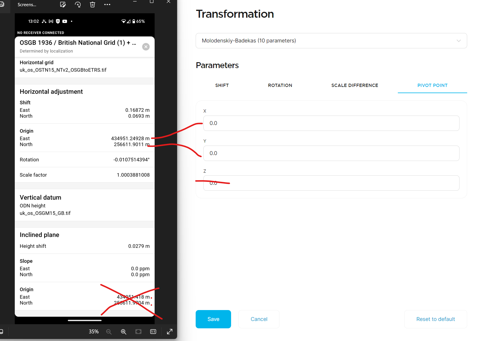
I believe I am doing everything right so far, until I get to the ‘Rotation’ section within the ‘Transformation’ section. I have a rotation shown in degrees, but the input required is rx ry rz. I have tried looking for online calulators/converters but to no avail.
I have attached screenshots, and any help would be greatly appreciated!
Ideally, it would be good if we could export these files as XMLs or similar like we do for other data collectors & machine control (.lok, .xml etc)
For future projects, I would usually run a site calibration through Trimble business center for machine control …am I able to gather sufficient parameters from TBC to create a custom co ordinate system?
This is a great question. Have you tried do a full project export and then importing it into another device? It might carry the necessary data. It would be nice to have a file similar to JXL or GC3.
I am able to export the localisation into my Localisations library, which can easily be applied to any new projects within Emlid Flow. It seems that this method only allows sharing between projects within the same username/login.
Ideally, I need to be able to
a) allow access/share the localisation ‘file/parameters’ between different user accounts (best option)
b) export a .xml / .lok / jxl / GC3 or Emlids own file type which can then be imported into another project being the same usename login or another.
Alternatively, as mentioned before ill experiment with; once localising a new project with Trimble Business Center, inputting all of the parameters into a Custom Co ordinate system on Flow 360.
This would be a more universal approach if I could match the correct parameters with the required ones (7 / 10 Moldenskiy) or something like that… not familiar with creating my own custom co ord systems really
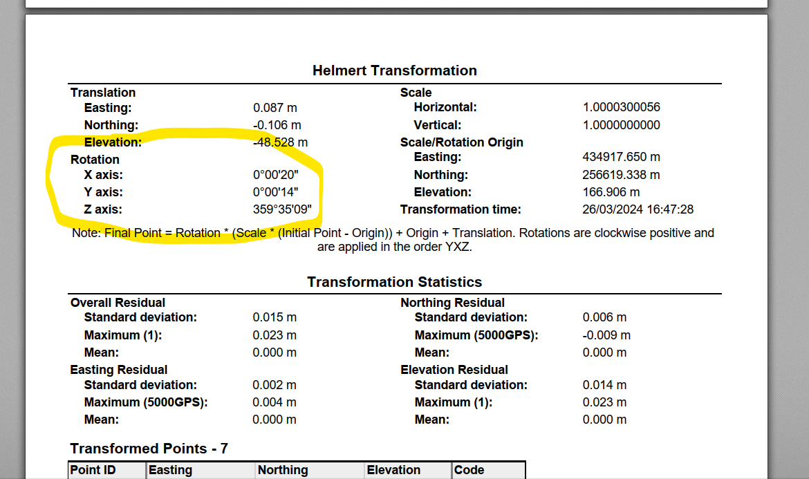
Trimble Business Centers ‘Transform Survey Points’ produces a report with the Helmert 7 parameters of the shift/rotations so will check this out in the field tomorrow
Fingers crossed! Was hoping for some input from EMLID now we are running x4 RS3 rovers & 1x RX…they must be busy!
Currently, we don’t support entering horizontal adjustment parameters for custom CRS. The parameters computed during localization differ from the 7 or 10 transformation parameters.
Aside from using TBC, as mentioned above, I suggest exporting all the points as CSV and importing the file to the other person’s account project.
After that, you can recreate the localization by using the same set of pairs as the old one. In that way, the parameters will be consistent on all projects.