Hello-- New user here. I’m laying it all out there I’m a bit of a newbie but I’ve done quite a great deal of reading and it seems this is way more difficult than it should be. Maybe I’m looking at things wrong…
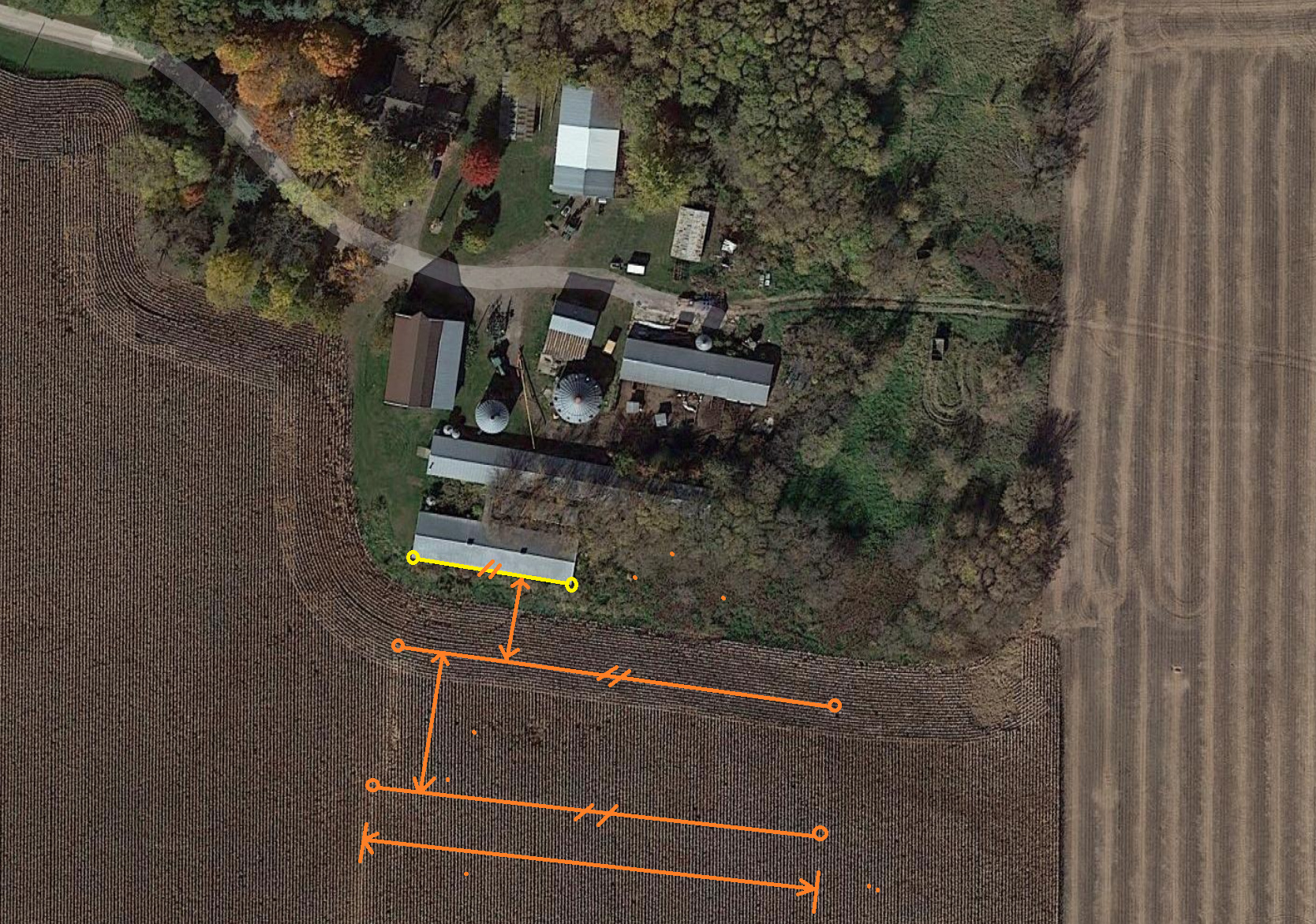
I am looking to create several offset line segments that will be parallel with an existing building. The length of these line segments will need to be dimensioned to length. The distance between segments also matters.
Can ReachView do this natively or do I need to utilize a GIS program to backfeed coordinate data into ReachView? Is the RS2 unit suitable for this type of point mapping?
@Beefey Reachview is only capable of collecting and staking out survey points (no CoGo funcitons). Any design will need to be performed with a GIS software. Once you have a design, you can import the points (not lines) on to your Emlid unit for stakeout.
This is easily done with QGIS in minutes, but you’ll need a bit of prior knowledge to do this efficiently (and at least two measured points, like the building corners, to draw the reference line from).
If it possible for you to do the pre-work beforehand, then I can also highly recommend QGIS. It does have a bit of learning-curve, but with google as your friend, you can do almost anything fairly quick!
I have used QGIS for years but mainly to convert data from one form to another, DEM or LIDAR to .shp
I have never really “drawn” with it. Is there an offset feature in it where you tell it I want line X copied 40 feet away to the left/right or N/S/E/W? I normally do this in my drainage software (Formerly Farm Works with the WM-Subsurface module, not free $3000 US). In it, you just right click the line, create offset, select the distance away (40 ft. for example), select how many times you want to copy it (say 10 times), and then select Left/Right (depends which way the line was drawn (start of the line being point A and the end of the line being point B) it it copies the line 10 times to the Left/Right 40 ft. apart from one another.
There are two QGIS processing tools that could give you the results you need (you can find these in the Processing Toolbox panel):
Array of offset (parallel) lines
Points along geometry
The first tool creates parallel copies of the input geometry, always on the “right” side. If you need it on the other side, just enter a negative distance value.
The second tool will create points along a geometry at a specified distance, so you can use this to mark the distance from the start vertice where you’ll want to cut the line.
In the case of that answer the goal was to take rectangular plots and subdivide them into smaller rectangular cells according to a number of rows and columns specified in the attribute table of each rectangular plot.
Awesome fellas! I tried monkeying around with ArcGIS/AutoCAD but I think its too difficult for me to use recreationally. I’m proficient at Solidworks but importing DXF (CAD) to DXF (GIS) apparently doesn’t work as it is not geolocated.
Gabriel-- I think you completely nailed it. It is obvious you’re very proficient at QGIS. For anyone else that may see this later I was able to see the video (animated jpeg) better by just zooming in on my browser. That took a second
JP Drain-- Yeah I could really see it being worthwhile for drain tile too if you were patterning a field. The only trick would be back feeding the data into Reachview would only allow you to stake points rather than follow line segments. As I understand you’d instead have to make a zillion points and that could in effect be straightforward or a nightmare delineating them.
I was able to get decent results with QAD plugin however I can’t get the dimension tool to work properly so I’ll probably have to go the digitization route.
Measuring distance by ellipsoidal vs cartesian seems very different and I’m not really following how that can be. My first thought is coordinate system issues. To bring these points to ReachView they MUST be in WGS84? As I understand WGS84 is not a projected coordinate system?
I think you’ve been given some good advice on how to do your survey! I’ll add just a few words.
If you decide to use GIS Software like QGIS, please note that you will need to export points in a CSV format to import them to ReachView 3.
If you’d like to use a 3rd-party app like FieldGenius, I’d recommend you check our guide on how to get precise coordinates from Reach on Android. It includes information about various GIS apps for Android that we have tested with Reach.