


- How it should be put the aerial of the aerial GNSS in relation to camera?
- Be the aerial GNSS should put over camera centrycznie?
- Which place of camera should definite while mapowania dronem to the correct geotagging of pictures dronów?
- How correctly to measure the height of the aerial GNSS in relation to camera?
Hi Pawel,
The antenna placement should be placed in a clear sky view without any obstacles and no electronic nearby to avoid interferences, we have this guide regarding this [antenna placement] (Antenna placement | RTK Modules)
It’s not necessary to put the antenna in the center of the camera. Some drones, such as DJI, have a designated place for the antenna and the module, and you can choose the offset in the photogrammetry software.
If you use a custom setup with your drone, then you will need to measure the distance between the center of photography of your camera and the antenna APC and add the offset value to the software.
1 Like
Hi Merryna,
Thank you for the answer.
He plans non - standards configurations drona.
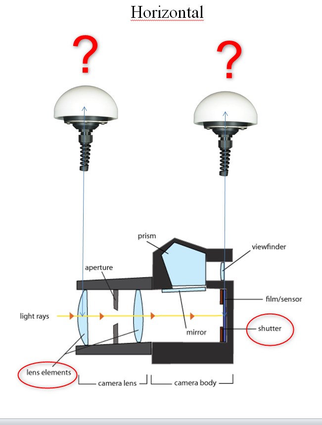
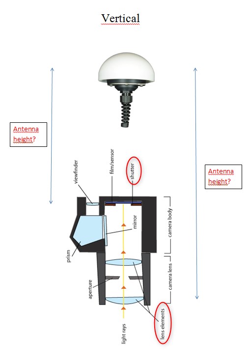
All Your answers are for me comprehensible. However I have to precise the question. Which element of the building of the apparatus for me the reference? Shutter? Lens elements? Another?
I will use software to fotogrametrii: OpenDroneMap - WebODM. I did not find the option of the shift of the aerial in the programme OpenDroneMap. You know this programme and can you me write such option exists in the programme OpenDroneMap??
Hi Pawel,
It will vary for different cameras, you can check the camera specifications for this. I tried to Google this and found this document that might be helpful. For example, if you use a DSLR camera, you can use its focal plane mark and add the lens length as the reference.
Photogrammetry software usually has a setting to input the offset value. I am not familiar with Opendronemap-WebODM. I suggest to check with their support for this.
Hi Merryna
He thanks for the answer. I found the gauge of the plane of focal length in my camera. I already know my point of the reference.
1 Like