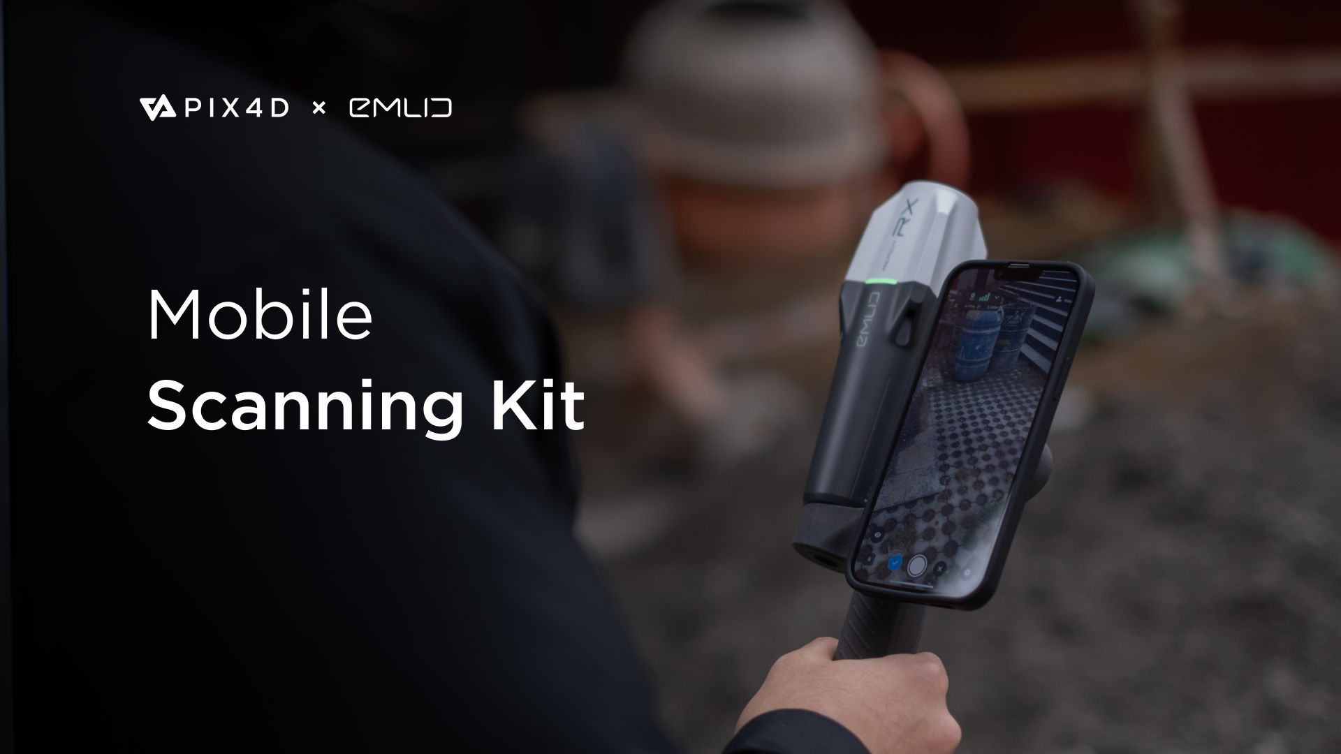
Meet the Pix4D & Emlid Scanning kit that combines advanced photogrammetry with RTK precision. The Scanning kit is designed to quickly capture accurate digital models when documenting trenches and as-builts, performing volumetric measurements, and enriching aerial data with terrestrial scans. All this by using a smartphone, the PIX4Dcatch app, and the Reach RX rover.
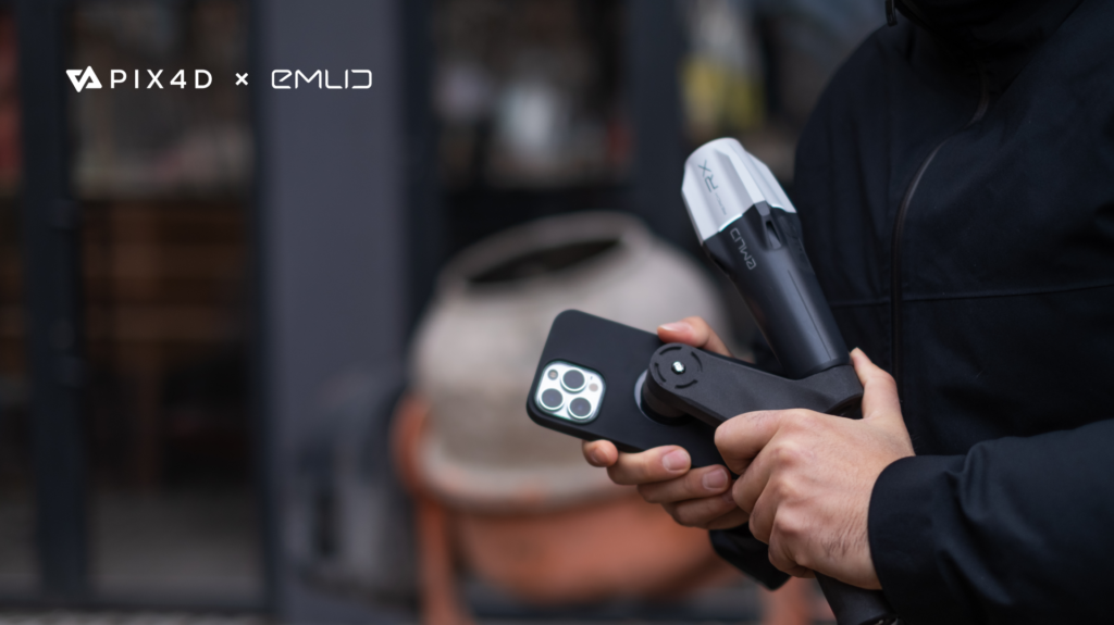
Plug & play: fully integrated solution easy to grip on
The newly released PIX4Dcatch app is at the core of the software part of the kit, enabling precise scanning for both photogrammetry and LiDAR projects. The hardware part features the Emlid Reach RX RTK rover equipped with an ergonomic handle and accessories. Emlid Reach RX is natively integrated with PIX4Dcatch and provides real-time positioning via NTRIP. To begin scanning, simply select Emlid in the RTK settings of PIX4Dcatch and add your NTRIP network credentials. The integrated solution doesn’t require additional setup or surveying skills—anyone on the team can use the kit, ensuring effective data collection as they move around the asset.
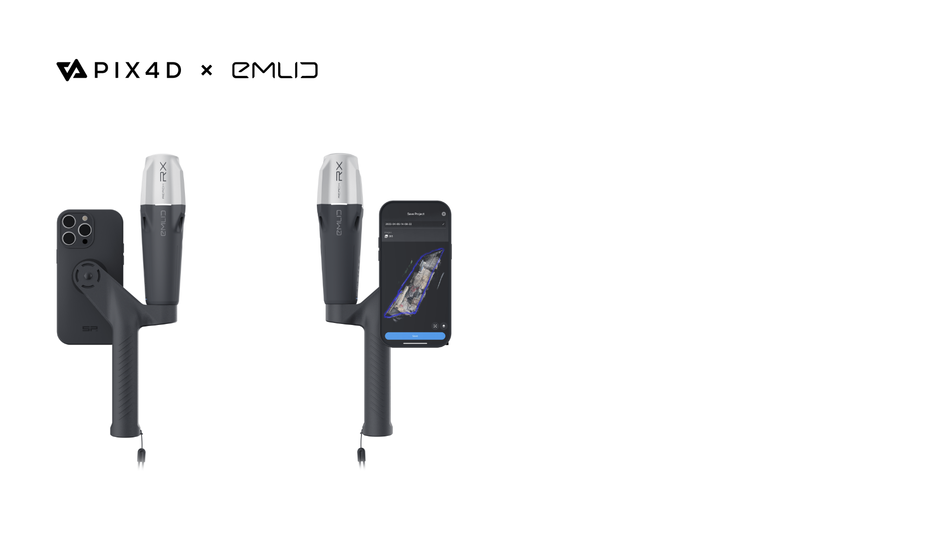
The Scanning kit comes with a handle with a left-to-right switch for a stable grip
Proven workflows across industries
Easy to deploy yet highly accurate, the Pix4D & Emlid Scanning kit will become an important asset for professionals and non-surveyors in a range of applications:
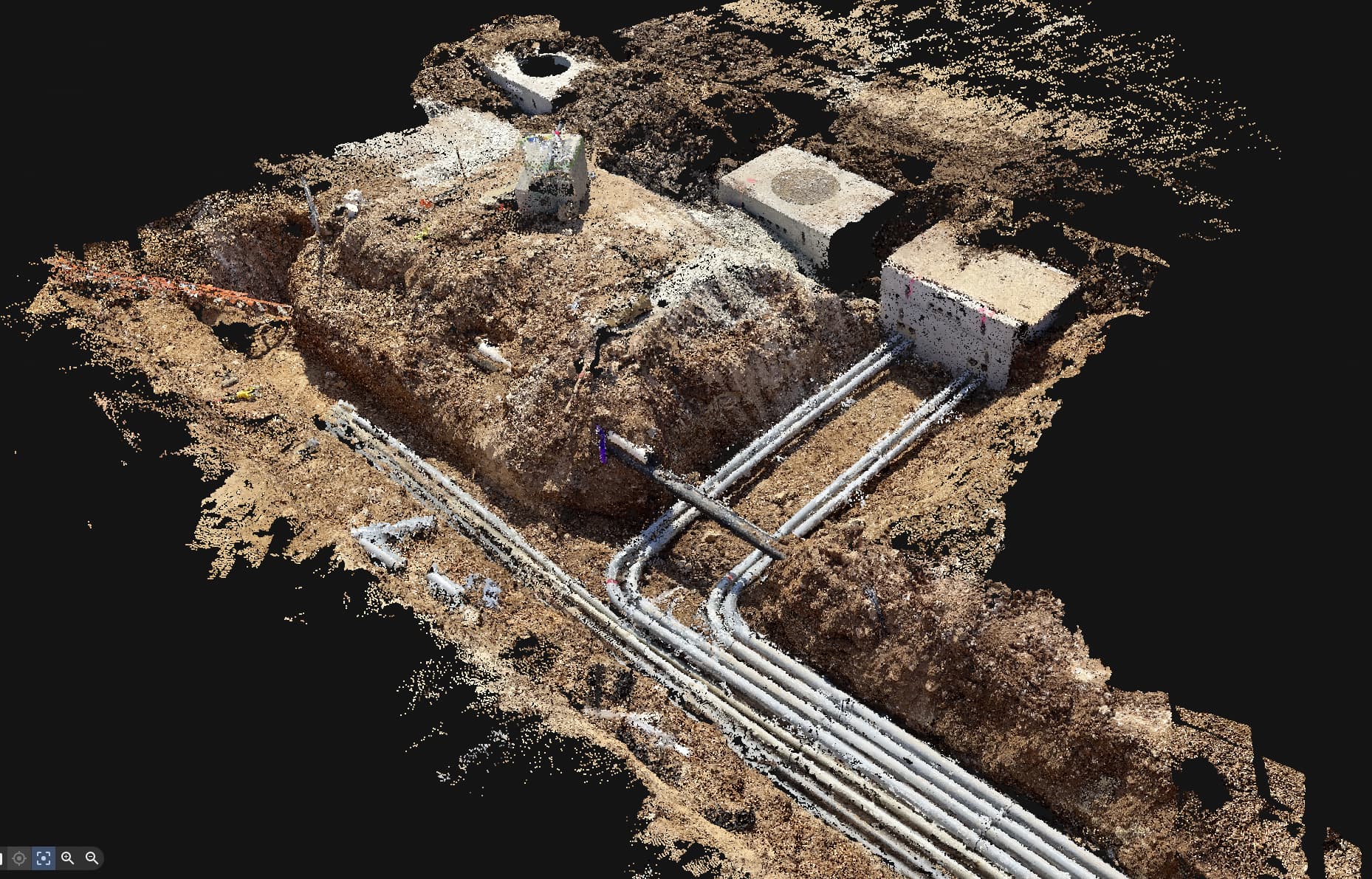
- Underground utility documentation for companies implementing Subsurface Utility Engineering (SUE) best practices.
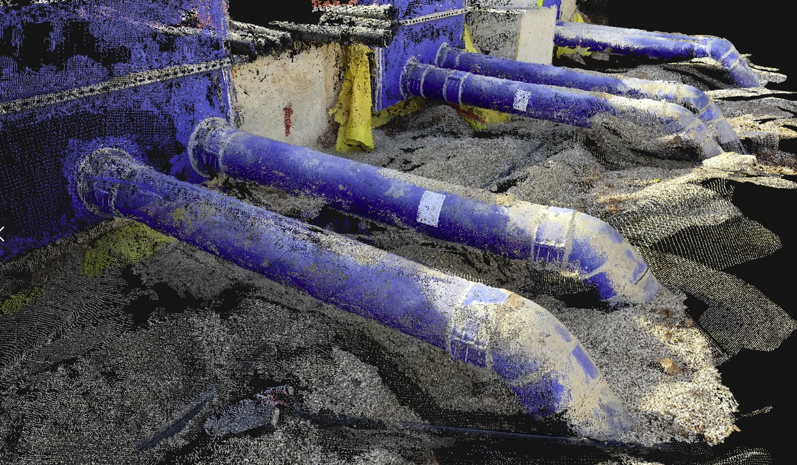
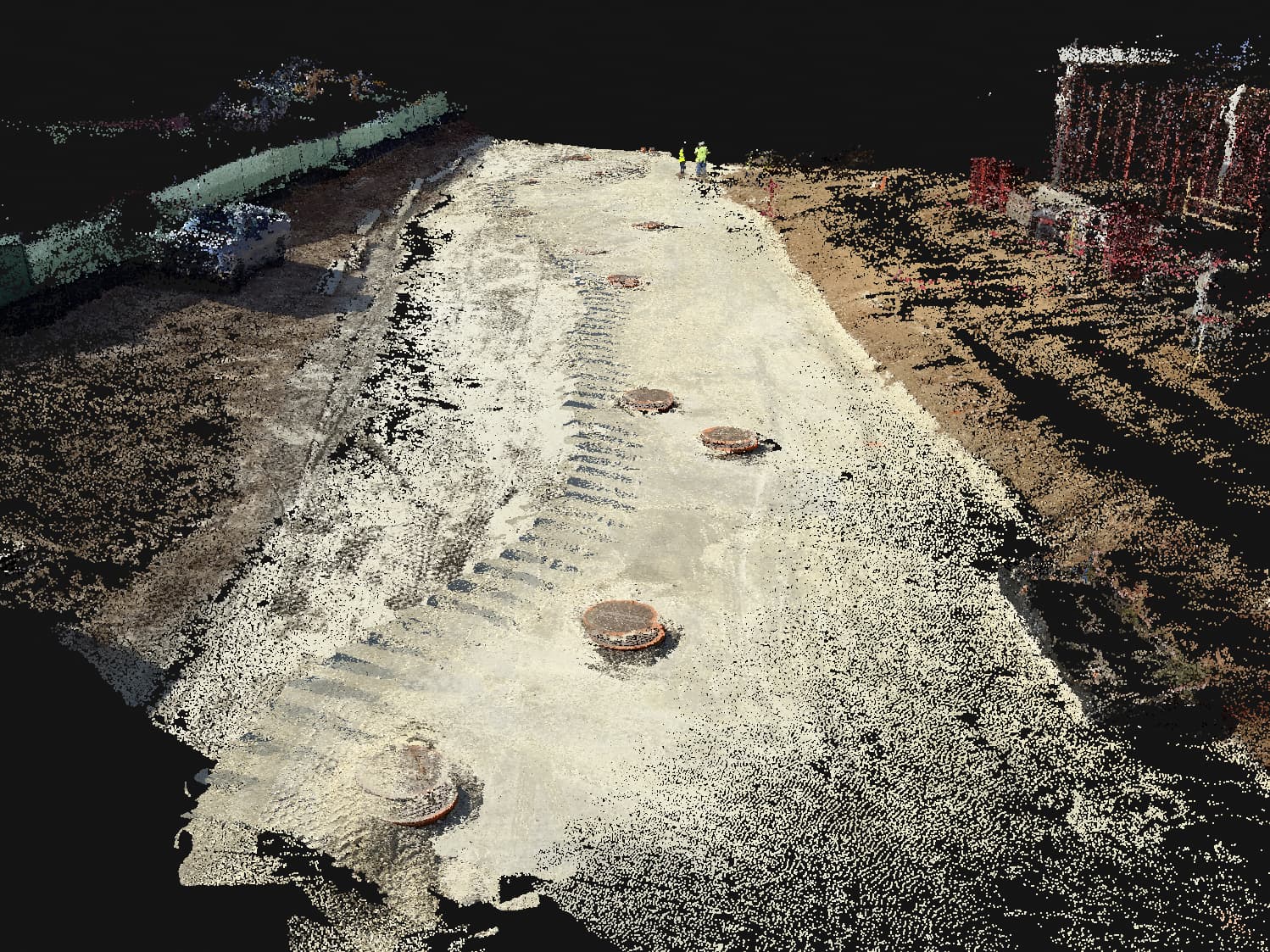
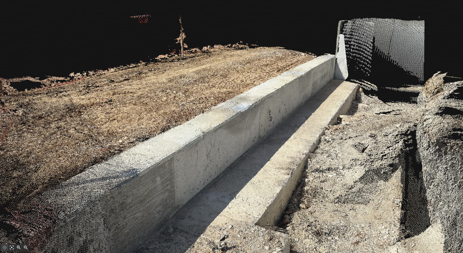
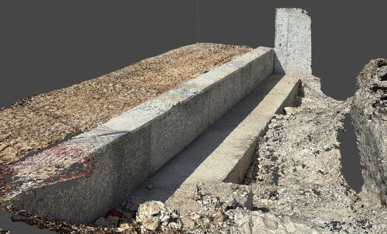
- Construction inspection. As-built scans with less time spent on data collection and drafting.
- Volumetric measurements. Effortless stockpile or cut and fill calculations.
- Crash reconstruction. Quick roadway clearance with easy and accurate accident scans.
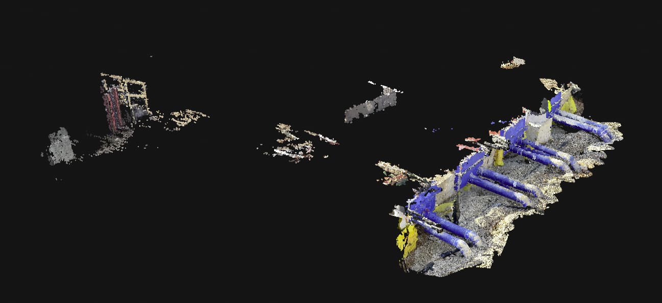
- Combined aerial & terrestrial surveys. Creating a complete site view that enriches drone imagery with terrestrial scans of areas inaccessible to a drone.
Hardware: survey-grade GNSS by Emlid
Emlid Reach RX works with any correction network (NTRIP) or a GNSS base station broadcasting RTCM3. The rover gets a fix in under 5 seconds even in challenging conditions and ensures centimeter-accurate positioning. Apart from the scanning tasks, it can be used with the survey pole as an RTK rover for data collection and stakeout. Designed for urban surveying, Reach RX has the following specs:
- Rated IP68, sealed and protected from water and dust.
- Weighs 250 grams and can be carried in your pocket.
- An industrial-grade battery handles both high and low temperatures and provides 16 hours of work on a three-hour charge. You can charge it on the go from a USB port or power bank.
Besides Reach RX, the Emlid Scanning kit includes additional accessories: a scanning handle, ground tags (5 pieces), and a carrying case.
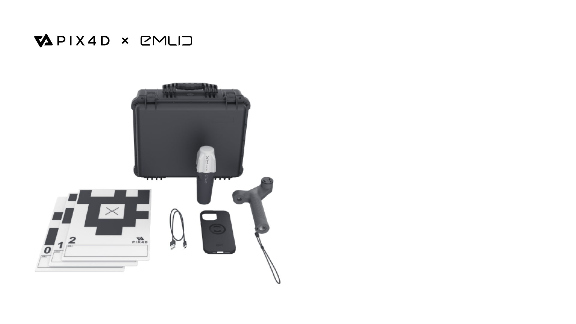
Emlid Scanning kit is ready to collect data right out of the box
Software: data capture & photogrammetry by Pix4D
The Emlid Scanning kit powered with the Pix4D software fully covers the entire field-to-office workflow for creating digital models.
The PIX4Dcatch mobile app in combo with Reach RX enables you to use your smartphone for scanning with RTK precision and generate a digital model within minutes. The captured data is stored online in PIX4Dcloud which allows you to annotate, measure, and share scans with stakeholders.
You can also verify geolocated positions and visualize the project in Augmented Reality. With PIX4Dmatic and PIX4Dsurvey, you can go even further if you need to analyze and extract insights from both terrestrial and aerial data. These apps provide online and offline processing, advanced photogrammetry capabilities, team collaboration, and AR for CAD overlays.
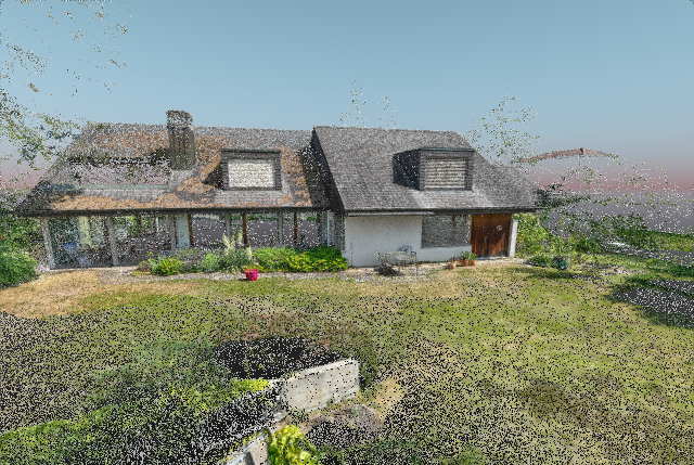
Combined aerial and terrestrial survey with the Pix4D & Emlid Scanning kit
How to order the Scanning kit
The Pix4D & Emlid Scanning kit is available from the Emlid online store. You can also order the Scanning kit from the official dealers’ network. Read more to discover how the new Scanning kit can contribute to your projects.