


This morning until 12.00am i measure some parcels. I got great fix data. But suddenly ar validation is under 3. Waiting about 30 minutes, then got fix again. Until about 12am, ar validation got under 3 again. Then, suddenly fix again. So I often turn off the rover then turn it on again. I use ntrip mode with my reach as the base station.
Is there any explanation for this problem?
@igor.vereninov @egor.fedorov @bide
When I experience this kind of problem:
- I open up rtkplot.exe
- “Open Obs data” --> rov_201701091200.obs
- switch view from Sat Vis to SNR/MP/EL
- pick G satellites instead of ALL
- look at Elevation graph
- see times when there are not 5 or 6 green satellites
- you may not get a fix during this time
- see times when there are 5 or more green satellites
- you will probably get an easy fix during this time
- you can avoid times of bad satellite geometry/signal by using mission planning software or online tools for same.
Have a look at your logs and let me know if my suggestion is true for the times you spoke of during your mission.
2 Likes
Thanks bide. I will try your advice soon.
Or solarflare ?
It could be the caster og base having a hickup of some kinde. Here we get notified if that happens using a public ntrip. Is there a service note you can check for the ntrip service? Or are you using direct link from your base to rover?
There is no public ntrip near by my location.
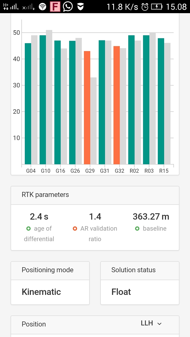
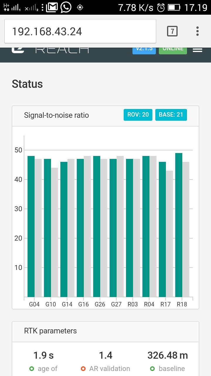
Just now I have checked with my smartphone wifi, base and rover connect to my smartphone wifi, the range between base and rover is 3 meters. And there was no fix result even though the green signal for base and rover between 8,9, and 10
I think about signal is not the poblem, because the green signal is 6 and more such as this picture
And until 1 hour before, I still couldn’t get fix with strong signal
Looks like bad geometry.
When you say great fix data, what does your AR log show?
The AR showed hundreds until 999.9.
How to analyze that is bad geometry?
AR could drop at a heartbeat if just one vital satelite gets blocked. Would be interesting to see this log file of yours.
Differential is also factor.
Have you tried this GNSS Radar
It doesnt give you geometry quality value.
I haven’t ever use that website. But I think when I get fix with AR is hundreds, then i walked under roof or trees, then float, then I get open area again, but still float. I restarted Reach (unplug the cable), then still float. That condition make me confused.
I tested with wifi smartphone with base and rover separate about 3 metres, still float.
Yesterday I got result beter than today…
Maybe there’s a way to analyze the log files, such as my uploaded files before.