


hello Everyone
I was using Geomax ZGP800 for establishment of ground control points and Geomax GeoOffice 3.6 for post processing and network adjustments.
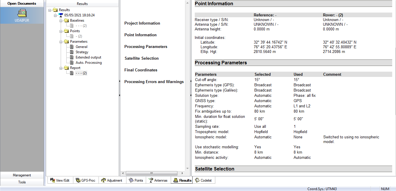
I have 2 Pairs of Emlid RS2 Receivers as well and want to do the same as above with them as well, i converted Ubox files to rinex 2.11 and uploaded them to software but Geo Office unable to process them and ambiguity is unresolved. Can anyone here suggest me how to correct my work flow.
screenshot attached
thanks!