Hello everyone,
I’ve been testing reach in static mode,
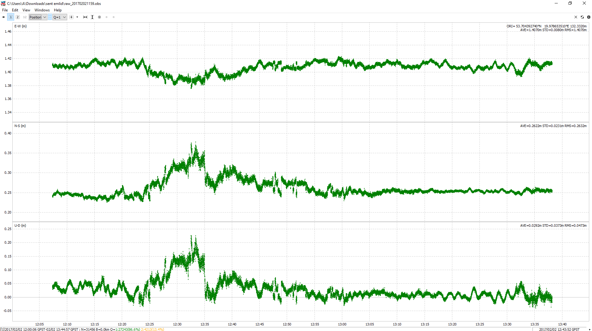
I Wanna check distance beetwen two reach devices (in field it is 1.430m - so they are close to each other)
So I set two devices in static mode, leave them for almost two hours (I didn’t move them for all that time) and then post-process the rinex files.
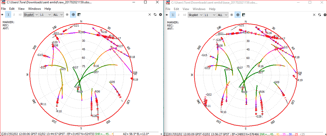
I know that I haven’t best sat visability (both devices have seen 8 sat. beetwen 13:00 and 13:15).
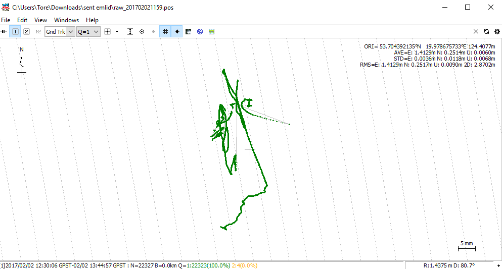
I couldnt get fix, the coordinates of the base taken from NTRIP is 53.70439274° 19.97865351° 132.332
Both reach were on same eleveation.
Can somebody please tell me what am I doing wrong?
This log looked noisy. Did you use propper grundeplate?
And good skyview and no interference around?
For rover it looks like a noisy area below 45 degrees and 35 degrees for base
Thanks for reply
My groundplate’s are round ( diameter 12cm)
I know that the place of observation that I have chosen isn’t the best, but I can get FIX using NTRIP corrections without any problems. In RTK I can get the distance calculated from coordinates 4 cm different then measured by tape,
Wow! How did You get 86.6% fixes? I think i need more knowledge about settings in RTKPOST. I can get only 34.8%, but Yes the distance is correct,
How did You know which coordinates are final?
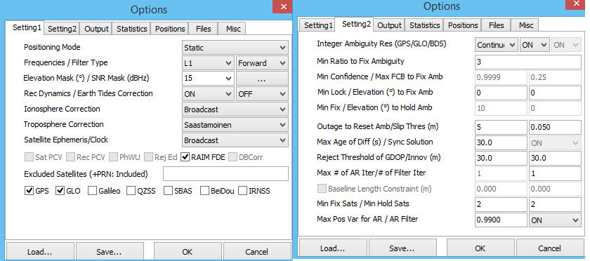
And at the end can You please check my settings?
But how does your surrounding looks like? Really curious to know how you could get that noise level
I have never got that much noise, even with obstruction up to 40 degrees and stand close to a antenna
I use Kinematic instead of Static in Position Mode (Setting1) and Fix and Hold instead of Continuous (Setting2).
Also, I set Elevation Mask to 30.
And in Positions I use Base Station LLH coordinates which are in your first message.
It doesn’t look to good ( there is 5 meters high building on the south - 5 meters from gps on the other direction there is almost clear sky) ( its dificult to me to describe) but as I mentioned I can get fix using ntrip server without any problems
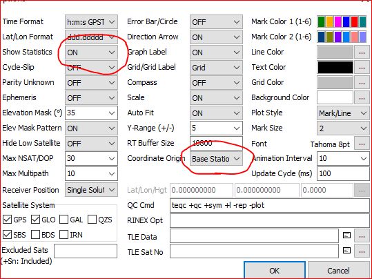
Another tip is to use time interval/span and Q1 (from drop down menu) to show a better average result.
But this also hide some of the truth, but in your case nice to use. @hondaafrica Thanks for feedback
We’ve just square each AVE in every dimension, sum them and get the square root of it
I’ll just look tomorrow if there any label somewhere in RTKPLOT with the same result.
I wonder if it would help if you put a vertical metal plate near the antenna which blocks the view of the building. (trading large multipath errors for small ones)