


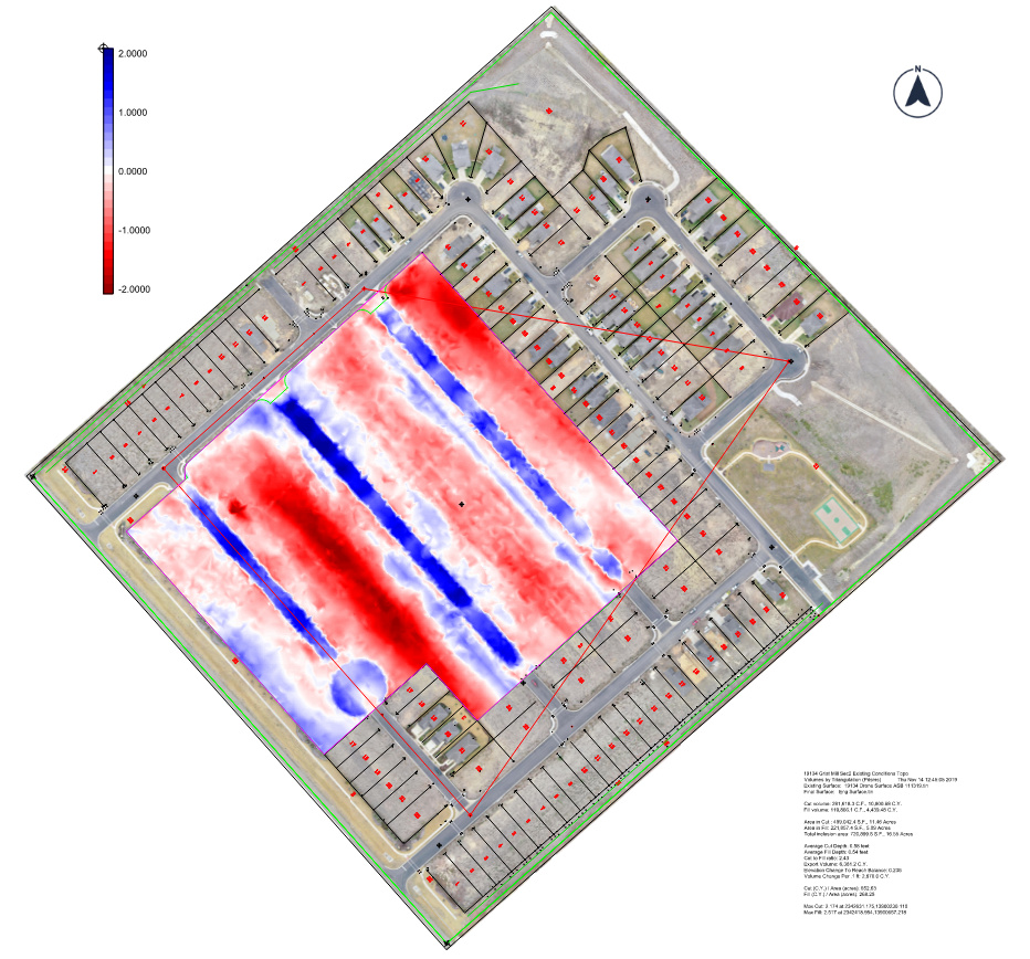
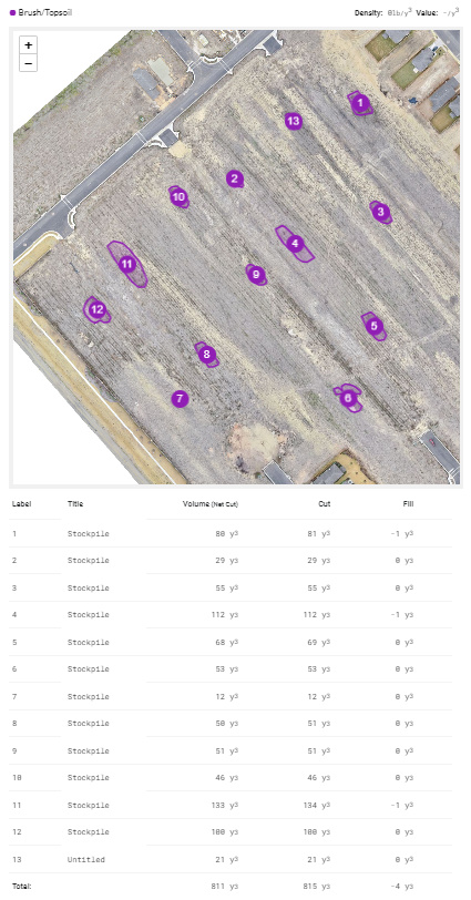
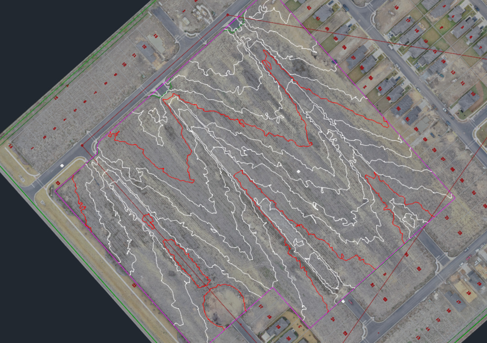
Just wanted to share a project I did for our Estimating Team yesterday. It is the 2nd section of a subdivision that was partially started by the contractor that completed the 1st section. Because of under-performance the initial contractor was fired and the developer is bidding out the remainder of the 2nd section. The option for companies to competitively and accurately bid this is to do their own surveys or guess. Traditional survey would take a two-man crew 7-8 hours to complete. I did it with a one-man drone crew in 3 hours. This doesn’t include the fact that I flew the entire subdivision and capture images at the same time. Here are the cut/fill map including deltas and quantities, the unforeseen stockpile quantity report and an image of the CAD DXF contours that we will use in our Estimating software. They asked me to do this Tuesday and I gave it to them this morning. Thanks to Emlid RS+, M+ and AShot.
8 Likes
That’s pretty cool Michael! I’ve never seen this type of application. What software do you use to estimate your job? Curious if it’s something I could use on my jobs in California.
We use Agtek for Civil. They are right there in Livermore CA. You can get a demo from Doug Pittman. They now have a grade module to handle point clouds also.
1 Like
This topic was automatically closed 100 days after the last reply. New replies are no longer allowed.