


G’day all,
My apologies if this question has been answered already. If it has I’ve not been able to find it.
We recently took delivery of a pair of Reach RS units.
We want to use them primarily for setting out points from our farm plans (in MapInfo or AutoCAD).
We have surveyors supply us with topo/feature data upon which we base our farm plans.
Next step is to set out the various points on the sites e.g. Fence posts, tree lines, irrigation channels, roads etc.
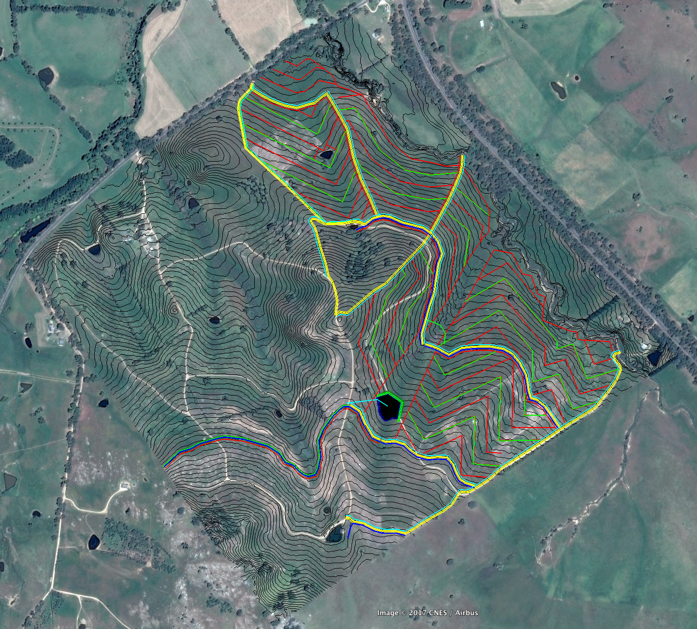
This 100ha project is one that we have to set out all of the above:
Is there a step workflow that someone could help us with please we’d be very grateful as we wish to open up the use of these units to our clients and local networks.
Thanks and all the best,
Darren J. Doherty
Director,
Regrarians Ltd.
www.Regrarians.org