Hi All,
I am fascinated by Reach RS2 and I bought one few months ago. Due to busy work, I have not had a great time to explore and put it to use.
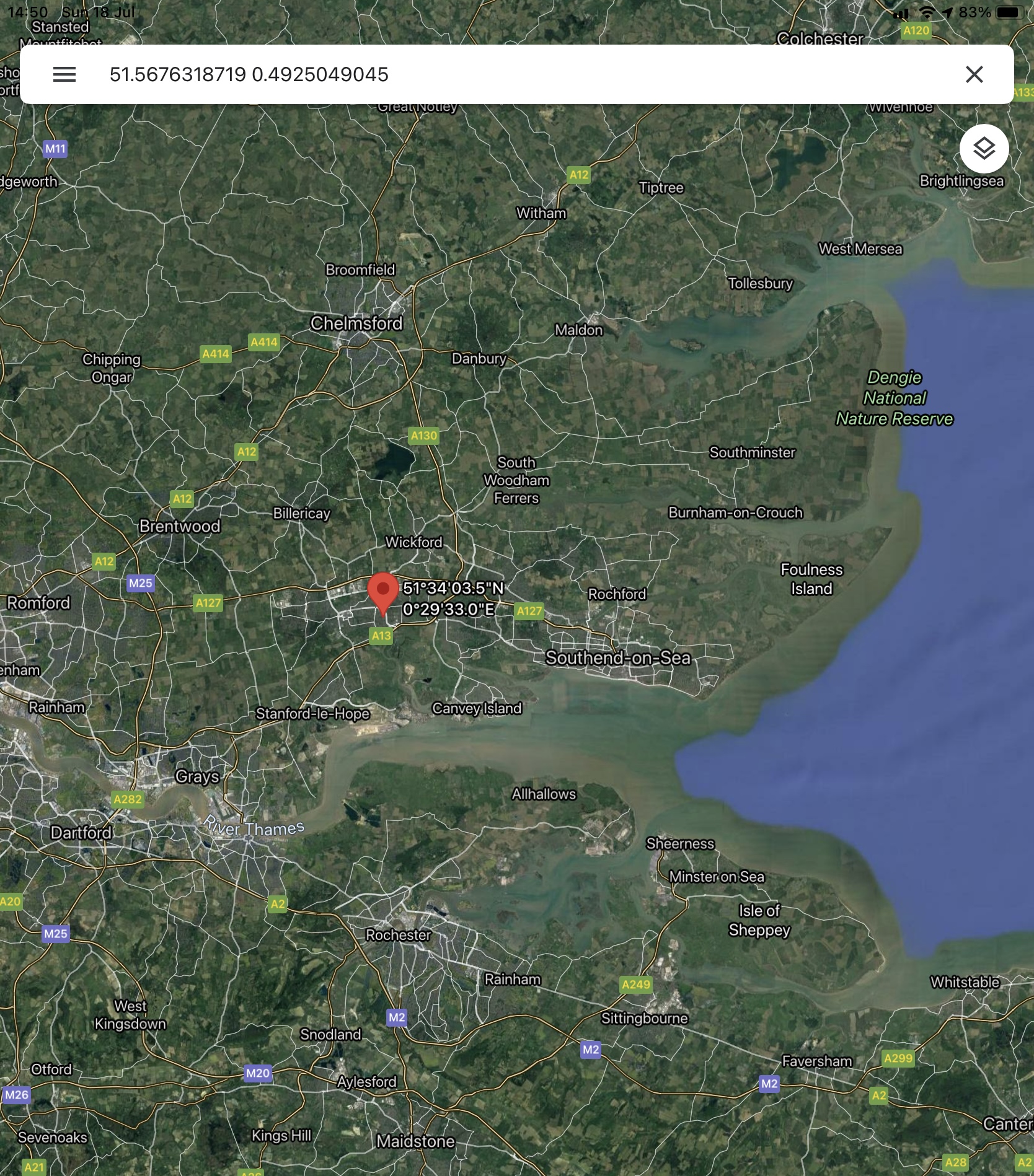
When I finally did, the setting for the coordinate system in Uk was so much in the Reachview 3 App that the few I have used did not give the coordinate values that is for the location where I am working, Essex in England
I am planning to use the Reach RS2 with Fieldgenius for Android.
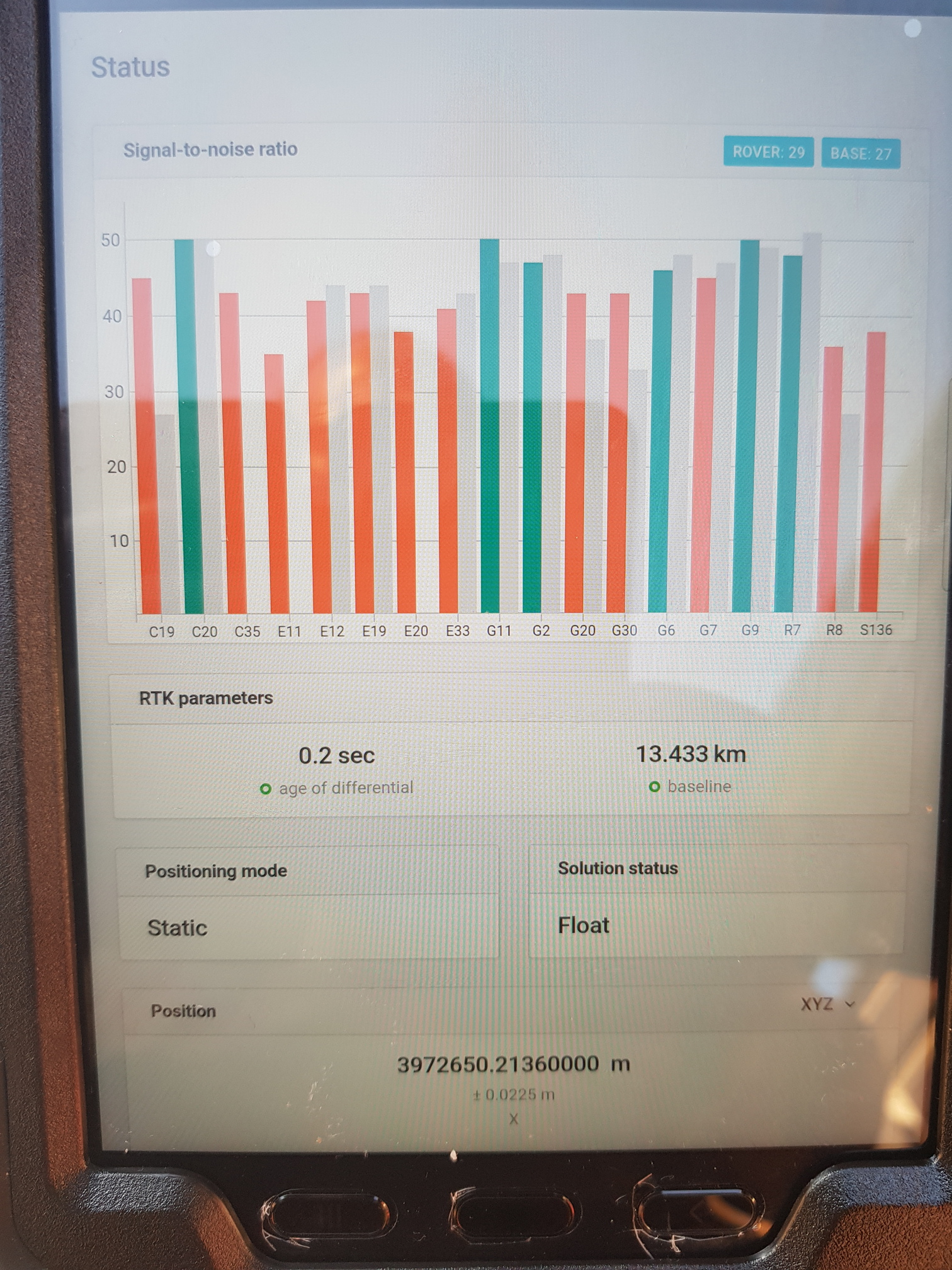
If any one has use the RS2 in Uk, I will like to get some support in getting the right setting . This is a coordinate value of a point in my locality.
E- 572842.837
N- 188360.807
Z- 21.532
Thank you
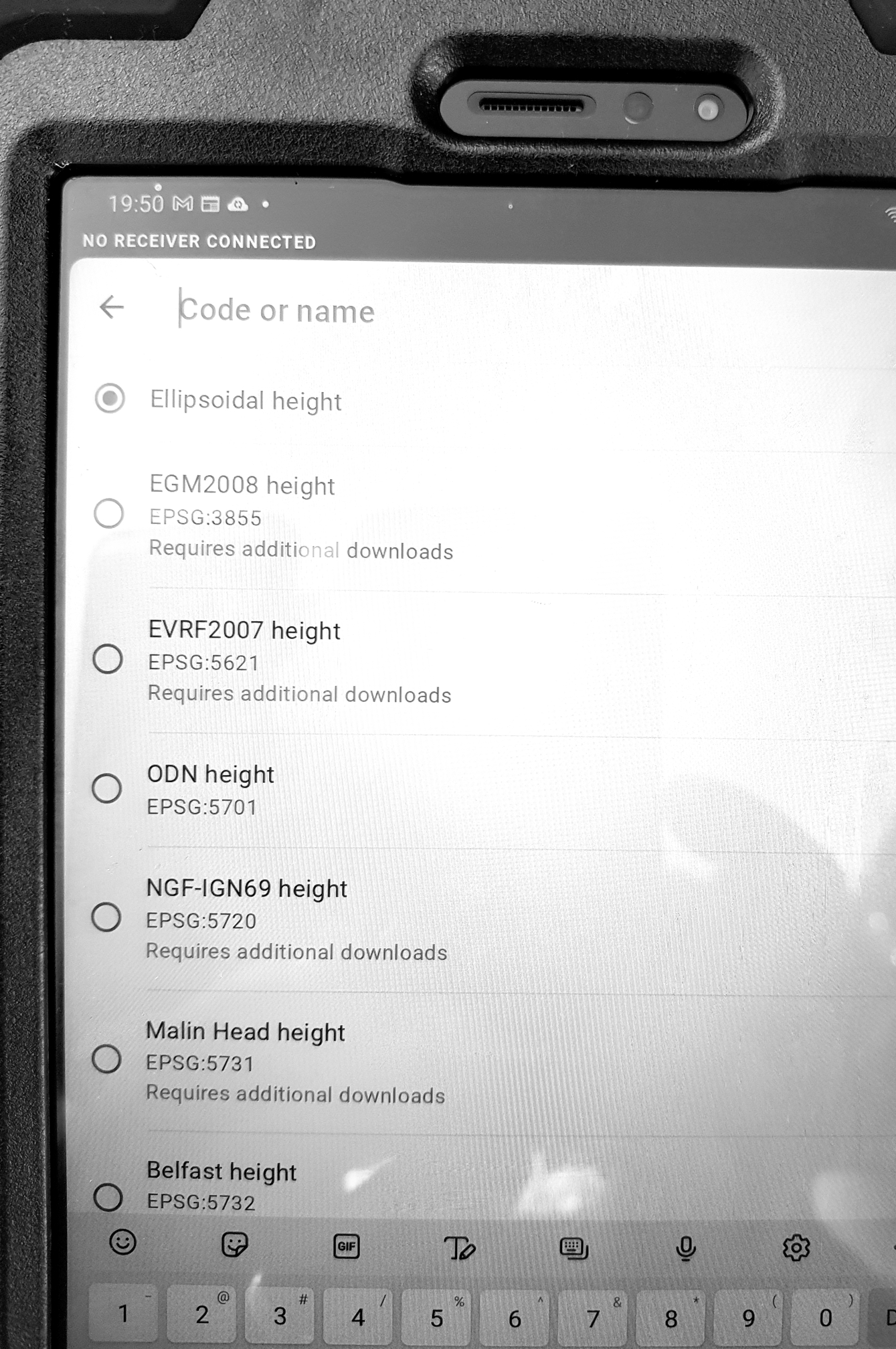
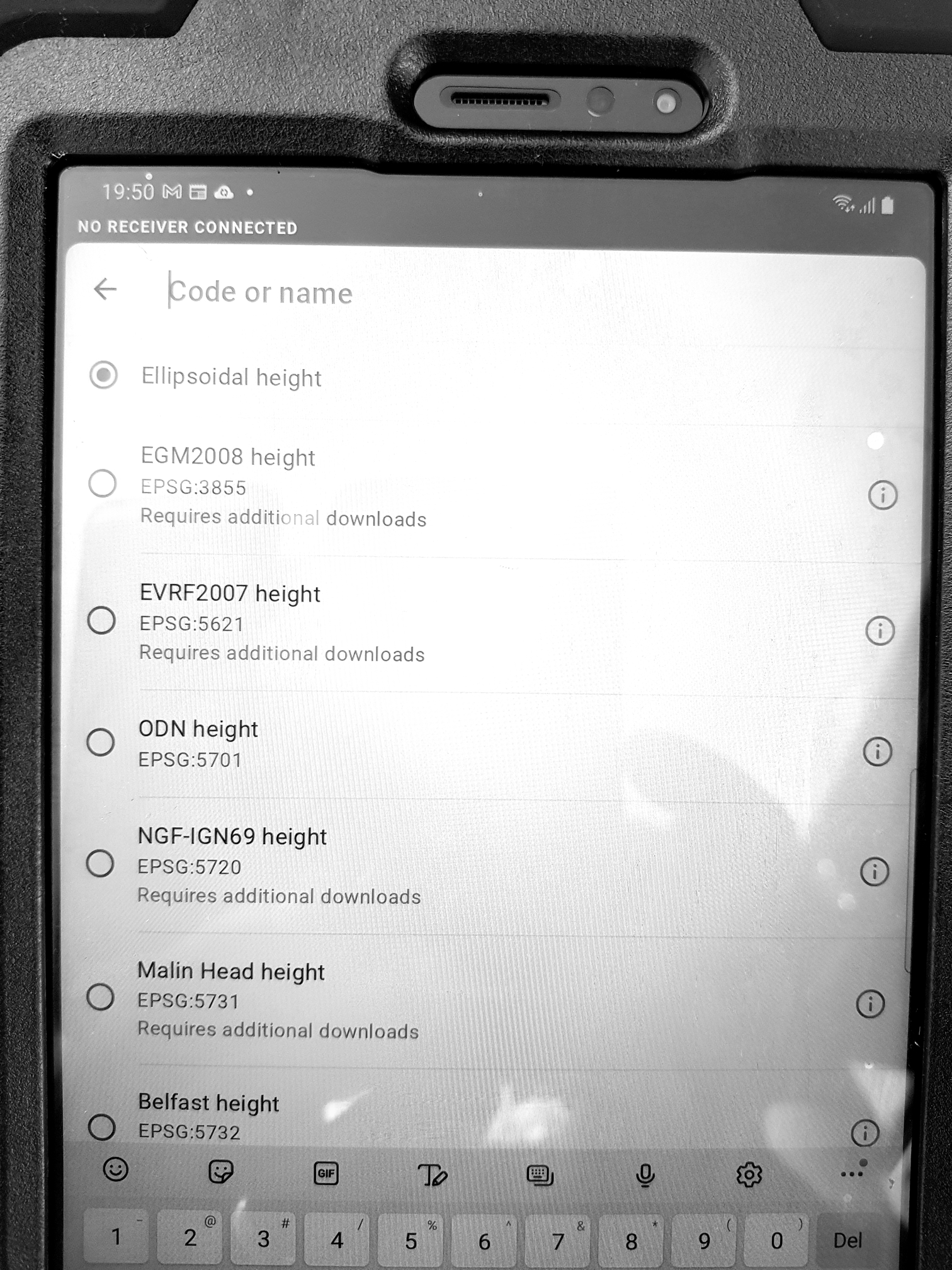
For RV3 download OSGB36 CRS and geoid and you will be good to go, however make sure you use ETRS89 with ellipsoid heights as your source. This is easily achieved by solving your initial observations using OS Net RINEX data from the nearest OS National Reference Station, or using a commercial service that provides ETRS89.
The whole of the UK is covered by OSGB36 so it doesn’t matter where you are within the OSTN15 / OSGM15 transformation region (there are several geoids included in this covering various island regions). There are two EPSG codes of interest, OSGB1936 EPSG::27700 which most OS Opendata products are projected, and OSGB1936 + ODN height EPSG::7405. Most of our British National Grid surveys and GIS products are EPSG::7405.
I see you are wanting to use FieldGenius (we use the Windows version on a tablet), you can download the required geoids and transformations, but again remember that your rover is feeding it ETRS89. Saying that, I have had some variances using FieldGenius that I don’t get with RV3.
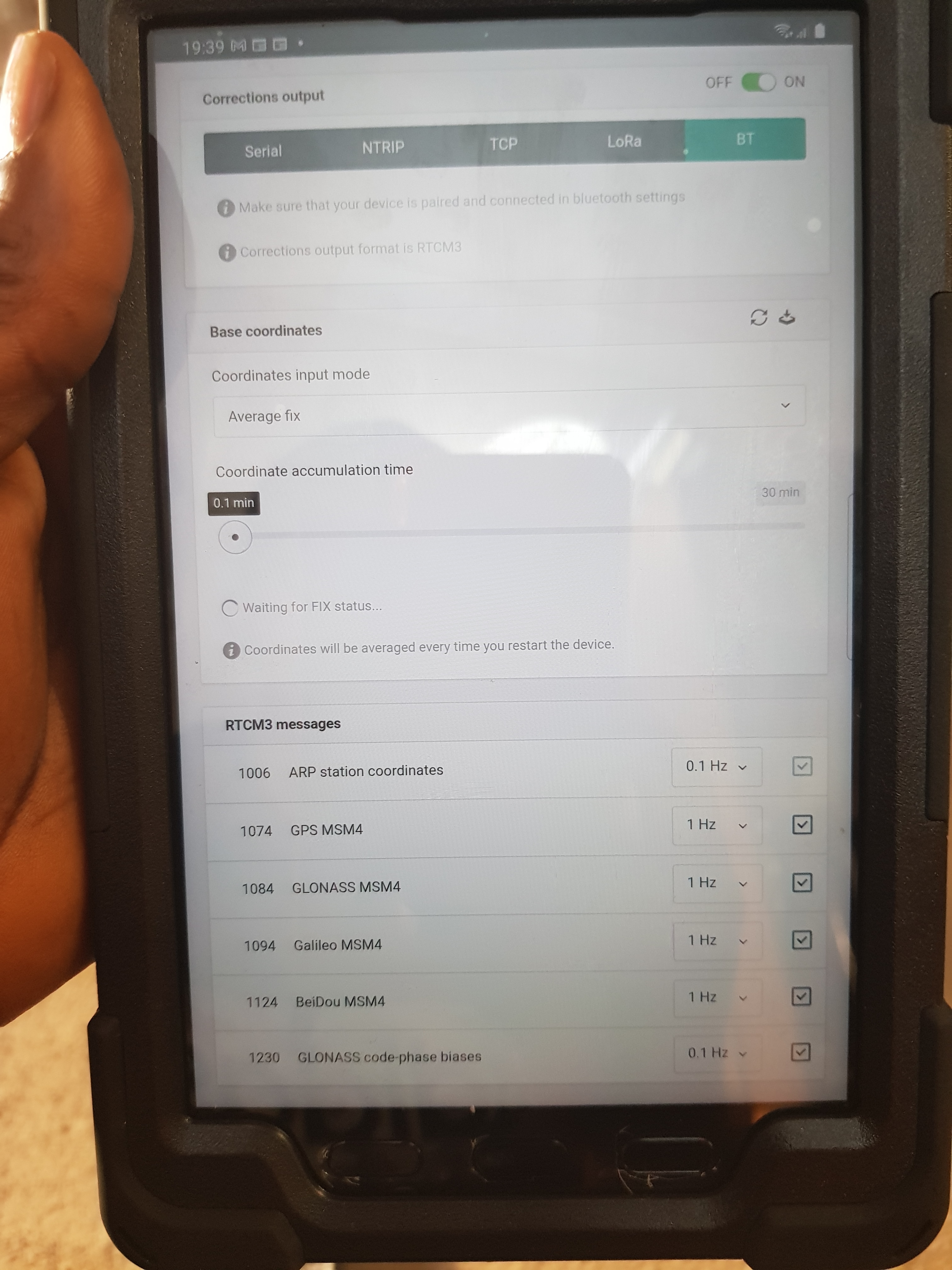
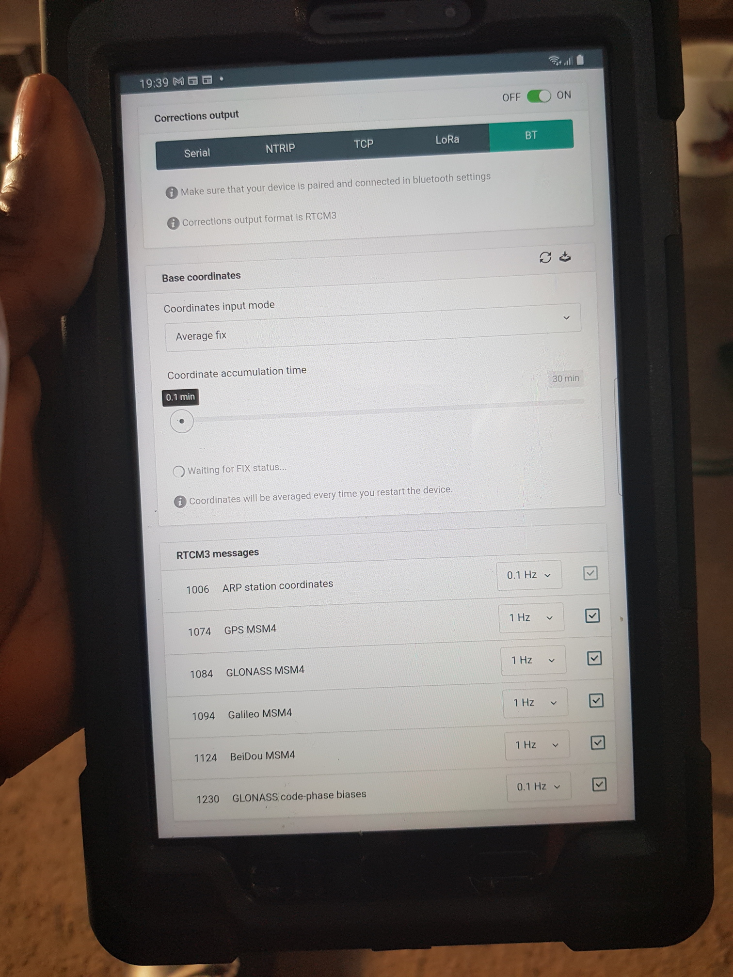
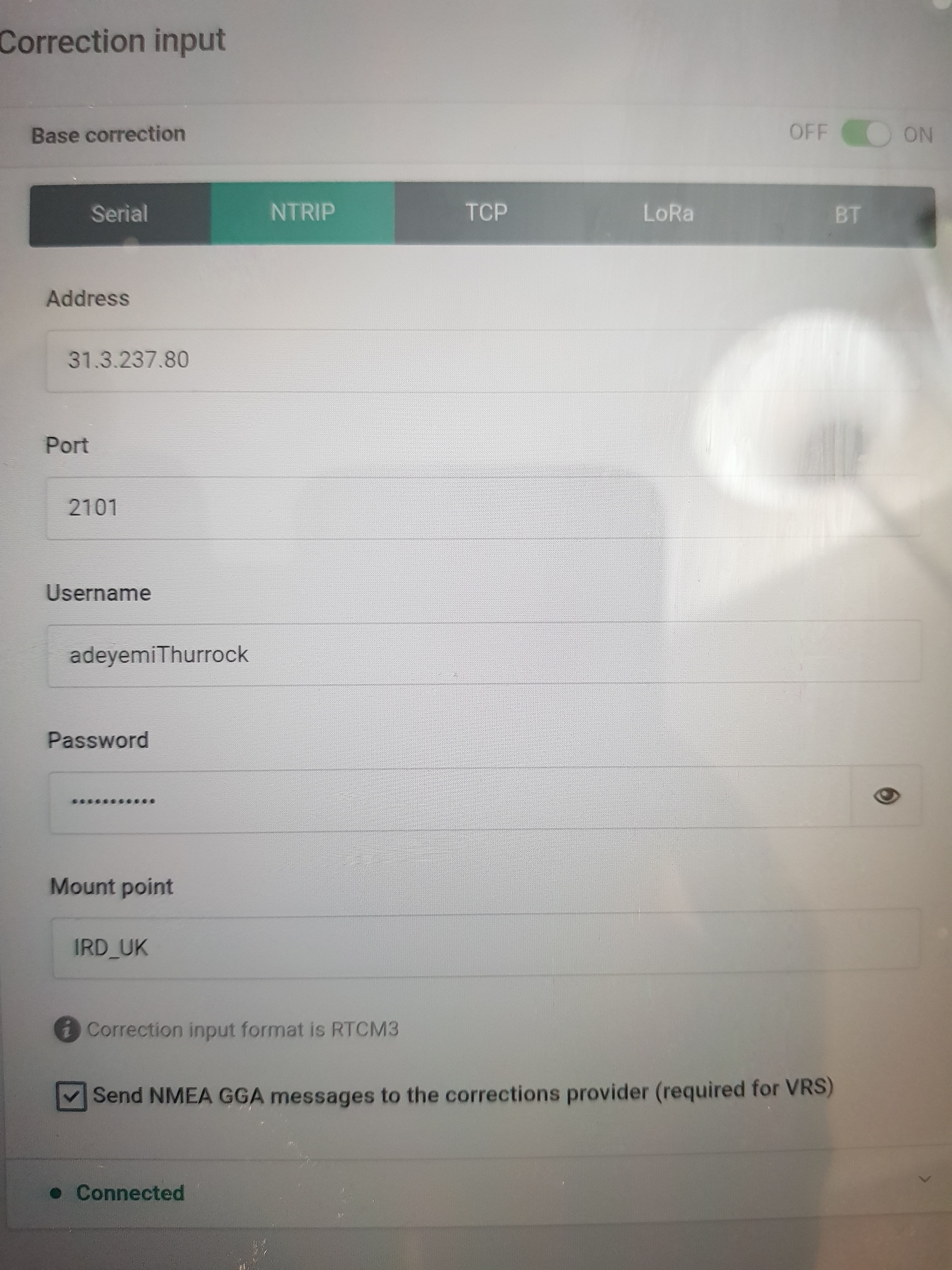
OSTN15 Geoid and the picture shows the rest of the information.
The correction service is from another person in the UK who set up a correction Base Station from where I am getting the correction from.
Hi Rory,
Thanks for this information. I will try and make some sense out of it and update my setting accordingly and see what happens.
Did you say that when I download the Field genius, I will be able to get the geoid downloaded?
I will catch up.
Thank you