Good morning.
I have made a measurement (Stop & Go) of some points using as base receiver the RS2+ and as rover the R3. When postprocessing the data with Emlid Studio, the results are not so good and I wanted to do the postprocessing using Leica Infinity to use precise ephemerides.
To postprocess the data with Leica Infinity, I need to generate a rinex file for each measured point from the rover rinex file, using the measurement times, this is where my question is.
When I exported the CSV file of the project, there are two columns called “Averaging start” and “Averaging end”, what is the relation of these times with the rover observations file?
An example of what I am doing for each point is this:
dates in the CSV file for point 1:
“Averaging start” : 2025-02-25 12:13:26.6 UTC+01:00.
“Averaging end” : 2025-02-25 12:13:31.6 UTC+01:00
dates to extract observations for point 1 from rover rinex file:
“start": 2025-02-25 11:13:44.6 GPST
“end": 2025-02-25 11:13:49.6 GPST
Once the rinex files are generated for each point, I go to Leica Infinity and process the data, but the geometry of the points is not exactly what I actually took in the field and it doesn’t look anything like what was generated with Emlid Studio either.
If you can help me with this I would be very grateful.
Hi @jvalencia658,
Welcome to the community!
Could you share more why the results are not so good? I’d like to investigate this further. Also, could you share how you compared the points?
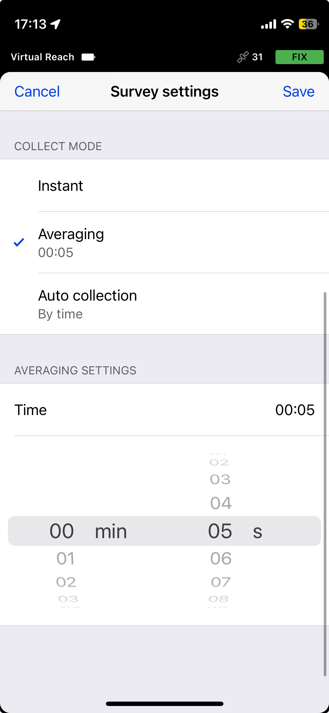
The averaging start is the time when you start on average of a point while the averaging end is the time when it finished, you can set this on Emlid Flow:
Do you use a specific software to extract the points?
I don’t have much experience with Leica Infinity software, and since it’s a third-party software, it will be challenging to check. However, I’d be happy to assist in investigating it in Emlid Studio. Please feel free to share the data.
If you’d prefer to share it privately, you can send it to support@emlid.com.
The points were surveyed to georeference a LiDAR point cloud. When applying the transformation using the coordinates obtained with Emlid Studio (converted to ETRS89 and projected to UTM), I compared them to the corresponding coordinates from the LiDAR dataset. The resulting RMSE was about 0.20 m in the XY plane and 1.2 m in Z. Considering that the expected accuracy of the LiDAR data is at the centimeter level, these differences suggest that the solution obtained through Emlid Studio was not sufficiently accurate for this application.
I’m using Emlid Studio and its (Convert to RINEX) feature, where I specify the start and end times for each point, with a logging interval of 0.2 seconds. These timestamps are taken from the project CSV file, using the “Averaging start” and “Averaging end” fields. I assume these times correspond to the observation epochs in the rover’s RINEX file, once adjusted for time zone (UTC+1) and leap seconds (18 seconds added).
For example:
However, this is where my main doubt lies: do these “averaging” timestamps actually align with the observation times in the rover’s RINEX file, or is there another offset or factor I should consider?
@jvalencia658 Thank you for the detailed explanation.
Could you share more on how you set the base? Are you using PPP? I’d like to better understand why a datum transformation is necessary in the workflow. Is it possible to use ETRS89 directly, to avoid transformation?
Additionally, could you share the reason for georeferencing the point cloud? Is it to check its accuracy, or is it intended as a verification step?
I’m currently looking further into the averaging time and will get back to you on that.
@jvalencia658
The averaging start and end times are the times when a point is collected. They are taken from the phone time and related to some part of the epoch time in the RINEX file.
Hope it helps, and feel free to let me know if you have any questions!