


What is the scale factor in rtk in reach rs2?
@bibhusan111 , scale factor is dependent on your location in the world, the datum you are working to and the elevation above (or below sea level).
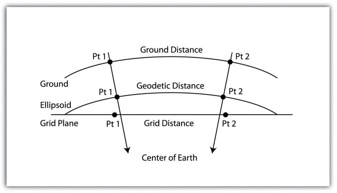
If you are working to a state datum, the scale factor for it will be published (so you can look it up) however this is a general approximation for the whole of the datum. Depending on your position on the state datum (and elevation), there will be local refinement of the scale factor. This is mainly due to translating WGS84 into your local/state datum for your location.
Hopefully this gives you an idea and some information to go looking for more information applicable for where you are?
Joel
3 Likes
Great explanation. Simply put a scale factor accounts for the difference between a distance between two points on a curved surface and the distance of the same line when projected onto a mapping plane or grid. This causes a particular problem when using GNSS equipment and machine control using a grid projection like construction layout and machine control. Design provides grid measurements and the Engineers provide surface and grid coordinates for benchmarks but they insist on putting surface coordinates on building corners and grid intersections.
5 Likes
This topic was automatically closed 100 days after the last reply. New replies are no longer allowed.