Hi,
First of all, I would like to say hello and express how grateful I am for this great forum. I have been reading here a lot of posts which were very useful!
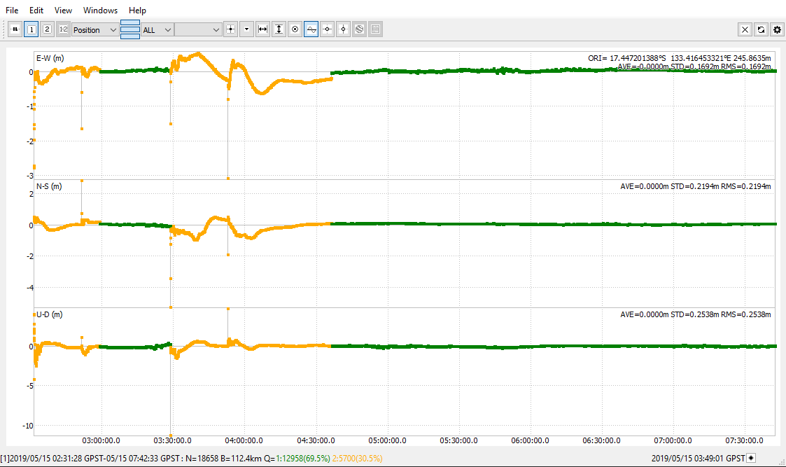
I have been trying a lot and unfortunately nothing has worked. So I hope, it is rather a small mistake I am doing somewhere, and maybe somebody here is able to spot it.
As the title of the post says, I am currently having trouble with post-processing my survey data using rtkpost (64bit) for Win10;
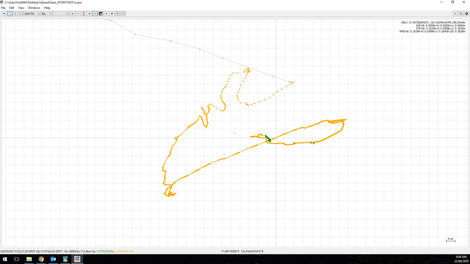
I was in the field last year, using two Reach Rs+ units respectively as base and rover. What I am trying to do now, is to post-process my base station observation data with data from an Australian GNSS station ( Renner Springs in the Northern Territory; c. 85 km from my study site). I know the distance to the GNSS station is not ideal, but I hope to still improve my base station data as there were no reference points nearby.
My work flow is according to the reach tutorial and I also looked into several descriptions here in the forum. I use rtkconv to convert my base and rover ubx files into .obs, .nav. and .sbs files. I have tried different settings; Auto, u-blox, Rinex. As the PPK workflow (without a corrected base) worked well, I assume the error is not in this step.
I downloaded daily GNSS data from Geoscience Australia (ftp://ftp.ga.gov.au/geodesy-outgoing/gnss/data/daily/2019/) and use the software tool crx2rnx to convert the _01D_30S_MO.crx file to a .rnx file. Afterwards I use rtkconv to create an .obs file from it and when I upload it to a PPP service (Natural Resources Canada), I get a decent report (which brings me to assume the file is the correct one?!).
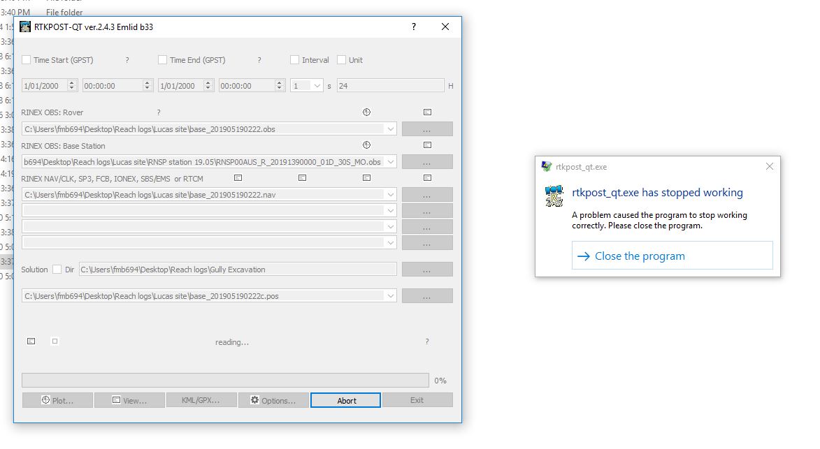
In rtkpost, I use the reach rs base station .obs files as Rover
I use the GNSS .obs file as Base Station
And I use the reach rs base station .nav file in the RINEX NAV,… section
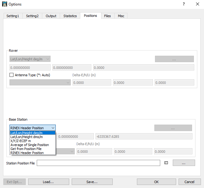
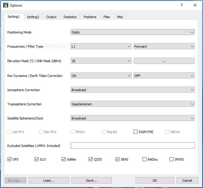
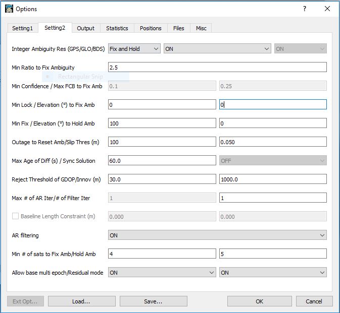
I tried settings from the reach tutorial but also adjusted some according to posts here in the forum. I choose Static in the section Setting 1. Here are my settings:
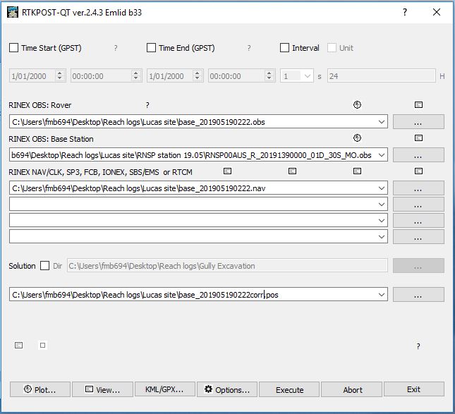
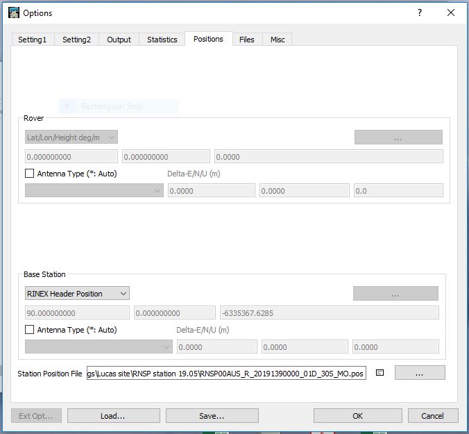
As seen in my settings, I uploaded a Station Position file created with an online PPP service (Natural Resources Canada), but it also crashes when I don’t do it.
I apologize if the error I am doing is trivial and I hope that someone here knows what to do!
All my best,
Fabian