Hello everyone i have a post-process of a point in a forest, where i got different results compared to RTKPost b28 with RTKPost b33 (From Github) and Topcon Tools 7.5.1. , do note that the base has a 7 hour observation and rover 2 has 1 hour. Here are the results, all of them fixed:
RTKPost b33: N 7044506.2318575 E 313909.48066629 U 450.6602 SDN 0.0022 SDE 0.0021 SDU 0.0059
RTKPost b28: N 7044499.4891569 E 313910.15219973 U 423.8340 SDN 0.0005 SDE 0.0014 SDU 0.0033
Topcon Tools 7.5.1: N 7044509.110 E 313908.680 U 449.178 SDN 0.010 SDE 0.010 SDU 0.014
I also used Brazilian PPP Solution to check their results and got these results:
PPP: N 7044508.297 E 313910.531 U 451.30 SDN 0.249 SDE 0.319 SDU 0.423
I have the files in RINEX 3.03 only, so you guys can check to see if you get similar results and share with me what could be doing this difference.
Here is a KML file of the point: KML Rover 2.zip (575 Bytes)
Use the Rtklib QT version and verify in position that the same coordinates are entered for both cases. I don’t have the differences you mention! always express at LLH in order to help you. RS2 or RS+ ?
Rs2, you mean the new version at emlid docs right? Im still in need to sit down and play with its new changes, but couldn’t yet, i know there are some posts but i’m not having the same time i had for the moment. Gonna try with that soon.
If i recall i used PPP, must have changed the settings so i could share the config file with a client with problems on their configs. Gonna check it as soon as possible
Yes, the one published in the emlid documents.
Do not forget to enter the coordinates manually in position.
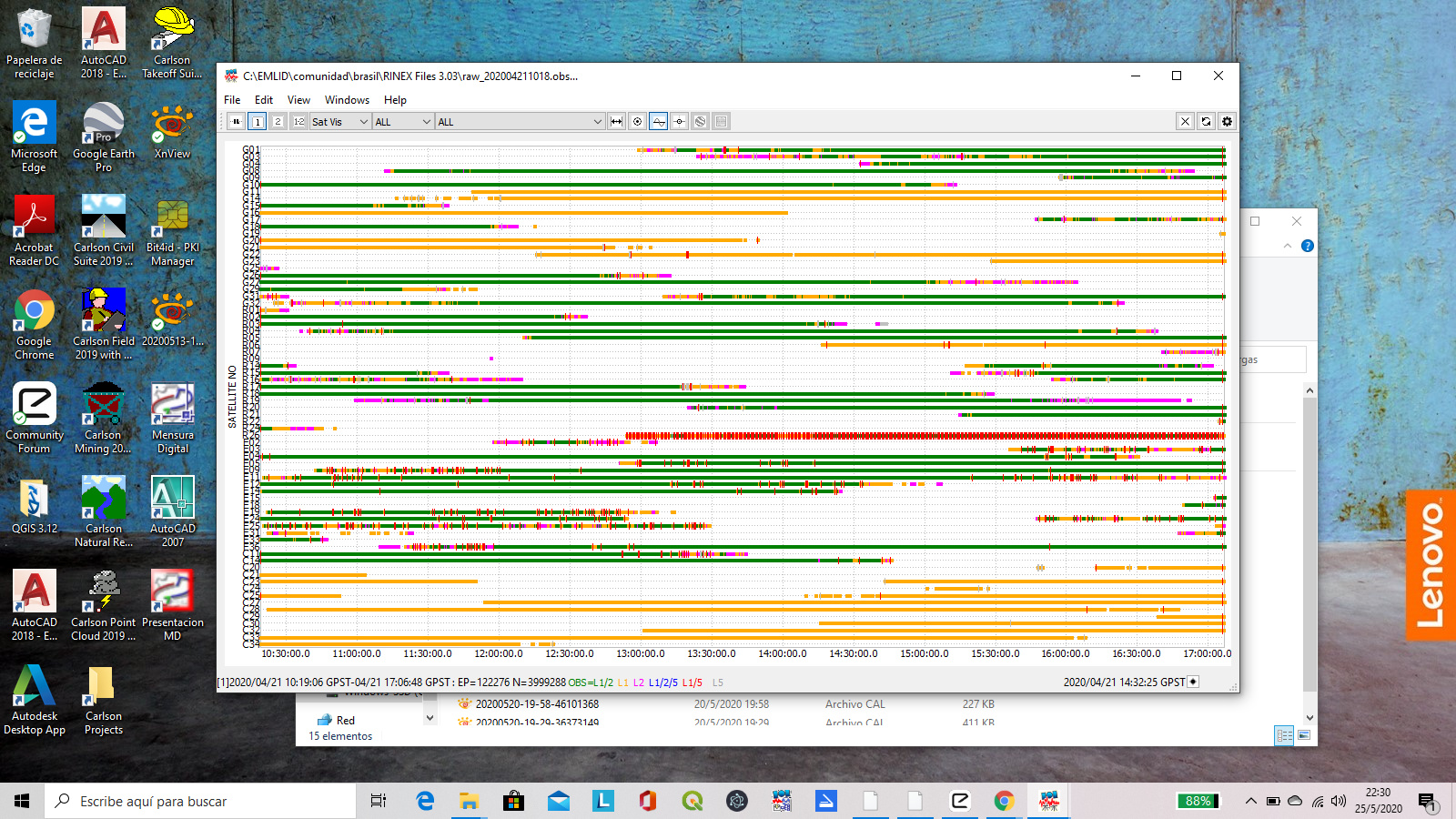
I see that rover and base are quite interfered,
I’ve been noticing a lot of concern with the glonass constellation in this forums, r26 is one i saw a interesting post by Ryszard about the glonass const elation, gonna keep an eye out. Here in Brazil a few companies are already removing r26 and another satellite in their processes
I’ve had the same for at least a year, but I do mostly PPK so I can remove it from the solution if needed. I will say that it does get removed at least three out of four times
Not sure why they would put it for download in the RS2 doc files then. Been using him along with b33 from RTKLib Github and with other post processes and getting similar results, until now.
Unless they have changed b28 recently, after the release of b33 qt
The position of your base is not in a place free of obstructions, it will be very difficult to obtain good results for the test you want to do and the rover is under the trees. Find a free place and do the tests
Yes i expect that the coordinates will vary around 30 to 50 cm max, since this is the limit for a fixed point under trees in our INCRA regulation. its very common here in Brazil people use PP to measure points under trees. But i agree that the base is not in an adequate position, was the best location the technician found inside the clients lands.