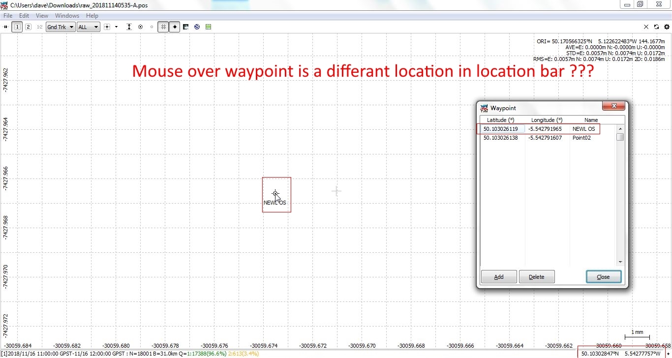
I’ve just noticed that when I create a waypoint then hover the mouse pointer over the same point there is a discrepancy between the waypoint LAT & LONG and the one in the lower right corner ?
Dave.
I’ve just noticed that when I create a waypoint then hover the mouse pointer over the same point there is a discrepancy between the waypoint LAT & LONG and the one in the lower right corner ?
Dave.
As far as I remember, the point added to the waypoint menu is the center of view, not place of the mouse cursor or indicator?
Hi @wizprod, Indeed, I was just wondering why when I hover the mouse over the location of that waypoint the location displayed in the lower right is different from that show for that waypoint, I was expecting them to be the same as they should be at the same location ?
To demonstrate I put the mouse pointer more or less at the same location as the waypoints LAT-LONG.
What I think it might be is a non-linearity error of some sort between LAT-LONG and the grid or when further away from the plot ‘coordinate origin’ ?
BTW all this is the BASE (ref pos) ~15.6Km from the ROVER
Hi @myozone,
I’ve no success in reproducing your issue.
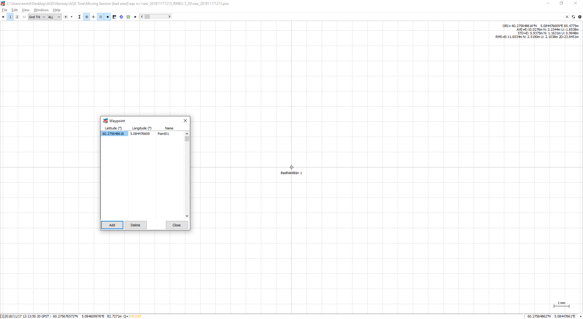
I set Coordinate origin as Base station and add Waypoint there.
After that, I set the largest possible scale, point mouse in the middle of base point and get the same result.
Here’s a screenshot:
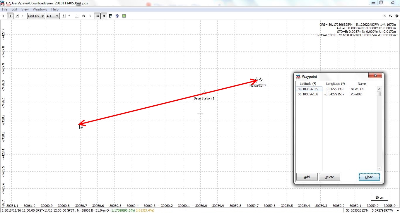
Hi Andrew, This happens when I add a POS file then place your mouse over the ‘base station 1’ point and look at the LAT-LONG in the lower right, it’s different to the one in the POS file. Also if you add the POS file’s REF POS as a waypoint you’ll see it’s different to the base station 1 location by about 750mm in my case (the referance staion is about 31Km away)
Dave.
Thinking about this some more, what I think it is, the POS file was created with another reference station that is using a different datum  Scrub that, it makes no difference.
Hi @myozone
A difference arises because even on the large scale it’s hard to hit the center of the point with a cursor.
Indeed, I’ve just uploaded a video to demo the issue
Have you tried deleting RTKplot.ini file?
@myozone, as you can see, you didn’t hit the center of the point with ┿ at the beginning.
To do it, please:
You’ll see no difference 
I followed your instructions exactly and all seems ok as you said. However, at the other end rover you get the same difference error. As I said before I think it’s a non-linearity error in RTKplot or something else ?
@TB_RTK Yep, tried and same error, but moving the origin as Andrew mentioned fixes it at one end with the other end still off - must be a quirk in RTKplot 
Dave.
Hi @myozone,
Can I ask you to make a video with this issue, please?
It’s a bit complicated to understand it through text and screenshots and I can’t reproduce it.
Thanks!
Hi Andrew, Good idea I’ve just uploaded - A picture paints a thousand words …
Dave.
Hi @myozone,
I’ve repeated all your steps from the video and can’t get the same issue.
The Average Point is still in the same right place.
Can I ask you to delete .ini file in the RTKLIB folder as @TB_RTK mentioned?
Do you still have the same issue after that?
Hi Andrew, Thank you for the reply. I’ve tried deleting RTKplot.ini and also tried different
versions of RTKplot. It’s quite simply to replicate.
Dave.
raw_201811140535-A.pos (2.4 MB)
@myozone, yes, I can confirm such RTKPLOT behavior with your pos file.
However, I can’t reproduce it with other pos files I have.
Quite an interesting issue.
Thanks for the report.
This topic was automatically closed 100 days after the last reply. New replies are no longer allowed.