You can start here for manual conversions:
“NGS Coordinate Conversion and Transformation Tool (NCAT)” NGS Coordinate Conversion and Transformation Tool (NCAT)
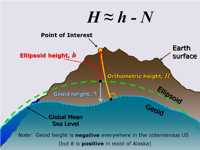
There is a lot to learn. It’s a journey. It’s not too complicated, but you need to make sure not to mix things up. I.e. feet to meters, Northings and Eastings, etc etc.
I am not really using ReachView 3, (I use FieldGenius for all that), but you should be able to use RV3 with your horizontal coordinate system needed (NAD83) and your vertical datum (NAVD88) and GEOID. (GEOID18). In AZ.