


Hi all !!! Is it possible to use an RS + as a base and the RS2 as a Rover? Both devices can be complemented by one L1 and the other L1 L2. for reasons of money buy a L1 L2 and then later another
Yep, it’s possible.
Of course you don’t get the benefits of Multi frequency, but you do get a much better antenna in the rs2.
Thanks Christian! I have CORS very distant 50 Km to 68 Km, the first has no NTRIP service and the second one but it works occasionally. I would have to see how to take advantage of them
1 Like
I would use the RS2 to establish a control point at your usual workplace or at home. Somewhere you feel safe about putting up an unattended receiver.
Log for as long as you have patience for. I would log for 12 hours, just to get some more averaging. But down to 15 min could do it. It would be a point you return to again and again, so why not spend some time gathering data.
When then before going out on a job, I would setup up the RS+ on the control point, connected to a WiFi broadcasting NTRIP.
When at the jobsite, I would use the better antenna of the RS2 and built-in mobile data connection to connect to the NTRIP stream from the RS+.
Of course, having an RS2 on the base as well, would significantly improve fix times, and the conditions under which a fix can be obtained and sustained.
1 Like
Christian, you say to use an RS + as a base at a known point and the RS2 as Rover using NTRIP?
Indeed so. For the base you can choose an optimal location with low risk of multipath, and with great skyview.
For the rover, you are not always blessed with optimal conditions, so better have a better antenna for this.
yep thank you I’ll think about buying an RS2 now and another later
1 Like
Hopefully by time then, maybe a newer RS2 (maybe RS2+?) will be out that has “TILT COMPENSATION”. Just “common sense” really… no brainer! This should be a standard feature for rovers this day and age!

1 Like
Tim, I do not see it as necessary for those of us who do land surveying to determine property limits, perhaps in surveying jobs.
unless there is someway of doing that without changing hardware like a gyro . Maybe it could be done some other way with the data it recieves ![]()
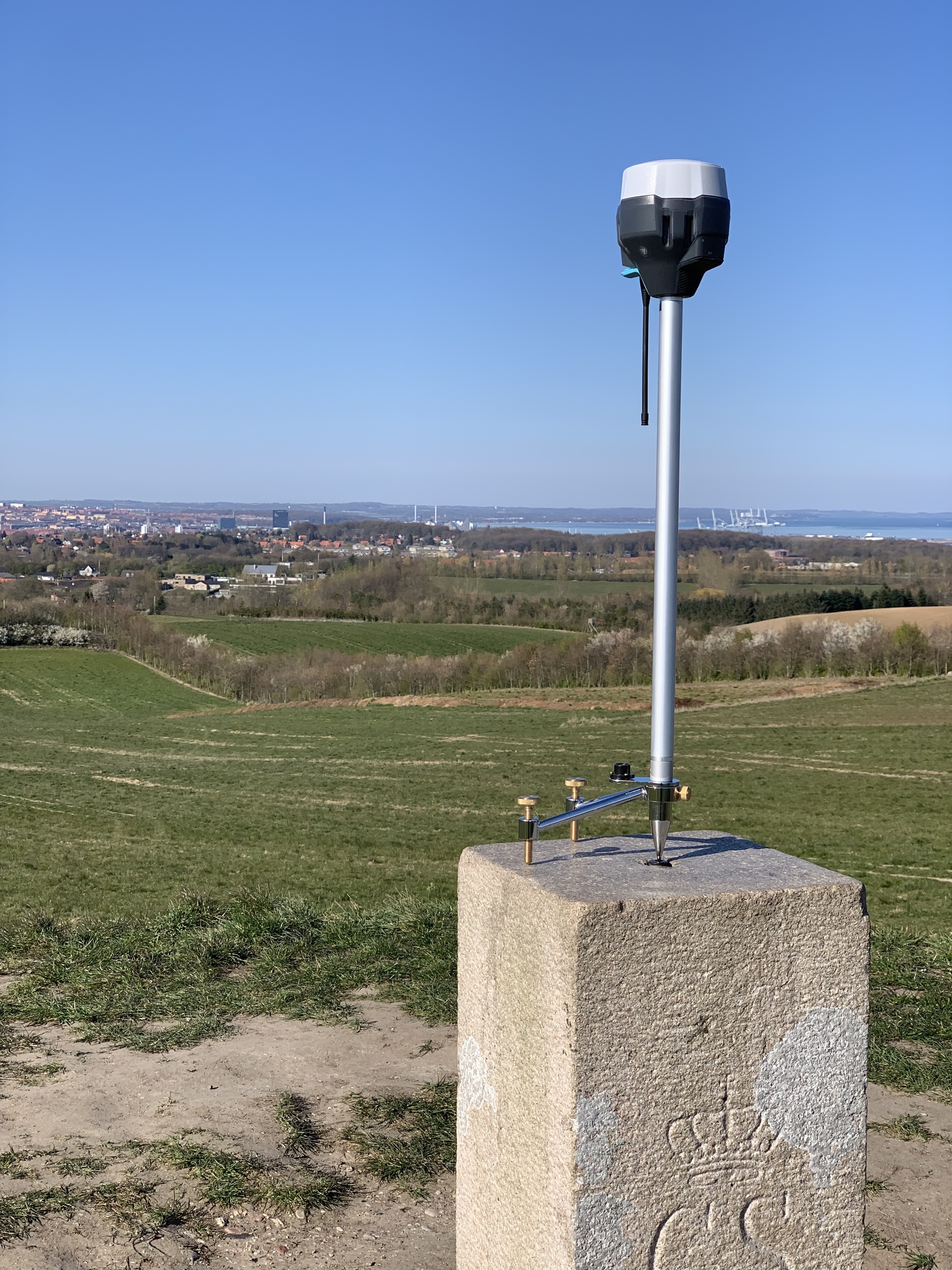
Still puzzled by the stand you have mountet there. Wouldn`t a small breeze tip it over?
2 Likes
Wondered that too? : /
Yep, hence it is faced into the wind.
With the extension it is very top heavy, so if not leveled or if not faced towards the wind, it will tip.
With no extension, it is much more stable, even with the rs2.
Wow, now that’s just lazy. I had to wade down into a pond yesterday to set a pool elevation indicator. I wonder if they can come up with something for that? Lol!
I’m reading this and it gives me pause. Why would you have the rover on NTRIP if the BASE is on established known point. Set up the base in base mode and manually enter your known points. Then transmit over LORA to the ROVER so you are receiving corrections. Why would you use a COR 50 to 60 km away when you have a base on the job site on a known point. NTRIP no longer required.
1 Like
Yes it is backwards from what you would normally do, but @wizprod was doing it that way on purpose.
He was testing to see how close the coordinates over NTRIP were to the published coordinates of the monument.
3 Likes
Ahh. Thanks for clarifying!
1 Like
Indeed so!