RS2 New Zealand - LINZ

Hi Guys,

I am after abit of advice/help.

I am looking at purchasing the RS2, I will be using it in New Zealand.

The main use would be for doing topographic surveys (No base station) (Can I connect this to the linz data base?

Also wanting to do rough construction boundary setouts, is this possible? How can we do this?

Thanks heaps,

Jack

What is it?

In general the RS2 is just a GNSS receiver. As such, it can do a huge amount of different jobs. It all depends on how it is applied in the field.

RS2 Rover.

LINZ is the new Zealand land information database

Not knowing specific database, you can probably export various layers etc.
Personally I would grab it either via QGIS, or export from a web-interface, if they have one?

But I actually you are better off calling the public instance that manages the database and ask them what is possible.

Hi Jack,

Welcome to our community!

LINZ is the new Zealand land information database

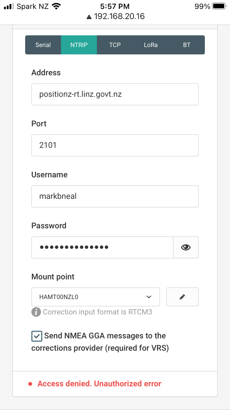
Do you plan to use LINZ as an NTRIP correction source for Reach RS2?

Also wanting to do rough construction boundary setouts, is this possible? How can we do this?

You can stake out separate points with the ReachView 3 Survey tool. If you need some additional options and know an app that supports them, you can integrate Reach with it. For Android apps, I’d recommend using the Mock location feature.

1 Like

Hi Jack, I recently used a RS2 receiver as a rover while connecting to a LINZ base station via NTRIP. You will need to sign up with the LINZ PositioNZ service. Once you have an account you simply enter the account details into the RS2 in order to receive corrections. Let me know if you need any further help.

As for boundary setouts you might be best to make use of a 3rd party app like Field Genius, I think the Reach 3 app is a little limited when it comes to cadastral work.

David CD Surveys, Feilding

1 Like

Hi David,

I have a Reach M2, and have signed up for Positionz service, recieved my password from LINZ, and entered details into the reachview app as per instructions from here (https://www.linz.govt.nz/data/geodetic-services/positionz/positionz-real-time-service).

I’m getting an error, as per attached (Access denied. Unauthorized error). Have you experienced this? Any suggestions?

Contact the provider. The user/pwd combination isn’t correct.

My mistake, it is activated by 6pm the next working day!

2 Likes

This topic was automatically closed 100 days after the last reply. New replies are no longer allowed.