


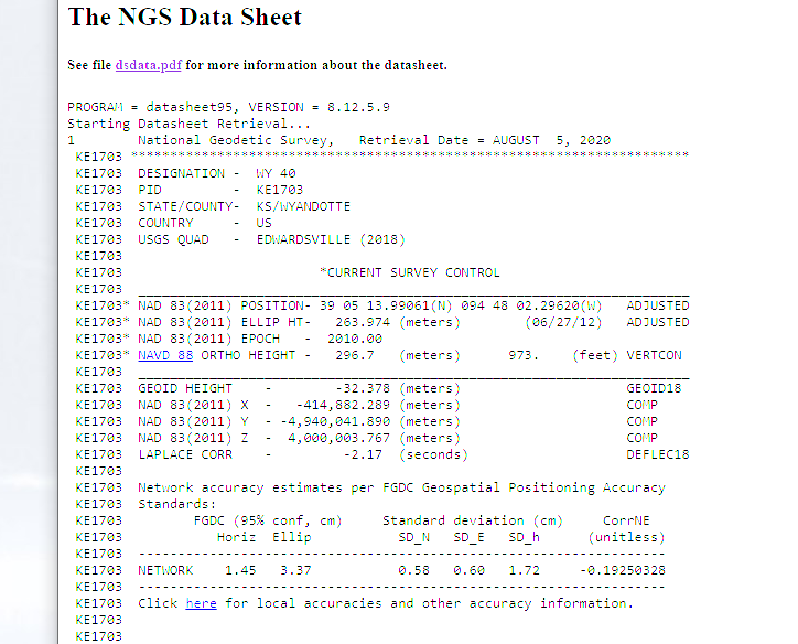
Do I just input the numbers from the data sheet? Also, do I have to transform the coordinates in any way for Pix4D. This is probably a basic question, but I am new to this industry.
Hi Juan,
Welcome to the community forum!
Do I understand correctly that you’d like to use this station’s coordinates in post-processing?
No, I want to use the coordinates as a known point for the base station. I think I figured that part out by inputting the coordinates into the base station. I placed the station about a mile away at a known point, but couldn’t get a fixed solution. So the journey continues.
Hi James,
That’s right. ReachView has a feature of manual input for the base station position.
To analyze what causes this issue, please, provide me with the following information:
- photos of the setup
- raw data log from the base and rover
- position and base correction log from the rover
This guide should help you on how to get the files.
I’d also ask you to start a new thread or send all the data via support@emlid.com on this issue to help us keep the discussion in this thread consistent.
2 Likes
This topic was automatically closed 100 days after the last reply. New replies are no longer allowed.