The calculation methods in ReachView 2 are designed for the WGS84 ellipsoid. However, GDA and WGS84 are similar, so that ReachView can apply the same methods to GDA coordinates. If you enter latitude, longitude, and elevation in GDA, the rover’s coordinates will be shown in GDA as well.
Please note that ReachView 2 can’t work with heights in AHD. However, you can configure your project in ReachView 3, so ReachView 3 will take GDA/WGS84 height from ReachView 2 and convert it to AHD.
Just to confirm; you need to enter the ellipsoidal height into RV2.
And then, in RV3, with AHD selected, it will output heights in AHD for you.
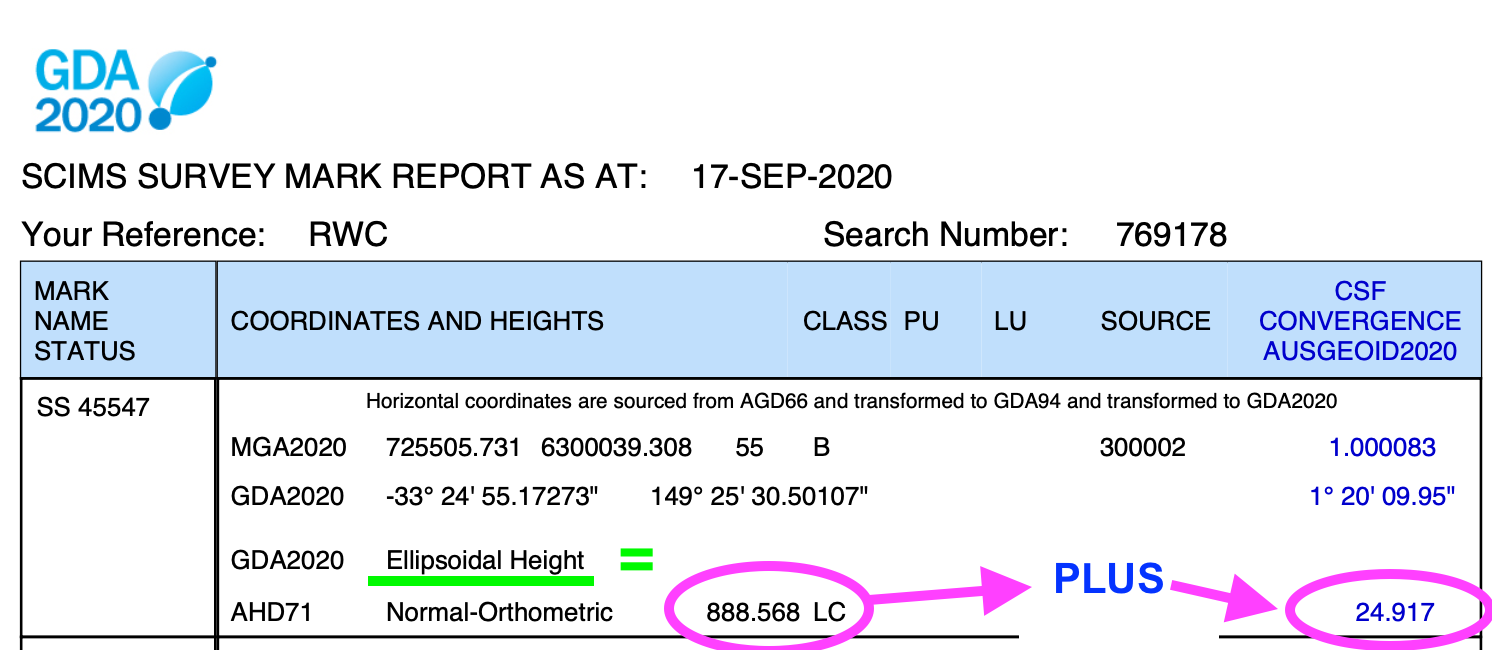
Use this to determine the ellipsoid/geoid separation:
AHD is not more, “accurate”. However it is definitely the vertical datum you need to be using as the resultant heights will represent the topography in the area. Ie. High points will be high and low points will be low (not necessarily the case with the ellipsoid!).
Hi James,
Yep most of its cleared up. Interestingly, I stumbled upon that part of the Geoscience website just on Thursday. BUT if out in the field, no internet , only a screen shot or pdf of the SSM like this one