


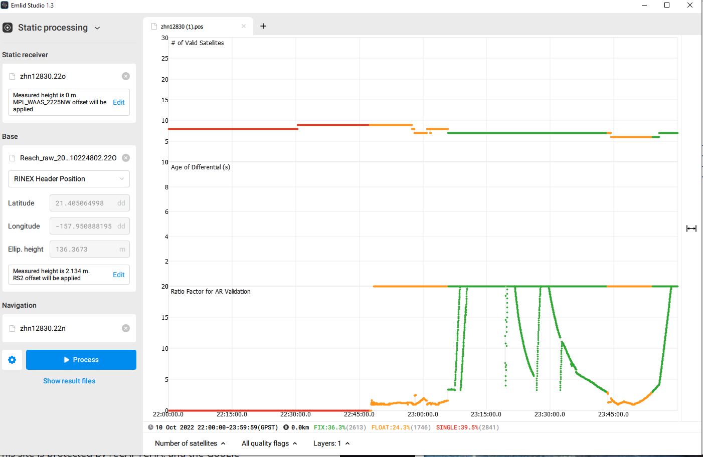
I have purchased an RS2+ to use as a base for our new LIDAR unit we are using on our M300RTK. I did a data collection yesterday and in EMLID Studio using the nearest CORS just a few miles away. (The results attached) of over 2.5 hrs of collection in an open field and under my direct observation the entire time. I have never seen such variations in data like this. Not too pleased with these results. Issues? Solutions?
PS No space weather issues. Clear sunny low wind day.

Hi Michael,
We’re in touch with you on this question via email. You shared the observation file from the rover. But to process your data, I need the navigation file and logs from your CORS as well. Please, send them to me.
And one short comment on the environmental conditions. Basically, the weather doesn’t affect satellite signals. The thing that really matters is the presence of obstacles on your site. They block the sky view for the device, which can lead to poor results. Here is a guide from our docs with some tips on the receiver’s placement.
2 Likes
This topic was automatically closed 100 days after the last reply. New replies are no longer allowed.