We currently run a program called insite pro for 3d modeling on all our jobs. Is there any way to import plans and/or models into any of emlid products?
Our goal is to be able to topo a potential jobsite, import that into a program called Insite Pro and then build the entire gps model in insite. After that is complete we would want to transfer it back to a Emlid product.
We are a civil construction contractor doing everything from tiny house dig outs up to muilti million dollar commercial sites and everything inbetween.
Probably best you look into MicroSurvey FieldGenius or others for robust features… Emlid Flow, even with some nice basic features… pretty much still in its infancy. Probably just get points in and out.
If you are already doing this kind of high level work, you should already have a hardware/software product solution in place to get the data back out to the site. Are you using Trimble, Leica etc already to do that? If you are looking to replace with Emlid, you may have to look into a totally different solution to do so. I.e. MicroSurvey FieldGenius (Windows, not Android) using Emlid receivers. Not sure if Trimble, Leica software will let you just “swap out” their equipment for Emlid… but if a NMEA device option, possibly… but doubt they would implement that… goes against their products.
I guess you could export points out from your software to pull into Emlid Flow, but it would be a mess of 3d points and maybe lines (if Emlid Flow even handles VECTOR DXF linework yet or not? I dont think so fully yet if at all… deal breaker). Flow really is pretty basic… its a nice a solution for many… but it has a very long way to go unless they hit it full on in developing it to bring it up to speed like FieldGenius and the rest. MicroSurvey has been in this for a very long time.
I have used the RS2 rover and RS2 base for over 3 + years running with Microsurvey FG in an Android tablet. (Junipers CT8) I have no problem gathering topo points downloading them in a TXT file and converting to my survey software cad program, I run old school Terra Model back at the office, build my models with it, download an XML back into the FG tablet and go chase the dozers or graders around the job with live cuts and fills.
You could also import CSV files into your perfered program and work from there. Emlid won’t go the distance yet for what you want, since you will need to localize on known job control, FG for Android makes it a breeze. Was a heavy GPS 5800 Trimble user using survey controller since the early 2000’s, but I find that I can work faster with the RS2’s, Still run my Trimble 5600 Total Station with Surey Pro when I need tighter points or in a bad GNNS canopy cover area.
We do currently run Topcons entire line of GPS and Rovers. We are mainly looking for something for our Estimators to use on projects during the bidding process. It is to costly and time consuming for us to set up the topcon system for every job we bid. Our main goal would be to use the RS2 to build a topo of the site that is localized to something and then bring that topo into our Insite Pro software so we can build an accurate take off model.
With that being said, What exactly can the RS2 do for a civil company like us? I know of a few larger companies around us that run the RS2 and they all love it. I am trying to find out exactly what it can do to help our guys.
Emlid Flow supports collecting points and lines. So you can survey with Reach RS2+ using it and export the results in CSV, DXF, or SHP format. I checked that the InSite software supports DXF projects. So I believe it should work well.
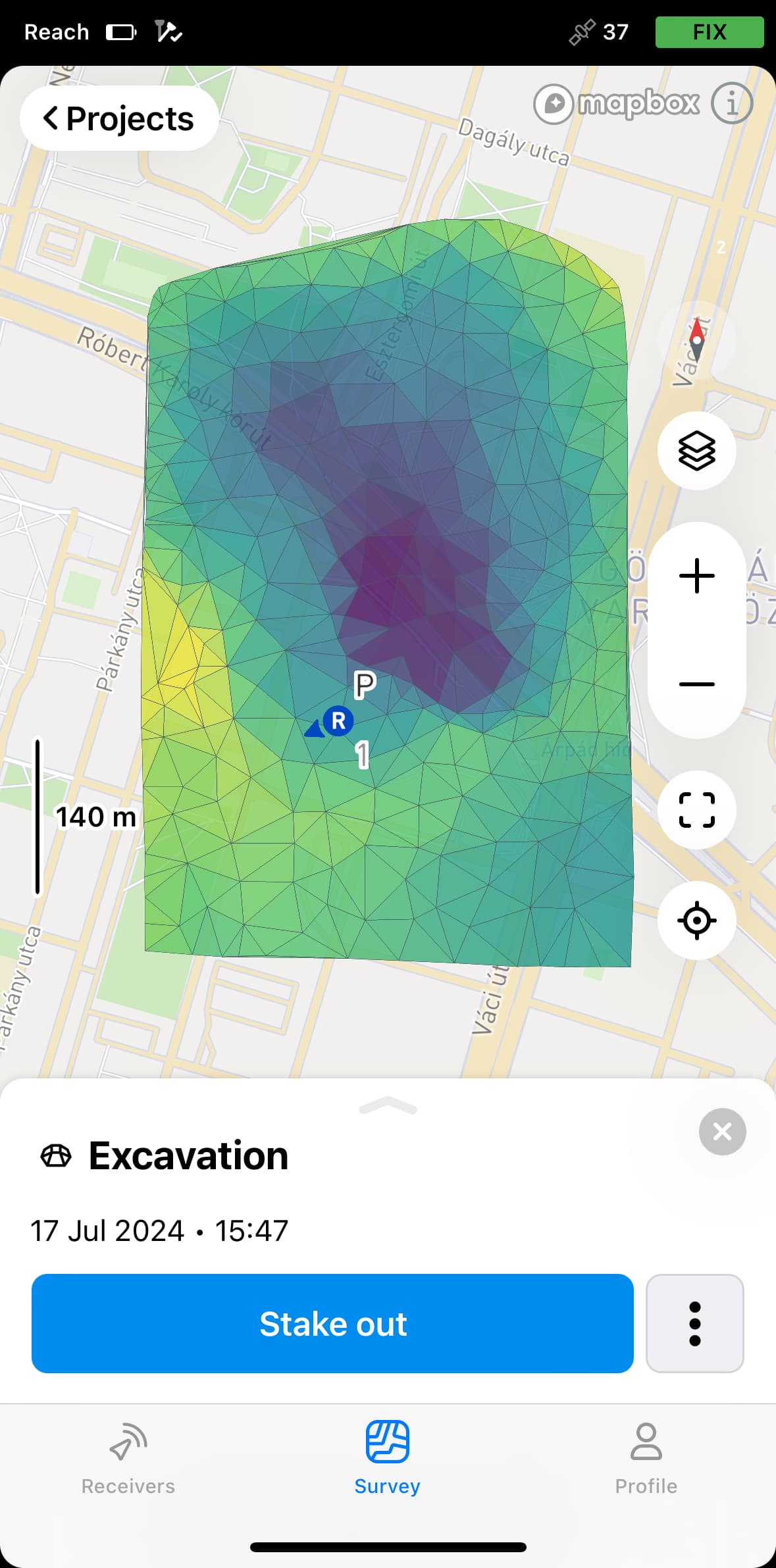
Speaking of 3D models, they are not supported in Emlid Flow for now. What kind of models do you usually have? Surfaces? In what format are they?
With the release of version 11 of Emlid Flow, you can now import and stake out LandXML surfaces. You can find all the details in our guide on working with surfaces.