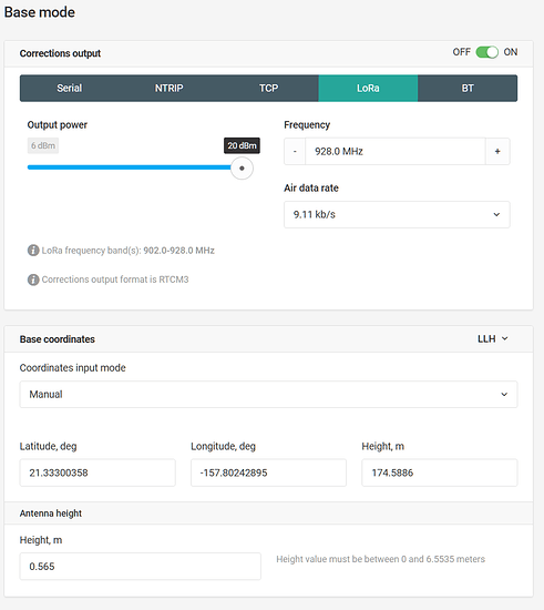
I just got a pair of RS units donated to the botanical garden where I work and have been using them for RTK. I’m amazed at how well the LoRa works with minimal fiddling, and even works well through forest conditions! Only rarely does it lose connection and that’s OK because we can do PPK.
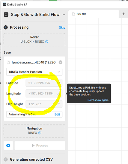
But there’s one annoyance I’ve encountered so far. I set the position through the web interface on wifi and the base seems to accept the coordinates. But when I load the Rinex or UBX for postprocessing, the header has coordinates other than what I entered. I assume they are coordinates that the base calculated for itself. So every time I do PPK I have to manually enter the latitude, longitude, and height above ellipsoid.
Is there any way to force the base to store the coordinates I enter? Or is there any way to set Emlid Studio to use those coordinates as a default?


